Why Buran Ghati Trek is on every trekker's list
Few treks in Himachal Pradesh demand as much respect — or deliver as much reward — as the Buran Ghati Trek. Crossing the Buran Ghati Pass at 4,700 metres above sea level, this route threads through the unspoiled wilderness of the Sainj Valley before depositing trekkers on the far side via a heart-pumping glacier rappel — an experience unique among mainstream Himalayan trails. Unlike the crowded corridors of Hampta Pass or Kedarkantha, Buran Ghati sees a fraction of the footfall, making it a genuinely remote adventure for those ready to earn their views.
Located in the Shimla and Kullu districts of Himachal Pradesh, the trail winds through dense cedar-oak forest, open alpine meadows, moraine fields, and finally bare glacial ice before the dramatic pass crossing. If you are hunting for a trek that combines technical challenge, cultural authenticity, and jaw-dropping Himalayan scenery, the Buran Ghati Trek belongs at the top of your 2026 shortlist.
With dozens of trekking options across Himachal Pradesh, the Buran Ghati Trek earns its place for several distinct reasons.
1. The Glacier Rappel — India's Most Exciting Trek Descent
The descent from the pass involves a fixed-rope rappel down a steep snow and glacier face. Most Himalayan passes are crossed on foot; Buran Ghati requires a harness. This single feature makes it unlike almost any comparable trek in the Indian Himalaya and is an absolute highlight for experienced trekkers seeking something beyond the ordinary.
2. The Sainj Valley Wilderness
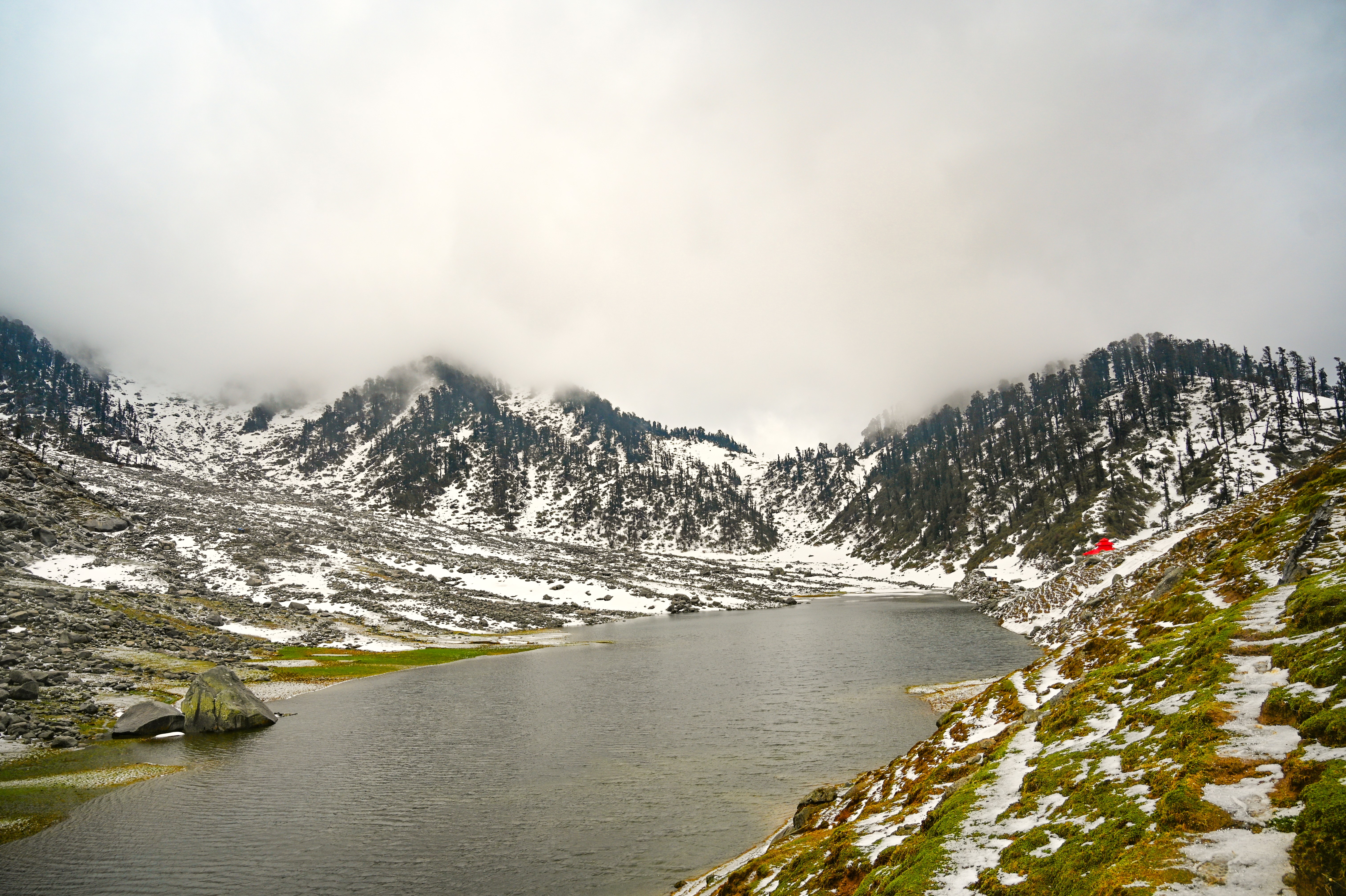
The exit route passes through the Sainj Valley, a largely undiscovered corner of the Great Himalayan National Park buffer zone. You will walk through oak and rhododendron forests with no phone signal, no teahouses, and virtually no other trekkers — pure Himalayan solitude.
3. Panoramic Views of Two Ranges
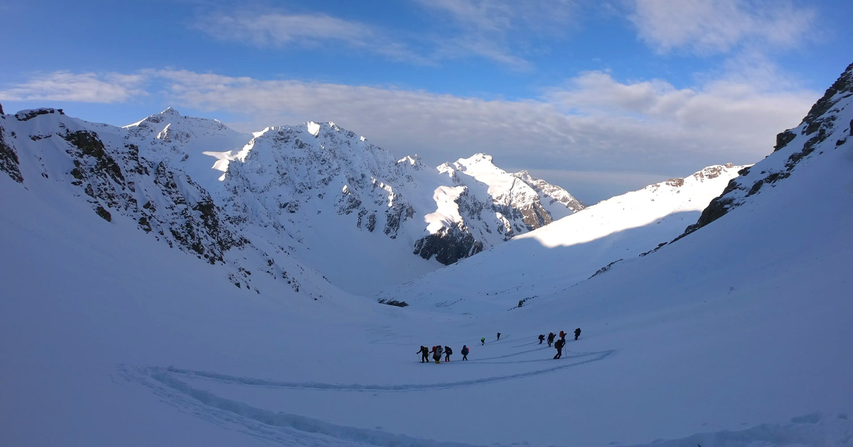
From the Buran Ghati Pass on a clear day, the Kinnaur Kailash massif dominates the eastern horizon while the Dhauladhar Range extends to the north-west. The 360° panorama is widely regarded as among the finest accessible from a Himachal pass.
4. Low Crowd Density
Compared to the Hampta Pass Trek, which sees thousands of trekkers each season, Buran Ghati averages a small fraction of that traffic. In the 2026 autumn season, most groups report days on trail without encountering another group.
5. Cultural Village Stops
The villages of Jakha and Barua offer glimpses of traditional Kinnauri-influenced Himachali culture — slate-roofed homes, carved wooden temples, and local hospitality that has not yet been shaped by trekking tourism.
"The moment our guide clipped my harness and I looked down that glacier, every tough day on the trail made complete sense. There is nothing else like Buran Ghati in India."
— Priya S., Bengaluru, September 2025 (testimonial shared on TrekYatra community forum)
At a glance
The route at a glance
The standard route runs Shimla → Janglik (base) → Dayara → Litham → Dhunda → Buran Ghati Pass → Barua, covering approximately 40 kilometres of trekking distance (excluding the drive stages). The total elevation gain from the Janglik trailhead at roughly 2,900 m to the pass at 4,700 m is approximately 1,800 metres.
The trail character changes markedly through each section:
- Janglik to Dayara: Forest trail through cedar and oak, river crossings, gradual ascent
- Dayara to Litham: Open meadows (bugyal), boulder fields, first glacier views
- Litham to Dhunda: Steepening moraines, scree, thin air — the landscape turns lunar
- Dhunda to Pass: Snow slopes, fixed ropes near the top, glacier — crampons essential
- Pass to Barua: Rappel descent, then a long valley walk through the Sainj Valley to civilisation
For context on how this compares to other Himachal routes, see our guides to the Pin Parvati Trek and best treks in Himachal Pradesh.
Elevation Profile at a Glance
| Campsite / Point | Elevation (m) | Cumulative Distance from Janglik (km) |
|---|---|---|
| Janglik (trailhead) | ~2,900 | 0 |
| Dayara Campsite | ~3,350 | ~8 |
| Litham Campsite | ~3,700 | ~16 |
| Dhunda Campsite | ~4,200 | ~23 |
| Buran Ghati Pass | ~4,700 | ~27 |
| Barua Village | ~2,600 | ~40 |
⚠ Specific elevation figures and cumulative distances are based on multiple trekking operator accounts and topographic references but should be verified against 2026 Survey of India maps or GPS-tracked route data before publication.
What each day actually looks like
The following 7-day plan accounts for the drive day, five core trekking days, and a buffer/acclimatisation day — a structure recommended by most registered operators running the Buran Ghati Trek in the 2026 season.
Day 1 — Shimla to Janglik (Drive Day)
Distance: ~200 km by road | Duration: 7–8 hours | Altitude gain: ~2,900 m at Janglik
Depart Shimla early morning (by 6 AM recommended) via Rampur, Rohru, and Chirgaon to Janglik village. The road beyond Rohru is narrow and mountainous — expect the final 50 km to take over two hours. Arrive at Janglik by afternoon, complete checkpost registration, meet your guide, and acclimatise with a short village walk. Overnight at guesthouse or tents at Janglik.
Key highlight: The drive itself offers superb views of the Pabbar Valley. Use the afternoon to sort gear and rest.
Day 2 — Janglik to Dayara Campsite
Trekking distance: ~8 km | Altitude gain: ~450 m | Walking time: ~4–5 hours
The trail begins steeply through forest before opening into the Dayara meadows. This is a relatively gentle introduction day — ideal for acclimatisation. River crossings can be tricky in early season. The Dayara meadows offer the first unobstructed mountain views. Overnight tented camp.
Key highlight: Dayara meadows at golden hour — a classic Buran Ghati photograph.
Day 3 — Dayara to Litham Campsite
Trekking distance: ~8 km | Altitude gain: ~350 m | Walking time: ~5–6 hours
The trail continues through mixed terrain — meadow, boulderfields, and the first patches of snow in shoulder seasons. Litham sits on a high shelf with views across the valley. Nights here are noticeably colder. Carry extra water as sources thin out beyond this point.
Key highlight: First clear views of the Buran Ghati glacier from the approach ridge.
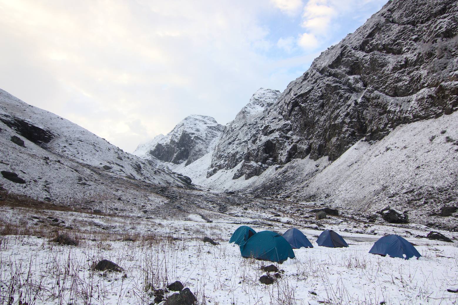
Day 4 — Litham to Dhunda Campsite
Trekking distance: ~7 km | Altitude gain: ~500 m | Walking time: ~5–6 hours
This is the hardest day before the pass. Moraines and scree dominate the second half of the ascent to Dhunda (~4,200 m). The campsite sits in a high rocky bowl — stark, beautiful, and cold. Acclimatisation walk recommended in the afternoon rather than resting flat. Hydrate aggressively and watch for AMS symptoms.
Key highlight: Camp under the shadow of the pass — the night sky at 4,200 m is extraordinary.
Day 5 — Dhunda to Buran Ghati Pass, Descent to Barua
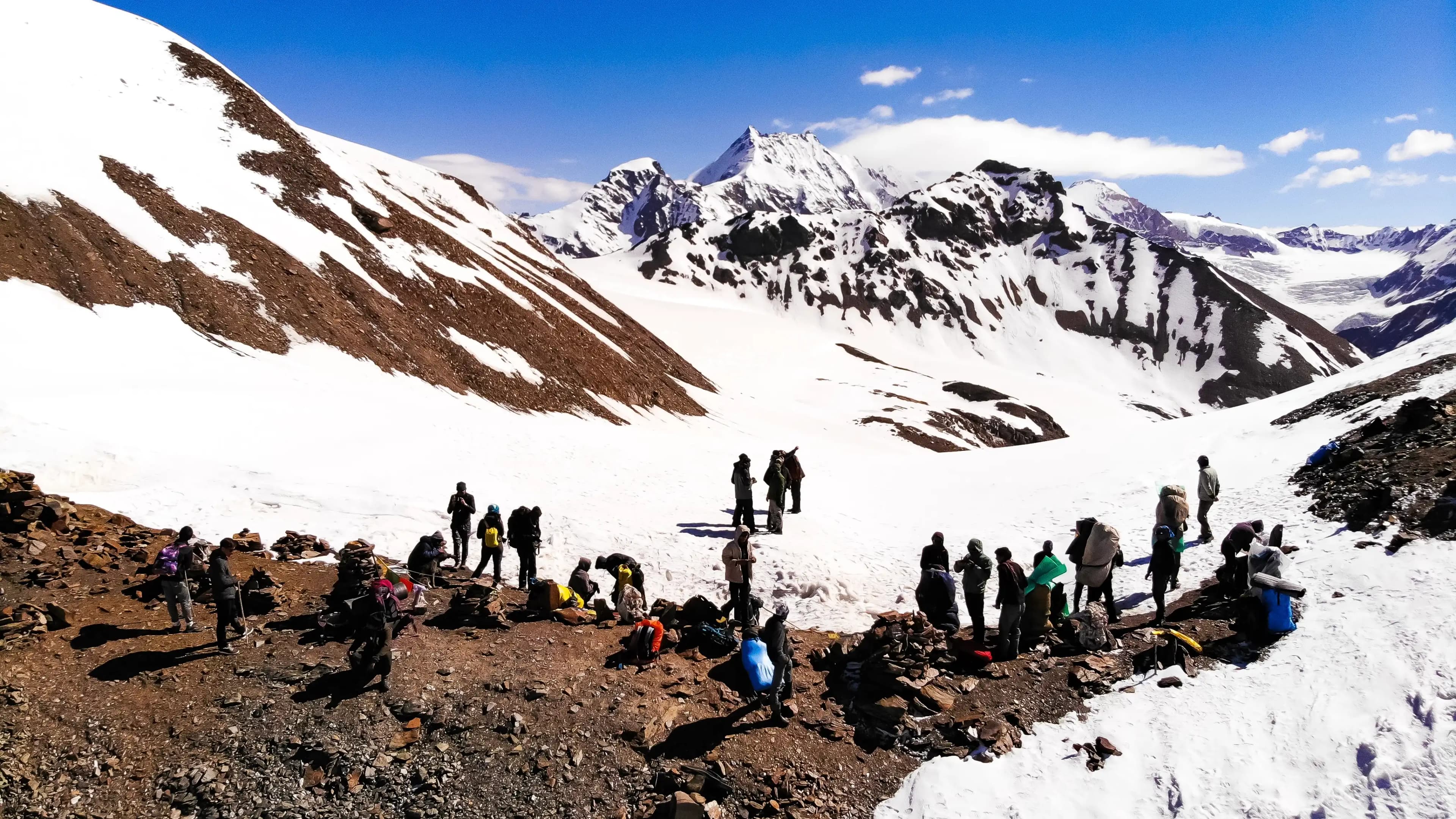
Trekking distance: ~17 km | Altitude gain/loss: +500 m / −1,600 m | Walking time: ~9–11 hours
The longest and most demanding day. Start no later than 5–6 AM to summit the pass before weather deteriorates. The final 200 m to the pass involves fixed ropes and crampons on snow/ice. At the pass (4,700 m), pause for photographs — the panorama is breathtaking. The descent begins immediately with the glacier rappel: guides fix ropes and assist each trekker down the steep snow face. After the rappel, a long descending walk through the Sainj Valley leads to Barua village. Overnight at Barua (guesthouse or homestay).
Key highlight: The glacier rappel and the Buran Ghati Pass panorama — the defining moments of the entire trek.
Day 6 — Buffer / Acclimatisation Day
Use: Rest at Dhunda or explore Barua area depending on group schedule
This day is built into the itinerary as a buffer against weather delays, altitude sickness in the group, or trail conditions at the pass. Groups in good shape may use it as an acclimatisation walk above Dhunda on Day 4 evening. Do not skip this buffer — the pass cannot safely be rushed.
Day 7 — Barua to Shimla (Drive Day)
Distance: ~180 km by road | Duration: 6–7 hours
Depart Barua via Sainj Valley, Aut, and Kullu, connecting to the Shimla highway. Alternatively, travel to Bhuntar for flights or onward buses. Reach Shimla by evening.
Campsite Guide: Where Will You Sleep on the Buran Ghati Trek?
| Campsite | Elevation (m) | Terrain | Water Source | Toilet Facilities | Mobile Network |
|---|---|---|---|---|---|
| Janglik | ~2,900 | Village, flat | Tap water in village | Guesthouse toilets | Yes (Jio/Airtel patchy) |
| Dayara | ~3,350 | Open meadow | Stream ~100 m | Pit toilet (if operator-provided) | Weak/no signal |
| Litham | ~3,700 | Rocky shelf | Stream nearby | Pit toilet (operator tent) | No signal |
| Dhunda | ~4,200 | Rocky moraine bowl | Snowmelt stream | Operator toilet tent | No signal |
| Barua | ~2,600 | Village, valley | Village supply | Homestay/guesthouse | Patchy signal |
⚠Toilet facility availability depends entirely on the operator. DIY trekkers must carry trowels and follow Leave No Trace protocols. Water source proximity at each campsite should be verified in season.
When to go
The Buran Ghati Trek has a defined trekking window shaped by snowpack, monsoon, and trail safety. Choosing the wrong month can turn an adventure into a survival situation.
May–June (Early Season)
The trail is open from late May as snow begins to melt. The glacier is fully intact, the rappel is more dramatic, and wildflowers are emerging in lower meadows. Nights are very cold (sub-zero at Dhunda), and river crossings are swollen with snowmelt. Best for: trekkers who want a full glacier experience and can handle cold conditions.
July–August (Monsoon — NOT Recommended)
The southwest monsoon brings heavy rain, landslides on approach roads, and leeches on forest sections. The trail above Litham becomes dangerously slippery. Most experienced operators suspend operations in July–August. This window is best avoided.
September–October (Post-Monsoon — BEST WINDOW)
This is the optimal trekking season for Buran Ghati. Skies are crystal clear after the monsoon, the Kinnaur and Dhauladhar views are unobstructed, trail conditions are stable, and autumn colours in the valley sections are spectacular. Temperatures are manageable — cold at the pass but comfortable at lower camps. This is the busiest period, though still far quieter than comparable treks.
November (Trail Closes)
Heavy snowfall typically closes the Buran Ghati Pass by mid-to-late November. Attempting the trail after the first major snowfall is extremely dangerous without specialist mountaineering equipment.
Weather and Trail Conditions by Month
| Month | Avg Daytime Temp (Pass) | Avg Night Temp (Dhunda) | Precipitation | Trail Condition |
|---|---|---|---|---|
| May | ~5–10°C | ~−5°C | Low-moderate | Snow on upper trail, streams high |
| June | ~8–12°C | ~−2°C | Low | Good, glacier intact |
| July | ~10–14°C | ~2–5°C | High (monsoon) | Risky — landslides, leeches |
| August | ~10–13°C | ~2–4°C | High (monsoon) | Risky — avoid |
| September | ~8–12°C | ~−1°C | Low | Excellent |
| October | ~3–8°C | ~−5°C | Very low | Excellent — cold nights |
| November | ~−2 to 3°C | ~−10°C | Moderate-high (snow) | Closing/closed |
⚠ Temperature ranges are indicative estimates based on altitude and regional climate data. Actual conditions vary year to year — consult IMD (India Meteorological Department) forecasts before the 2026 trek.
Is this trek right for you?
Difficulty Rating: 4/5 (Difficult)
The Buran Ghati Trek is not a beginner route. Its difficulty rating stems from four key factors:
- Glacier Rappel: The pass descent requires rappelling on a fixed rope down a steep snow/ice face. While guides manage the technical setup, trekkers must be comfortable with a harness and moderate heights.
- High Pass Crossing at 4,700 m: Sub-zero temperatures, low oxygen, and unpredictable weather at the summit demand both physical fitness and mental composure.
- Long Daily Distances: Days 4 and 5 involve 7–17 km of trekking on rough terrain with 500–600 m of elevation gain. Expect 6–11 hours of walking.
- Remote Trail: The Sainj Valley section has no evacuation infrastructure. Any injury or severe AMS requires a multi-hour carry to a road.
Recommended Fitness Preparation (6 weeks before trek):
- 30 minutes of sustained cardio (running, cycling, stair climbing) at least 4 times per week
- Weekend hikes with a loaded 15 kg backpack on gradients
- Core and leg strengthening exercises 3 times per week
- Review our high-altitude trek fitness training guide for a structured programme
Who Should NOT Attempt This Trek:
- First-time trekkers with zero high-altitude (above 3,500 m) experience
- Individuals with diagnosed cardiac or respiratory conditions
- Anyone who has not completed at least one moderate Himalayan trek (e.g., Kedarkantha or equivalent)
- Trekkers unwilling to follow guide instructions on the glacier section
What permits you need
Inner Line Permit: Not required. The Buran Ghati Trek does not enter a restricted zone under the Inner Line Permit system. This distinguishes it from treks like Pin Parvati that require additional documentation.
Forest Department Camping Permit: Required for all trekking parties. This permit is obtained from the Himachal Pradesh Forest Department office at Janglik (or via a registered trekking operator who handles it on your behalf). Carry original government-issued ID (Aadhaar card or passport) for each trekker.
- Estimated cost (2026): ₹200–₹400 per person (⚠ Fee structure need to be verified with the Janglik Forest Office or HPTDC before travel)
- Group Registration: All trekking parties must register at the Janglik Checkpost before entering the trail. The register captures group size, guide details, expected return date, and emergency contacts.
- Organised Operator Permits: If trekking with a registered operator, they typically handle permit procurement. Confirm this in writing before booking.
Important Note: Permit regulations and fees in Himachal Pradesh are subject to revision by the Forest Department. Always verify current requirements with the HPTDC (Himachal Pradesh Tourism Development Corporation) or the local Janglik Forest Office before your 2026 trek. See our Himachal Pradesh trekking permits guide for broader context.
What this trek will cost you
The Buran Ghati Trek can be undertaken DIY (with an independent guide) or as part of an organised group package. Here is a realistic 2026 cost breakdown.
Cost Comparison Table
| Cost Item | DIY Estimate (₹) | Package Included |
|---|---|---|
| Transport: Shimla–Janglik (shared taxi) | ₹500–800 per person | ✅ Included |
| Transport: Barua–Shimla (return) | ₹600–900 per person | ✅ Included |
| Forest Dept camping permit | ₹200–400 per person | ✅ Included |
| Guide (local, certified) | ₹800–1,200/day × 6 days | ✅ Included |
| Porter (optional) | ₹700–1,000/day × 6 days | Often included |
| Food & camp meals | ₹500–700/day × 6 days | ✅ Included |
| Tent & sleeping bag rental | ₹300–500/day if rented | ✅ Included |
| Crampons & harness rental | ₹200–400/day | ✅ Included |
| Total Estimate | ₹8,000–₹12,000 | ₹12,000–₹18,000 |
⚠ All cost figures are estimates for the 2026 season based on regional market rates and operator pricing trends. Actual costs vary by group size, season, and operator. Verify current rates directly with local guides and operators in Janglik or Rohru.
DIY vs Organised Package — Which to Choose?
DIY is feasible for experienced trekkers who can hire a certified local guide independently (recommended through Rohru-based trekking associations). Organised packages are strongly recommended for anyone attempting Buran Ghati for the first time, given the technical glacier section.
What to pack
Packing correctly for Buran Ghati is non-negotiable. The trail swings from forest humidity to glacier cold within a single day. See our full trekking packing list for India for a master checklist.
Clothing
- Thermal base layers (top and bottom) — at least 2 sets
- Mid-layer fleece or down jacket
- Waterproof and windproof outer jacket
- Waterproof trekking trousers
- Gaiters (frequently forgotten — essential for snow and scree)
- Balaclava (frequently forgotten — critical for summit day)
- Warm trekking gloves (waterproof outer layer)
- Sun hat and UV-protection sunglasses (glacier UV intensity is extreme)
- Wool or synthetic trekking socks × 4 pairs
Gear
- Trekking poles (mandatory — reduces knee strain on long descent)
- Crampons (if self-guided; provided by operators)
- Harness (provided by operators; DIY trekkers must arrange independently)
- 50L+ backpack with rain cover
- Sleeping bag rated to −10°C (frequently forgotten or underestimated — standard 0°C bags are insufficient at Dhunda)
- Trekking boots (waterproof, ankle support, broken in before the trek)
- Headlamp + spare batteries
- Water bottles (2 × 1L) + water purification tablets or filter
Documents
- Government-issued photo ID (original + photocopy)
- Forest Department camping permit
- Emergency contact card (laminated, in top lid of pack)
- Travel insurance documents (medical evacuation cover strongly recommended)
Medical Kit
- Diamox (acetazolamide) for AMS prevention — consult your doctor before use
- Ibuprofen / paracetamol
- Blister treatment kit (moleskin, needle, antiseptic)
- Rehydration salts / electrolyte sachets
- Sunscreen SPF 50+ (reapply every 2 hours above 3,500 m)
- Personal prescription medications
Food & Nutrition
- High-calorie energy bars × 10–15
- Dry fruits and nuts
- Instant oats or porridge sachets
- Dark chocolate (cold-weather morale is real)
What Gear Can You Rent at Janglik?
| Item | Rent Available at Janglik | Approx. Rent Cost/Day |
|---|---|---|
| Crampons | Yes | ₹150–250 |
| Harness & carabiner set | Yes (via operator) | ₹200–350 |
| Sleeping bag (−10°C rated) | Yes | ₹200–300 |
| Trekking poles | Yes | ₹100–150 |
| Tent (2-person) | Yes | ₹300–500 |
| Trekking boots | No — own footwear essential | — |
| Thermal base layers | No — own clothing essential | — |
⚠ Rental availability at Janglik is limited and seasonal. Availability in 2026 should be confirmed with local operators or the village pradhan in advance. Do not rely on rental availability for critical safety gear — own your sleeping bag and base layers.
Recommended gear for this trek
Staying safe on the mountain
The Buran Ghati Trek involves genuine hazards that require preparation, not just fitness.
Acute Mountain Sickness (AMS)
AMS can affect anyone above 3,000 m regardless of fitness. Symptoms include persistent headache, nausea, dizziness, loss of appetite, and disturbed sleep. The only effective treatment for severe AMS is immediate descent — do not wait to see if it improves at altitude. Mild symptoms can be managed with rest and hydration. Read our altitude sickness prevention guide before departure.
Rule: If a trekker loses coordination, becomes confused, or develops a cough that produces frothy sputum (signs of HACE or HAPE), initiate descent immediately and contact emergency services.
Glacier Rappel Safety
- Attempt the glacier rappel only with a certified guide — do not improvise
- Check harness fit before leaving Dhunda camp
- Follow the guide's weight distribution and footwork instructions precisely
- Never cross the glacier section if weather is deteriorating
Weather Windows
- Start the summit push no later than 5–6 AM — afternoon storms are common above 4,000 m
- If clouds build and visibility drops at the pass, turn back — the pass cannot be safely navigated in a whiteout
- Check IMD mountain weather forecasts the evening before summit day
Emergency Contacts
- Rohru Police Station: 01782-240039
- Himachal Pradesh Emergency Helpline: 1077
- Nearest hospital with surgical capability: Regional Hospital Rampur, approximately 80 km from Janglik (⚠ Distance and facility capability should be verified for 2026)
- HPTDC Emergency: Contact via HPTDC Shimla office
Satellite Communication
For solo trekkers or small independent groups, carrying a satellite communicator (Garmin inReach or equivalent) is strongly recommended. Mobile networks are completely absent above Janglik for most of the route.
Guide Requirement
While not legally mandated, trekking Buran Ghati without an experienced local guide is strongly discouraged. Trail markers are absent above Litham, the glacier section is unmarked, and evacuation without a guide familiar with the terrain is extremely difficult.
Similar treks to explore
Kareri Lake Trek: Complete Guide for 2026
Plan your Kareri Lake trek with our 2026 guide covering route, difficulty, permits, cost, packing list, best time to visit, and day-wise itinerary.
Indrahar Pass Trek: Routes, Difficulty & Best Time
Indrahar Pass trek is a moderate-to-difficult 4-day route in the Dhauladhar range, starting from McLeod Ganj and reaching 4,342 m (14,245 ft). Best done September–October.
Pin Parvati Pass Trek: The Ultimate Guide 2026
Complete Pin Parvati Pass trek guide 2026: route, itinerary, permits, costs, best time, packing list & safety tips for this 110km Himachal crossing at 5,319m.
Common questions answered
The Buran Ghati Trek is rated Difficult (4/5) and is not recommended for first-time Himalayan trekkers. The glacier rappel requires comfort with a harness and fixed-rope technique, the pass crossing at 4,700 m involves sub-zero temperatures and low oxygen, and summit day (Day 5) covers up to 17 km with a total elevation change of over 2,100 metres. Beginners are advised to first complete at least one moderate high-altitude trek — such as Kedarkantha or a similar sub-4,000 m route — before attempting Buran Ghati.