Why Naranag Gangabal Trek is on every trekker's list
Imagine standing at the edge of a deep sapphire lake, the 5,000-metre Harmukh massif reflected in its glassy surface, not a road or a rooftop in sight. That is the reward waiting at the end of the Naranag Gangabal Trek — one of Kashmir's most spectacular and still-underrated alpine journeys.
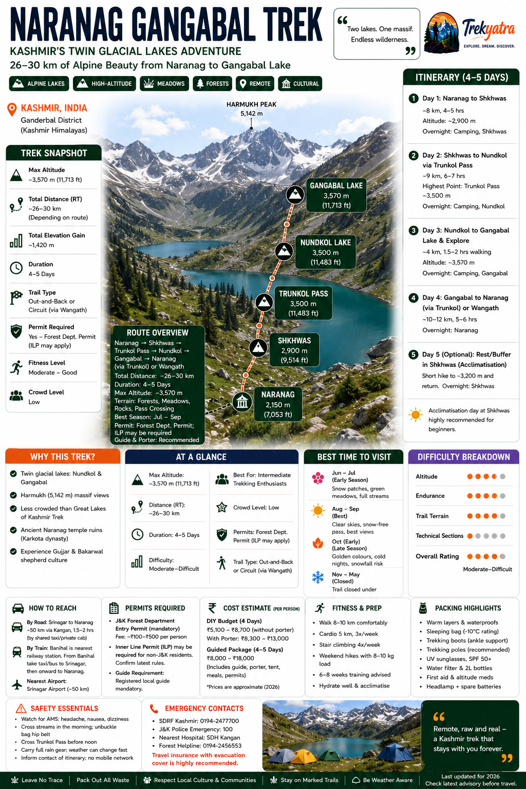
Starting from the ancient ruins of Naranag (~2,150 m), this trek winds through dense cedar and pine forests, opens into rolling alpine meadows, crosses the dramatic Trunkol Pass (~3,500 m), and finally delivers you to the twin glacial lakes of Nundkol and Gangabal (~3,570 m). The standard itinerary covers approximately 26–30 km over 4 days, though a relaxed 5-day version suits beginners well.
Unlike the Great Lakes of Kashmir Trek — its famous neighbour — the Naranag Gangabal trail sees far fewer footprints. If you want raw Kashmiri alpine wilderness without the crowds, this is your trek.
Kashmir has no shortage of beautiful treks, so what makes this route worth choosing in the 2026 season?
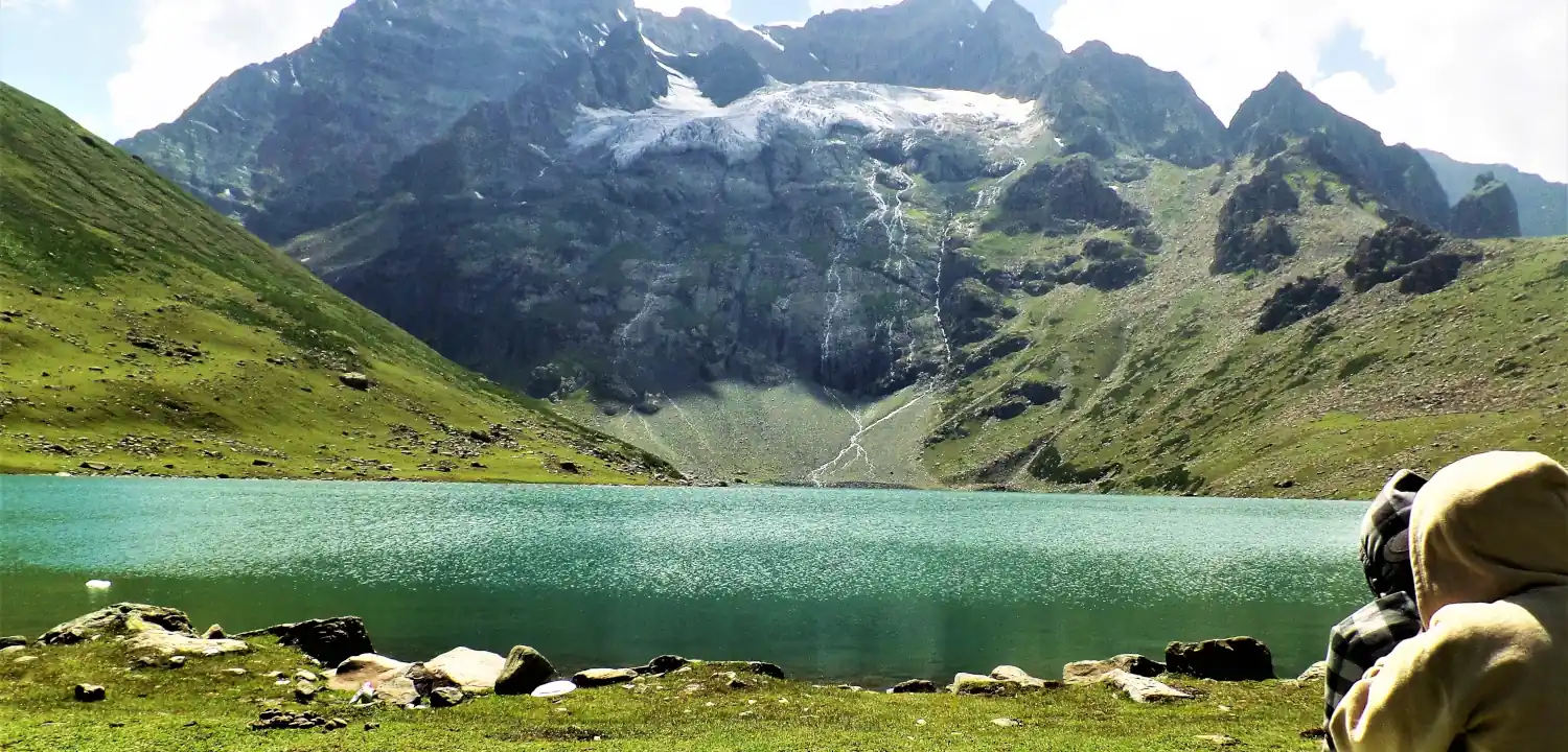
Twin glacial lakes. Gangabal Lake and the smaller Nundkol Lake sit side by side in a high cirque, both fed by glacial meltwater. The colour contrast — deep indigo Gangabal against the turquoise shimmer of Nundkol — is extraordinary, especially in morning light.
Harmukh massif backdrop. Harmukh Peak (approximately 5,142 m) dominates the skyline above the lakes. Trekkers camp directly beneath its ridgelines, and on clear days the glaciers are visible with the naked eye.
Relatively uncrowded. While the Great Lakes of Kashmir Trek draws large groups, the Naranag Gangabal trail remains quieter, making it more suitable for trekkers who value solitude and authentic wilderness.
Cultural layover at Naranag ruins. The trek begins at Naranag, home to an 8th-century Hindu temple complex. These stone ruins — believed to date to the Karkota dynasty period — add a historical dimension that purely alpine routes lack.
Authentic Kashmiri shepherd culture. The trail passes Gujjar and Bakarwal shepherd encampments. Interaction with these communities is an experience no curated resort stay can replicate.
For trekkers exploring the best treks in Kashmir, the Naranag Gangabal route sits firmly in the top tier for its combination of accessibility, scenery, and relative quiet.
At a glance
Ask TrekSage about Naranag Gangabal Trek
Get instant answers grounded in verified trek data — beginner-friendliness, best months, permits, packing, and more.
The route at a glance
The full trail runs from Naranag village to Gangabal Lake with a descent option via Wangath. Total distance is approximately 26–30 km depending on the exit route chosen. The elevation gain from the trailhead (~2,150 m) to Gangabal Lake (~3,570 m) is roughly 1,420 metres.
Terrain shifts significantly across the trail: forested river valleys in the lower sections give way to open alpine meadows, a rocky pass crossing, and finally a high-altitude lake basin with sparse vegetation.
Naranag to Shkhwas
Distance: ~8 km | Estimated time: 4–5 hours | Altitude gain: ~2,150 m to ~2,900 m
The trail begins at the Naranag temple complex, crossing a wooden bridge over the Wangath stream. For the first two kilometres the path climbs gently through walnut and maple trees before entering dense Himalayan cedar and pine forest. This section is forested, shaded, and relatively straightforward — good for warming up legs and acclimatising lungs.
Along the way, expect two or three minor stream crossings on stepping stones; these are generally safe outside early June when snowmelt can swell water levels. The trail opens at Shkhwas, a broad alpine meadow popular with Gujjar shepherds, offering the first unobstructed views of the surrounding ridgelines.
Shkhwas to Trunkol Pass
Distance: ~9 km | Estimated time: 5–6 hours | Altitude gain: ~2,900 m to ~3,500 m (pass)
This is the crux of the entire trek. The trail from Shkhwas ascends steeply through a series of switchbacks, crossing boulder fields and lingering snow patches well into July. The meadow terrain gives way to sparse alpine scrub and then bare scree as you approach the pass.
Trunkol Pass (~3,500 m) demands a slow, steady pace. Altitude effects begin to be felt here — headaches or shortness of breath are common for trekkers without prior acclimatisation. The views from the pass are panoramic: the Sind Valley to the west, and the first tantalising glimpse of the Gangabal basin to the east.
Trunkol Pass to Gangabal Lake
Distance: ~4–5 km from pass | Estimated time: 2–3 hours | Altitude at Gangabal: ~3,570 m
The descent from Trunkol Pass is steep initially, softening as you reach the shore of Nundkol Lake. Nundkol (approximately 3,500 m) is smaller and more intimate than Gangabal; many trekkers prefer camping here for better wind shelter. A short walk of roughly 1.5–2 km along the connecting trail leads to Gangabal Lake itself.
Gangabal is one of the largest high-altitude lakes in the Kashmir Himalayas. Harmukh's glaciers loom directly above, and the campsite on the lake's eastern shore offers arguably the finest high-camp view on any Kashmir trek. Brown trout fishing is permitted with a local licence — worth arranging in advance.
What each day actually looks like
The standard format is 4 days. A 5-day variant — which adds an acclimatisation half-day at Shkhwas — is recommended for first-time high-altitude trekkers. Very fit trekkers occasionally complete the route in 3 days, but this is not advised for the experience it compromises.
Day 1: Naranag to Shkhwas Camp
Distance: ~8 km | Campsite altitude: ~2,900 m | Walking time: 4–5 hours
Depart Naranag after exploring the temple ruins — an early 7:00 AM start is ideal. The first section through forest is pleasant and the gradient manageable. Arrive at Shkhwas by early afternoon, pitch camp, and spend the evening acclimatising. Shepherds at Shkhwas often sell fresh milk — take the opportunity. Clear evenings offer good views of the ridges ahead.
5-day variant: Rest at Shkhwas on Day 2, use the time for a short acclimatisation hike to ~3,200 m and return.
Day 2: Shkhwas to Nundkol Lake via Trunkol Pass
Distance: ~9 km | Highest point: Trunkol Pass ~3,500 m | Campsite altitude: ~3,500 m | Walking time: 6–7 hours
This is the most demanding day. Start no later than 6:30 AM to avoid afternoon cloud build-up and ensure you cross the pass in clear conditions. The ascent to Trunkol Pass takes 4–5 hours from Shkhwas. Take regular short breaks, hydrate consistently, and do not rush. Once over the pass, the descent to Nundkol Lake takes 1.5–2 hours. Camp on the Nundkol shore — the silence here after a hard day's walk is profound.
Day 3: Nundkol to Gangabal Lake and Exploration
Distance: ~4 km (to Gangabal and back or one-way) | Altitude: ~3,570 m | Walking time: 1.5–2 hours walking, rest of day free
A shorter, relatively easy day — and a welcome one. Move camp to Gangabal Lake in the morning or set up a day camp. Afternoon options include lakeside exploration, photography, or fishing. This is the best day for Harmukh views; try to be on the lakeshore at dawn for alpenglow on the glaciers. Altitude and cold nights require a warm sleeping bag — temperatures can drop sharply even in August.
Day 4: Gangabal to Naranag via Wangath or Retrace
Distance: ~10–12 km depending on exit route | Walking time: 5–6 hours
Two descent options exist. The most common is retracing via Trunkol Pass to Shkhwas and down to Naranag — familiar trail, safe, and predictable. The alternate exit via Wangath village follows the Gangabal stream north-west and eventually joins the Naranag–Kangan road at Wangath, adding variety but requiring local trail knowledge. Confirm trail conditions with your guide before choosing the Wangath exit. Reach Naranag by early afternoon for onward transport to Srinagar or Kangan.
When to go
June–July (Early Season): The trail is accessible from mid-June onwards as snowmelt clears Trunkol Pass. Meadows are brilliantly green, wildflowers carpet Shkhwas, and streams are full of meltwater. The trade-off: snow patches on the pass make it trickier, and stream crossings can be higher than usual. Best for trekkers comfortable with snow underfoot.
August–September (Peak Season — Recommended): This is the optimal window for the 2026 trekking season. Skies are clearest, the pass is fully snow-free, lake reflections of Harmukh are at their sharpest, and temperatures at camp are cold but manageable (typically 2–10°C at night). August also coincides with lower humidity, which is a distinct advantage in Kashmir where the tail of the South Asian monsoon can occasionally bring cloud and drizzle.
October (Autumn/Late Season): The trail is still open in early October, and the light is golden and atmospheric. However, nights at Gangabal drop to near-freezing or below, and snowfall can begin by mid-October, closing the pass unpredictably. Suitable only for experienced trekkers with proper cold-weather gear.
November–May (Closed): The trail is effectively closed under deep snow. Trunkol Pass is impassable without mountaineering equipment. Do not attempt this route outside the June–October window.
Note on monsoon: Kashmir lies in a rain-shadow from the main South Asian monsoon, so July–August typically sees less rainfall than the rest of the Himalayas. However, western disturbances can bring short but intense rain or hail at any time during summer — always carry full waterproofs.
Is this trek right for you?
Overall rating: Moderate-Difficult.
The Naranag Gangabal Trek is not a beginner-friendly stroll, but it is within reach for anyone with a reasonable fitness base and proper preparation. The single hardest section is the ascent to Trunkol Pass on Day 2 — a sustained climb of over 600 metres with some scrambling over loose rock near the top.
Fitness requirements: You should be comfortable walking 8–10 km on flat ground for several consecutive days before attempting this trek. Ideally, you will have done at least one prior trek at altitudes above 2,500 m. Cardio fitness is more important than raw strength.
Recommended training (6–8 weeks before the trek):
- Stair climbing or stair machine: 30–45 minutes, 4 times per week
- Running or brisk walking: 5 km, 3 times per week
- Yoga or stretching: to improve flexibility and breathing capacity
- Weekend hikes with a loaded pack (8–10 kg) to simulate trail conditions
Age suitability: Generally suitable for ages 14–60 with good fitness. Children below 12 and elderly trekkers above 65 should consult a physician before undertaking the Trunkol Pass section.
Altitude acclimatisation: The highest camp (Gangabal, ~3,570 m) is well within the range manageable without supplemental oxygen, but altitude sickness is not entirely ruled out — particularly on Day 2 at the pass. The 5-day itinerary with an acclimatisation day at Shkhwas significantly reduces risk for those new to altitude.
What permits you need
Permits are mandatory for the Naranag Gangabal Trek. Two separate documents may be required depending on your residence status.
1. J&K Forest Department Entry Permit
Required for all trekkers. The Gangabal Lake area falls within a protected forest zone managed by the Jammu & Kashmir Forest Department. Permits can be obtained at:
- The Forest Department checkpost at Naranag (at the trailhead)
- The District Forest Office in Ganderbal or Srinagar
Approximate fee: INR 100–500 per person per trek.
2. Inner Line Permit (ILP)
Non-residents of Jammu & Kashmir are required to obtain an Inner Line Permit for certain protected and border-adjacent areas in the Union Territory. Whether Gangabal specifically falls under the current ILP requirement should be confirmed with local authorities, as the regulatory framework has evolved in recent years.
3. ATOAI-Registered Guide Requirement
The Forest Department generally requires trekkers on this route to be accompanied by a registered local guide. Solo unguided trekking may not be permitted. Hiring a guide from Naranag village is the most practical option.
Important: Permit rules and fee structures in J&K can change between seasons. Always confirm current requirements with the J&K Forest Department or check our Kashmir Trekking Permits Guide before you travel.
What this trek will cost you
DIY Cost Breakdown (Per Person, 4 Days)
| Item | Estimated Cost (INR) |
|---|---|
| Transport: Srinagar to Naranag (shared taxi) | 400–600 |
| Transport: Return from Naranag/Wangath | 400–600 |
| Forest Department permit | 100–500 |
| Local guide from Naranag village (4 days) | 2,500–4,000 |
| Tent/sleeping bag rental (Srinagar) | 500–1,000 |
| Food supplies (self-cooked, 4 days) | 1,200–2,000 |
| Porter (optional, per day) | 800–1,200/day |
| Estimated DIY total (without porter) | ~5,100–8,700 |
Guided Package Cost
Organised packages from Srinagar-based operators or ATOAI-registered agencies for the Naranag Gangabal Trek typically range from INR 8,000–18,000 per person for a 4–5 day itinerary. This usually includes guide, porter, tent, meals, and permits.
Budget tips:
- Hire guides directly from Naranag village rather than through city agencies to reduce cost.
- Travel in a group of 4–6 to split transport and guide costs.
- Rent gear (sleeping bags, trekking poles, rain covers) in Srinagar's Lal Chowk area rather than buying.
- Use shared taxis from Kangan bus stand to Naranag rather than private cabs.
See also our Tarsar Marsar Trek Guide for a cost comparison with another popular Kashmir route.
What to pack
Packing right is the difference between a miserable experience and an extraordinary one. The Gangabal Lake Trek involves sub-zero nights, exposed pass crossings, and zero access to shops once you leave Naranag. See our detailed Kashmir Trek Packing List for the full breakdown.
Clothing & Layering
- Base layer: Moisture-wicking thermal top and bottom (merino wool or synthetic)
- Mid layer: Fleece jacket or insulated down jacket (at least 600-fill)
- Outer layer: Waterproof and windproof hardshell jacket and trousers (Gore-Tex or equivalent)
- Trekking trousers: Quick-dry, durable — carry one warm pair for camp
- Headwear: Warm beanie, sun hat, balaclava for Trunkol Pass
- Gloves: Lightweight inner gloves + waterproof outer mitts
- Sun protection: UV-blocking sunglasses (Category 3+), sunscreen SPF 50+
- Socks: 3–4 pairs of merino wool trekking socks
Trekking Gear & Equipment
- Backpack: 40–50L with rain cover
- Sleeping bag: Rated to at least -10°C (essential for Gangabal nights)
- Sleeping mat: Foam or inflatable — insulation from frozen ground matters
- Tent: 3-season, freestanding (included in most guided packages)
- Trekking poles: Highly recommended for Trunkol Pass descent
- Headlamp: With spare batteries — pre-dawn starts are common
- Water bottles: Minimum 2 litres capacity; carry a water filter or purification tablets
- Dry bags/pack liners: To waterproof your gear inside your bag
Food, Water & Nutrition
- High-energy trail snacks: dry fruits, nuts, dark chocolate, energy bars
- Instant oats, noodles, and soup packets for camp meals (if going DIY)
- Electrolyte sachets — essential above 3,000 m to manage hydration
- Oral rehydration salts (ORS) in case of mild altitude symptoms
- Drinking water: available from streams (always filter or purify) and at campsites
Documents & Emergency Items
- Government-issued photo ID (Aadhaar, passport, or voter card)
- Printed copy of Forest Department permit and ILP (if applicable)
- Travel insurance documents (with emergency evacuation cover — strongly recommended)
- Emergency contact list: SDRF Kashmir, your trek operator, family
- Basic first-aid kit: altitude medication (Diamox — consult doctor), bandages, antiseptic, blister kit, pain relief tablets
- Whistle and emergency space blanket
Staying safe on the mountain
Altitude sickness: Acute Mountain Sickness (AMS) can affect anyone above 2,500 m, regardless of fitness. Symptoms include headache, nausea, dizziness, and fatigue. If symptoms worsen rather than improving with rest, descend immediately — do not attempt to push through to the pass. Diamox (acetazolamide) can be taken as a preventative; consult your doctor before the trek.
Weather changes: Kashmir weather is unpredictable. Clear mornings can give way to afternoon hail or lightning storms on exposed ridges. Always cross Trunkol Pass before noon. Carry full waterproofs at all times and know where to shelter — boulder overhangs on the pass approach provide some protection.
Stream crossing safety: Meltwater streams are most dangerous between late May and early July when snowmelt peaks. Never attempt a crossing if water is above knee height — wait for water levels to drop, typically in the morning before solar heating increases melt. Unbuckle your backpack hip belt before crossing so you can shed the pack quickly if you fall.
Trail navigation: The trail between Shkhwas and Trunkol Pass is not always clearly marked, particularly in snow or fog. A guide with local knowledge is invaluable here. Do not rely solely on GPS — download offline maps but trust your guide over any app.
Mobile network: Expect no reliable mobile signal from Shkhwas onwards. Inform someone trusted of your itinerary and expected return date before departing Naranag. Satellite communicators (e.g., Garmin inReach) are a worthy investment for solo or small-group trekkers.
Emergency contacts:
- SDRF (State Disaster Response Force) Kashmir: 0194-2477700
- J&K Police Emergency: 100
- Nearest hospital: Sub-District Hospital, Kangan
Travel insurance: Trek-specific travel insurance with emergency helicopter evacuation cover is strongly recommended. Standard travel insurance often excludes high-altitude trekking — read the fine print carefully.
For detailed guidance on staying safe in the region, see our How to Reach Srinagar for Trekking article for logistics and pre-trek preparation tips.
Similar treks to explore
Padum to Darcha Trek: Complete High-Altitude Route Guide
The Padum to Darcha trek covers ~115–120 km in 8–9 days, crossing Shingo La (~5,060 m) between Zanskar and Lahaul.
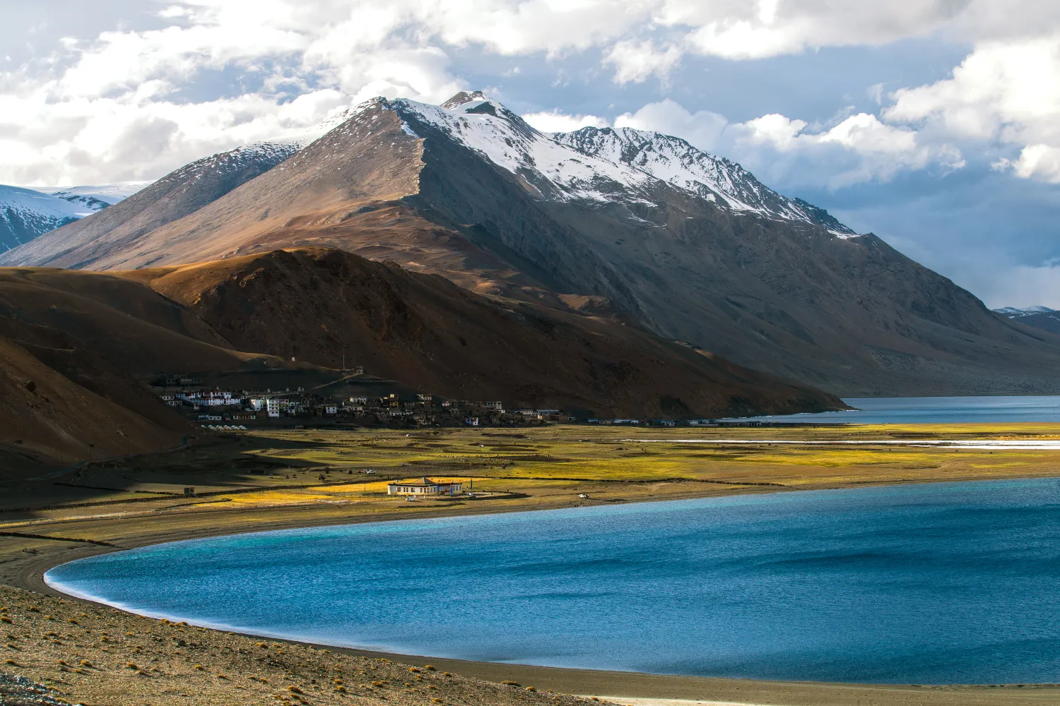
Rumtse to Tso Moriri Trek: Complete Ladakh Trail Guide
The Rumtse to Tso Moriri trek is an ~80 km, 7–8 day strenuous Ladakh trail crossing Kyamar La (~5,460 m) and Polokongka La (~5,190 m), ending at Tso Moriri Lake
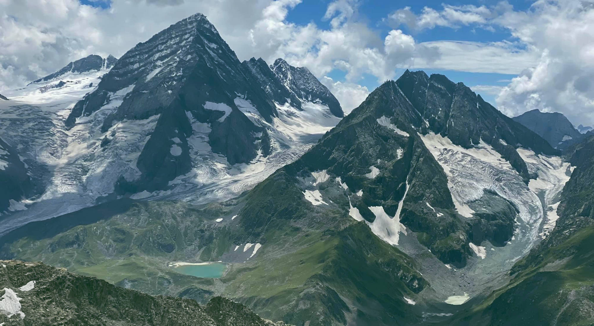
Kolahoi Glacier Trek: Complete Kashmir Guide 2026
The Kolahoi Glacier Trek is a moderate-to-challenging 6-day route from Aru Valley near Pahalgam to Kashmir's largest glacier at 4,100 m.
Common questions answered
The trek is rated Moderate-Difficult. The most demanding section is the ascent to Trunkol Pass (~3,500 m) on Day 2, which involves steep switchbacks, boulder terrain, and possible snow patches. Prior trekking experience at altitude above 2,500 m is strongly recommended. Fit beginners can manage with a 5-day itinerary and acclimatisation day.
Naranag Gangabal Trek — Latest News
LG Sinha orders reopening of Naranag
Lieutenant Governor Sinha orders reopening of Naranag Gangabal Trek in Kashmir. Trekkers can now plan expeditions to Gangabal Lake with proper permits and safet
Kashmir’s Trekking Ban Left A Legal Fight In Its Wake
Kashmir's trekking ban affects Naranag Gangabal Trek access. Legal fights ongoing. Here's what trekkers need to know about bookings and alternatives.
LG Sinha orders reopening of Naranag
LG Sinha orders reopening of Naranag Greater Kashmir
Live Conditions
Real-time weather & trail status
Trail Conditions
Crowdsourced reports from trekkers who've done this route
Sign in to add a trip report
Find a Trek Buddy
Connect with trekkers planning the same route
No buddies yet for this trek
Sign in and be the first to post a planning signal.