Why Khaliya Top Trek is on every trekker's list
Uttarakhand has no shortage of treks, so why pick Khaliya Top in 2026?
1. Unobstructed Panchachuli Views
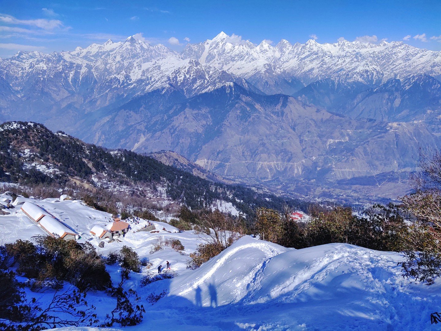
Few treks in Kumaon place you this close to the Panchachuli I–V range without requiring technical alpine skills. The meadow summit is essentially a grandstand for one of India's most photogenic mountain arrangements.
2. Rhododendron Forests
The trail cuts through dense oak and rhododendron forest. In spring (March–May), the hillside blazes red and pink — a spectacle that rivals anything in Sikkim or Himachal.
3. Beginner-Accessible
With an elevation gain of roughly 1,300 m over 6 km and no technical sections, Khaliya Top is listed among the top Uttarakhand treks for beginners. It rewards newcomers with views that veterans would envy.
4. Long-Weekend Viable
A 2-night/3-day format (including travel days) makes it one of the few genuine Himalayan experiences achievable in a long weekend from Delhi or Dehradun.
5. Nanda Devi Biosphere Proximity
The trail sits within the buffer zone of the UNESCO-nominated Nanda Devi Biosphere Reserve, giving the entire landscape a protected, pristine character you won't find near more commercialised trek corridors.
For more options in the region, explore our best treks in Kumaon guide.
At a glance
Ask TrekSage about Khaliya Top Trek
Get instant answers grounded in verified trek data — beginner-friendliness, best months, permits, packing, and more.
The route at a glance
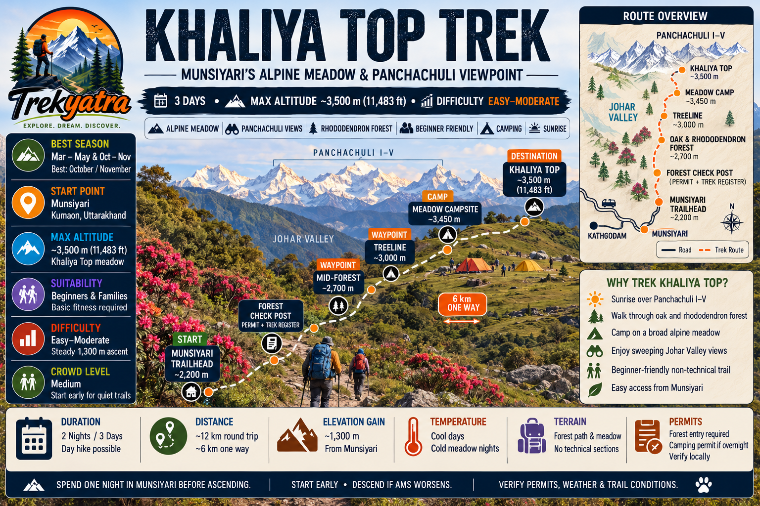
The Khaliya Top trek is a straightforward out-and-back trail starting from Munsiyari town (approximately 2,200 m) and ascending to the Khaliya Top meadow (approximately 3,500 m). The one-way distance is roughly 6 km, making the round trip approximately 12 km. Elevation gain is approximately 1,300 m.
Trail Character:
The trail begins on a forest path through oak and rhododendron woodland. The gradient is steady but manageable. After approximately 3–4 km, the forest thins and you emerge onto open alpine scrub. The final kilometre opens into the broad, flat meadow that defines Khaliya Top. There are no scrambles or exposed ridges — the path is well-worn and, in good weather, clearly defined.
Elevation Profile (approximate):
- Munsiyari trailhead: ~2,200 m
- Mid-forest waypoint: ~2,700 m (approximately 2.5 km in)
- Treeline transition: ~3,000 m (approximately 4 km in)
- Khaliya Top summit meadow: ~3,500 m (6 km)
Trailhead and Starting Point
The trailhead is located within Munsiyari town, near the Tribal Heritage Museum and the Nanda Devi Temple area on the upper side of the settlement. Most guesthouses in Munsiyari can point you to the start within minutes. Look for the painted signboard indicating the forest trail to Khaliya Top.
Trek Register Point: Before entering the forest, you will pass a forest department check post where you must present your forest entry permit and log your details in the trek register. Do not skip this step — it is both a legal requirement and a safety record. The Munsiyari Forest Range Office (located in town, near the main market) is where you obtain permits in person before the trek.
Key Trail Landmarks
- Birthi Forest Zone: The first major stretch of dense mixed forest, rich in birdlife. Langurs are common sightings.
- Treeline Transition (~3,000 m): The forest gives way to low alpine scrub and the first clear mountain views open up. This is a natural rest point.
- Flat Meadow Plateau: The broad, gently sloping meadow that forms the upper trail. Camping sites are established here.
- Summit View Point: From the highest point of the meadow, on a clear day you can see Panchachuli I, II, III, IV, and V, Nanda Devi, Rajramba Peak, and Hardyal Peak. The 360-degree panorama also takes in the Johar Valley below.
What each day actually looks like
The recommended format is 2 nights / 3 days, with one day for arrival and acclimatisation, one full trek day, and one descent/buffer day. Fit trekkers can complete the round trip in a single long day.
Day 0 – Arrival in Munsiyari
Munsiyari is approximately 295 km from Kathgodam (the nearest major railhead) and around 310 km from Pantnagar Airport. The journey by shared jeep or private cab from Kathgodam takes 10–12 hours on mountain roads via Almora and Pithoragarh. Detailed transport options are covered in our how to reach Munsiyari guide.
On arrival: Check into your guesthouse, eat a hot meal, and take a gentle acclimatisation walk around town — the viewpoint near the Tribal Heritage Museum offers your first glimpse of Panchachuli. Visit the Munsiyari Forest Range Office (open on weekdays and most mornings; confirm hours locally) to obtain your forest entry permit and camping permit if you plan to stay overnight on the trail. Carry original government-issued photo ID.
Overnight: Munsiyari town (guesthouses available across budget ranges; ₹600–₹2,500/night for a double room).
Day 1 – Munsiyari to Khaliya Top Camp
- Start time: 6:00–7:00 AM (early start avoids afternoon cloud build-up)
- Distance: ~6 km
- Estimated duration: 5–6 hours at a comfortable pace
- Altitude gain: ~1,300 m
- Campsite: Established meadow campsite near the summit (~3,500 m)
The trail enters the forest immediately after the check post. The first 2 km are the steepest. Pace yourself — slow and steady is the Himalayan rule. By mid-morning you'll be into the rhododendron belt. Lunch break at the treeline. Reach camp by early afternoon (1:00–2:00 PM), giving you time to set up tent, rest, and be fully present for the sunset over Panchachuli — one of the finest views in Kumaon.
Overnight: Tented camp at Khaliya Top meadow. Sleeping bag rated to at least -5°C is essential even in summer.
Day 2 – Summit Exploration and Descent to Munsiyari
- Wake up: 5:00–5:30 AM for golden-hour alpenglow on Panchachuli
- Exploration: 1–2 hours on the meadow
- Begin descent: 7:30–8:00 AM
- Estimated descent duration: 3–4 hours
- Arrive Munsiyari: Early to mid-afternoon
Spend the first light of Day 2 on the meadow — this is the moment Khaliya Top is famous for. The Panchachuli peaks catch the sunrise in shades of amber and rose. After breakfast at camp, pack up and begin the descent by mid-morning. The forest trail down is faster and gentler on the knees if you use trekking poles. Back in Munsiyari by early afternoon with time to shower, eat a proper meal, and arrange your return transport.
Optional: If the forecast is clear and you want more time on the summit, extend your camp stay to a second night and descend on Day 3.
One-Day Option: Fit trekkers who start by 5:30 AM can complete the round trip in approximately 9–11 hours. This is not recommended for first-timers or anyone not acclimatised to altitude.
When to go
Spring (March–May) — Highly Recommended
Rhododendrons are in full bloom from late March through April. Skies are generally clear in the early morning. Temperatures are mild at the meadow (5–12°C during the day). This is one of the two peak seasons.
Early Summer (June) — Good
A narrow pre-monsoon window. Warmer temperatures, occasional clouds, but still manageable. June is getting shorter as monsoon onset creeps earlier — check weather forecasts before committing.
Monsoon (July–September) — Avoid
Trail surfaces become slippery and hazardous. Leeches are active in the forest zone. Visibility is poor, mountain views are largely blocked by cloud. We do not recommend Khaliya Top during active monsoon.
Autumn (October–November) — Best Overall
Post-monsoon skies are crystal-clear and the air is crisp. The Panchachuli views are at their sharpest. Temperatures drop quickly in November — carry warm layers. October and November represent the ideal window for photography and first-time trekkers.
Winter (December–February) — Snow Trek
Khaliya Top transforms into a snow-covered landscape. The trail is partially accessible but requires microspikes or crampons, a -15°C rated sleeping bag, and prior cold-weather trekking experience. A local guide is mandatory in winter. Trail conditions vary significantly year to year — verify locally before planning a December–February visit.
Is this trek right for you?
Overall Rating: Easy to Moderate
Khaliya Top is one of the most beginner-friendly Himalayan treks available. There is no technical climbing, no exposed ridgeline traversing, and no glacier crossing. The primary challenge is the sustained elevation gain of approximately 1,300 m over 6 km, which requires cardiovascular stamina.
Recommended Preparation:
- 2–3 weeks of regular cardio: brisk walking, jogging, stair climbing, or cycling
- At least 2–3 sessions per week of 45–60 minutes each
- No prior trekking experience strictly required, but any past hiking experience is an advantage
Age Suitability:
- Children aged 10 and above with adult supervision (confirm fitness individually)
- Seniors in good cardiovascular health can complete the trek; consult a physician if in doubt
- Those with respiratory or cardiac conditions should seek medical clearance before any Himalayan trek
Altitude Mountain Sickness (AMS):
The risk at 3,500 m is relatively low compared to higher Himalayan treks, but AMS is a real possibility, especially if you ascend without proper acclimatisation. Spend at least one night in Munsiyari (2,200 m) before attempting the summit. Recognise early AMS symptoms: persistent headache, nausea, dizziness, loss of appetite. If symptoms worsen, descend immediately. Read our full altitude sickness prevention guide before your trek.
What permits you need
A forest entry permit is mandatory for the Khaliya Top trek. The trail passes through the buffer zone of the Nanda Devi Biosphere Reserve, which is managed by the Uttarakhand Forest Department.
Permit Details (2026):
| Permit Type | Issuing Authority | Approximate Cost | Notes |
|---|---|---|---|
| Forest Entry Permit | Munsiyari Forest Range Office | ₹150–₹200 per person per day | |
| Overnight Camping Permit | Munsiyari Forest Range Office | Additional fee — verify locally |
How to Obtain:
- Permits are issued in person only at the Munsiyari Forest Range Office, located near the main market in Munsiyari town.
- There is no online portal for these permits as of 2026 (verify locally — this may change).
- Carry original government-issued photo ID (Aadhaar, passport, or voter ID).
- Permits are typically issued during office hours on weekdays; Saturday availability varies — confirm before arrival.
For a broader overview of trekking permits in Uttarakhand, see our Uttarakhand trek permits guide.
What this trek will cost you
DIY Budget (Per Person)
| Item | Approximate Cost (2026) |
|---|---|
| Forest entry + camping permit (2 days) | ₹300–₹400 |
| Local shared transport (Munsiyari town) | ₹100–₹200 |
| Tent rental (if not carrying own) | ₹300–₹500/night |
| Sleeping bag rental | ₹200–₹400/night |
| Meals (Munsiyari + trail) | ₹600–₹1,000 |
| Miscellaneous (snacks, water, etc.) | ₹300–₹500 |
| DIY Total (approx.) | ₹2,500–₹4,000 |
Guided Package (Per Person from Munsiyari)
Several local operators in Munsiyari offer guided Khaliya Top packages including guide, porter, camping equipment, meals on trail, and permit assistance.
| Package Type | Approximate Cost |
|---|---|
| 2-night guided camp package | ₹5,000–₹9,000 per person |
| Day-trek with guide only | ₹1,500–₹2,500 per person |
Local Operators: Several trekking outfitters operate out of Munsiyari town; ask at your guesthouse for reputable local guides registered with the forest department. Avoid unregistered guides who cannot produce valid registration.
Note: Prices above do not include transport to/from Munsiyari, accommodation in town, or travel insurance (strongly recommended).
What to pack
A well-packed bag is the difference between a great trek and a miserable one. Keep your pack under 12 kg for comfort on this trail. Full gear recommendations are also available in our Himalayan trek packing list guide.
Clothing (Layering System):
- Moisture-wicking base layer (top and bottom)
- Mid-layer fleece or down jacket
- Waterproof and windproof outer shell jacket
- Trekking trousers (quick-dry)
- Warm hat, gloves, and neck gaiter
- Thermal socks (2–3 pairs)
- Sun hat or cap
Footwear:
- Ankle-support waterproof trekking boots (broken in before the trek)
- Camp sandals or lightweight shoes
- Gaiters (useful in snow season)
Gear:
- Sleeping bag rated to -5°C minimum (winter: -15°C)
- Trekking poles (highly recommended for descent)
- 30–40 litre trekking backpack with rain cover
- Headlamp + spare batteries
- Sunglasses (UV400 or higher)
- Sunscreen (SPF 50+) and lip balm
- Reusable water bottles or hydration bladder (3L capacity)
- Offline maps downloaded: Maps.me or Gaia GPS
Nutrition:
- Trail snacks: nuts, energy bars, dried fruit, chocolate
- Oral rehydration salts / electrolyte sachets
- Personal water purification tablets
Documents:
- Original photo ID (Aadhaar / passport)
- Forest permit and camping permit copies
- Emergency contact list (printed)
- Travel insurance documents
First Aid:
- Basic first aid kit (bandages, antiseptic, blister pads)
- Paracetamol and ibuprofen
- Diamox (Acetazolamide) for AMS prevention — consult a physician before use
- Personal prescription medications
[Affiliate product card slot — trekking poles, sleeping bags, layering kits]
Staying safe on the mountain
1. Altitude Mountain Sickness (AMS)
AMS can affect anyone regardless of age or fitness. Symptoms to watch: persistent headache, nausea, vomiting, loss of coordination, confusion. If you or anyone in your group shows moderate to severe symptoms, descend immediately — do not wait for morning. Never ascend with AMS symptoms. See our altitude sickness prevention guide.
2. Hydration
Drink a minimum of 3 litres of water per day on the trail. Dehydration accelerates AMS and fatigue. Avoid alcohol the night before trekking.
3. Weather Awareness
Mountain weather at 3,500 m can change within minutes. Clear morning skies can become hail or snowfall by early afternoon, particularly in spring and autumn. Start early, aim to reach camp by 1–2 PM, and never dismiss a darkening sky.
4. No Solo Trekking in Winter
From December through February, snow on the trail can obscure the path entirely. Do not attempt Khaliya Top solo in winter without a registered local guide.
5. Register at the Forest Office
Always sign the trek register at the Munsiyari Forest Range Office check post. This ensures rescue teams know you are on the trail if an emergency arises.
6. Emergency Contacts:
- SDRF Uttarakhand (State Disaster Response Force): Contact number to be verified with local Munsiyari SDRF post before departure
- Uttarakhand Tourism Helpline: 1364
- Nearest Major Hospital: District Hospital Pithoragarh, approximately 140 km from Munsiyari
- Munsiyari PHC (Primary Health Centre): Located in Munsiyari town; for non-emergency medical support
7. Offline Navigation
Cell coverage is unreliable beyond Munsiyari town. Download Maps.me or Gaia GPS maps of the Munsiyari area before you leave mobile coverage. Carry a physical compass as backup.
8. Leave No Trace
Khaliya Top's meadow is fragile and protected. Pack out all waste, do not pick vegetation, and use designated fire zones only. Open fires are restricted in the biosphere buffer zone — verify rules at the forest office.
Similar treks to explore
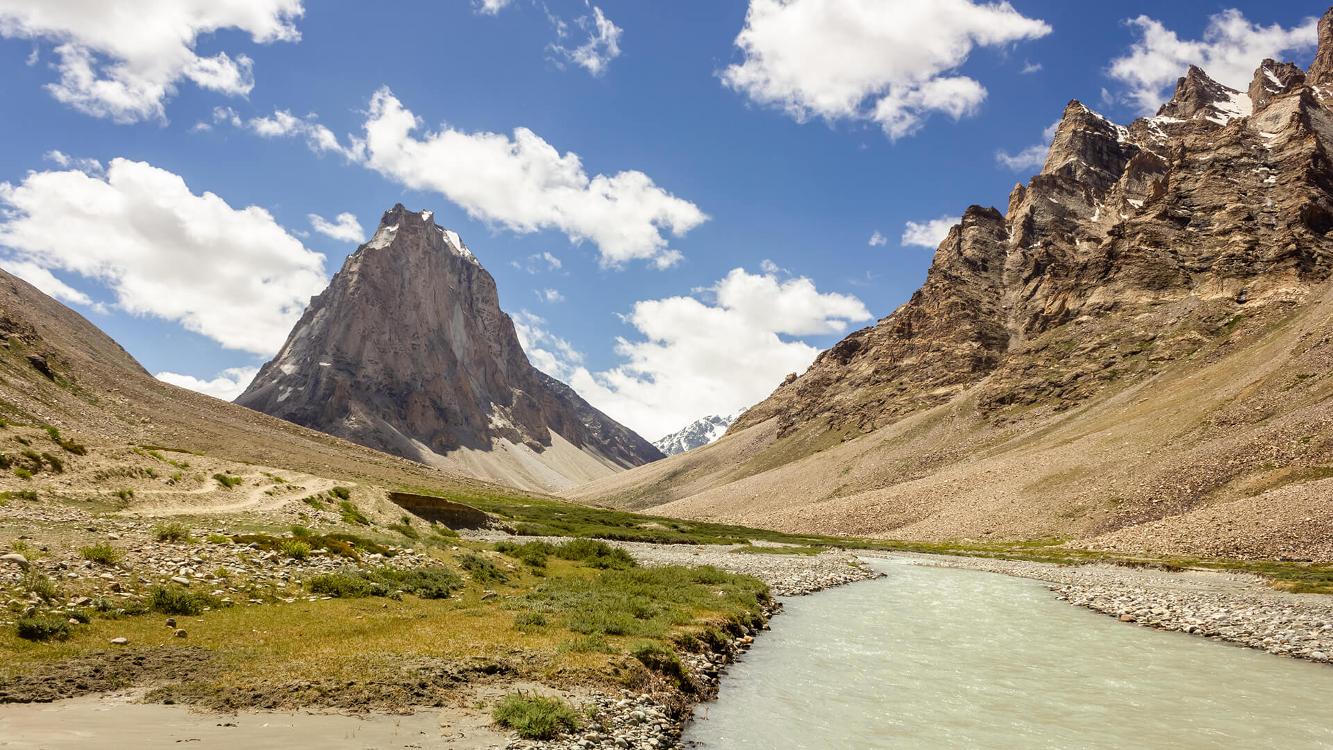
Padum to Darcha Trek: Complete High-Altitude Route Guide
The Padum to Darcha trek covers ~115–120 km in 8–9 days, crossing Shingo La (~5,060 m) between Zanskar and Lahaul.
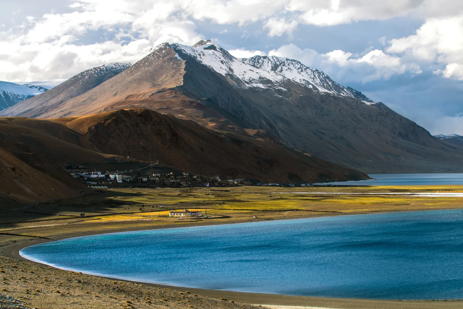
Rumtse to Tso Moriri Trek: Complete Ladakh Trail Guide
The Rumtse to Tso Moriri trek is an ~80 km, 7–8 day strenuous Ladakh trail crossing Kyamar La (~5,460 m) and Polokongka La (~5,190 m), ending at Tso Moriri Lake
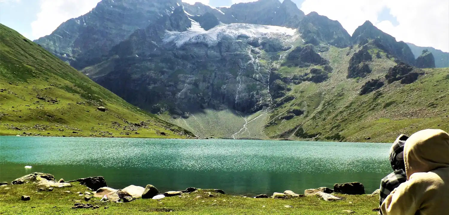
Naranag Gangabal Trek: Complete Guide (2026)
The Naranag Gangabal Trek is a 4–5 day moderate-difficult alpine trek in Kashmir, covering ~26–30 km from Naranag (2,150 m) to Gangabal Lake (3,570 m).
Common questions answered
Khaliya Top is rated easy to moderate and is one of the most beginner-friendly Himalayan treks in Uttarakhand. The trail is 6 km one-way with an elevation gain of approximately 1,300 m. There is no technical climbing or scrambling required. Basic cardiovascular fitness — built over 2–3 weeks of regular exercise — is sufficient for most people.
Live Conditions
Real-time weather & trail status
Trail Conditions
Crowdsourced reports from trekkers who've done this route
Sign in to add a trip report
Find a Trek Buddy
Connect with trekkers planning the same route
No buddies yet for this trek
Sign in and be the first to post a planning signal.