
Why Madmaheshwar Trek is on every trekker's list
The Madmaheshwar Trek is a moderate 48 km round-trip Himalayan trek in Uttarakhand, reaching the sacred Shiva temple at 3,497 m — open May to November, permit required.
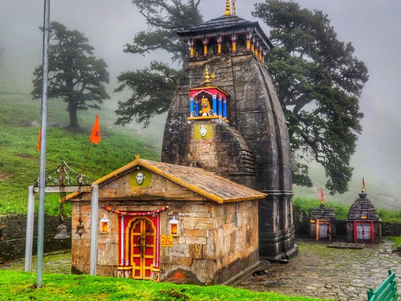
Tucked deep in the Garhwal Himalaya, the Madmaheshwar Trek leads pilgrims and adventure seekers to a 12th-century Shiva temple at 3,497 m, where legend says Lord Shiva's navel (nabhi) touched the earth. As the second shrine of the Panch Kedar circuit, Madmaheshwar occupies a unique place in Hindu tradition—yet, unlike the thronged ghats of Kedarnath, the trail here still feels refreshingly wild.
The one-way trekking distance from Ransi basecamp is approximately 24 km, climbing from around 2,100 m to 3,497 m over four days. On clear mornings, the twin peaks above the temple frame jaw-dropping panoramas of Kedarnath, Chaukhamba, and Neelkanth peaks—views that rival anything the Uttarakhand Himalaya has to offer. Whether you are a first-time Himalayan trekker seeking spiritual connection or an experienced mountaineer wanting a quieter alternative to the Valley of Flowers, Madmaheshwar delivers.
What Is the Spiritual Significance of Madmaheshwar Temple?
Hindu mythology records that after the Kurukshetra war, the Pandavas sought Lord Shiva's blessings to atone for killing their kin. Shiva, wishing to avoid them, disguised himself as a bull and dove into the earth at Kedarnath—but different parts of his body emerged at five locations across the Garhwal Himalaya, collectively known as the Panch Kedar.
At Madmaheshwar, it is Shiva's navel (nabhi) that is venerated. The temple, built in the classic North Indian Nagara style, is managed by the Kedarnath temple committee and opens each year in May (exact date set by the Hindu almanac) and closes after Diwali in October or November. The season for the 2026 trek is expected to follow the same May–November window; check with local authorities for the precise opening date closer to your travel.
For those undertaking the full Panch Kedar pilgrimage—Kedarnath, Madmaheshwar, Tungnath, Rudranath, and Kalpeshwar—Madmaheshwar is typically the second stop and the highest effort required after Kedarnath.
What Makes the Madmaheshwar Trek Unique?
- High-altitude bugyals (meadows): The approach through Narbagaon bugyal and the meadows surrounding the temple are among the most photogenic alpine grasslands in Uttarakhand.
- 360° Himalayan panoramas: The side trip to Budha Madmaheshwar (4,200 m) offers unobstructed views of the entire central Garhwal skyline.
- Off-beaten character: Compared to the Valley of Flowers or Kedarnath, Madmaheshwar sees significantly fewer trekkers, meaning you share the trail mainly with local pilgrims and wildlife.
- Kedarnath Wildlife Sanctuary: Much of the route passes through this protected area, home to musk deer, Himalayan black bear, and a rich variety of birds.
At a glance
Ask TrekSage about Madmaheshwar Trek
Get instant answers grounded in verified trek data — beginner-friendliness, best months, permits, packing, and more.
The route at a glance
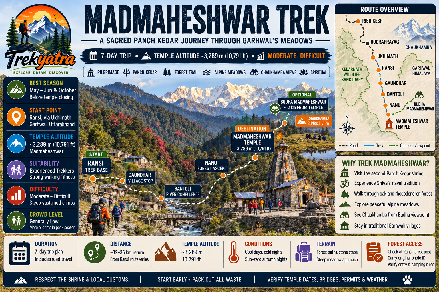
The journey begins in Rishikesh and ends—at least logistically—back there. The road head is Ukhimath (1,317 m), from which a short drive or walk takes you to Ransi village (2,100 m), the official trek start. The trail then climbs through forests and meadows via Bantoli, Narbagaon, and finally to Madmaheshwar temple.
An alternate route through the Kedarnath Wildlife Sanctuary exists but is less travelled and requires additional coordination with forest authorities.
What Is the Distance and Altitude Profile of the Madmaheshwar Trek?
| Point | Altitude | Cumulative Trek Distance from Ransi |
|---|---|---|
| Rishikesh | ~1,600 m (approx.) | Road |
| Ukhimath | 1,317 m | Road (~200 km from Rishikesh) |
| Ransi (Trek Start) | ~2,100 m | 0 km |
| Bantoli | ~2,600 m | ~5 km |
| Narbagaon | ~3,050 m | ~13 km |
| Madmaheshwar Temple | 3,497 m | ~24 km |
| Budha Madmaheshwar (optional) | ~4,200 m | ~27 km |
Key Landmarks on the Madmaheshwar Trek Route
- Ransi Village: Last motorable point; forest checkpost for permits; basic guesthouses; starting point for all trekkers.
- Bantoli Forest Camp: Dense rhododendron and oak forest; river crossings; first major camping spot.
- Narbagaon Bugyal: Open alpine meadow; sweeping preliminary views; last major stop before the temple.
- Madmaheshwar Kund: A small sacred glacial lake adjacent to the temple; considered holy by pilgrims.
- Budha Madmaheshwar Viewpoint (4,200 m): The crown jewel of the trek—a 6 km round trip from the main temple offering the closest ground-level views of Kedarnath and Chaukhamba peaks.
From Rishikesh:
- Shared jeeps and private taxis run to Ukhimath via Rudraprayag; total road distance approximately 200 km, journey 7–8 hours
- From Ukhimath, hire a local jeep or walk (~8 km) to Ransi basecamp
- State buses (UPSRTC/Uttarakhand Roadways) ply to Ukhimath from Rishikesh bus stand; slower but cheaper
From Delhi:
- Overnight bus or train to Haridwar/Rishikesh (approx. 6–7 hours by train from New Delhi)
- Connect to Ukhimath as above
- See our Rishikesh to Badrinath travel guide for broader regional transport context
Nearest Airport: Jolly Grant Airport, Dehradun (~30 km from Rishikesh, ~230 km from Ukhimath)
Nearest Railhead: Haridwar Junction or Rishikesh Railway Station
For more best treks in Uttarakhand starting from Rishikesh, explore our complete regional guide.
What each day actually looks like
Day 1: Rishikesh to Ukhimath (Drive ~200 km, 7–8 hrs)
Depart Rishikesh early (ideally by 5:00–6:00 AM) to avoid afternoon congestion on mountain roads. The route passes through Devprayag (confluence of Alaknanda and Bhagirathi), Rudraprayag, and Augustmuni before arriving at Ukhimath. The drive covers approximately 200 km and takes 7–8 hours depending on road conditions and stops.
Ukhimath (1,317 m) is the base town for Madmaheshwar pilgrims and has several guesthouses and dhabas. Use the afternoon to rest, hydrate, and explore the Ukhimath temple complex. Overnight in Ukhimath.
Altitude: 1,317 m | Drive: ~200 km
Day 2: Ukhimath to Ransi to Bantoli (Drive + Trek ~5 km, 3–4 hrs)
A short 8 km drive from Ukhimath brings you to Ransi village (2,100 m). Register at the forest checkpost and collect your permits here. The trek to Bantoli (2,600 m) covers approximately 5 km through mixed forest, gaining around 500 m in altitude. The trail is well-defined and the gradient is gentle—a good warm-up day.
Overnight at Bantoli tea house or camping. Basic meals available at local stalls.
Trek Distance: ~5 km | Altitude gain: ~500 m | Duration: 3–4 hrs
Day 3: Bantoli to Narbagaon (8 km, 5–6 hrs)
This is the most scenic forest day. The trail winds through dense rhododendron, oak, and fir forests with several river crossings (log bridges; take care in monsoon). As you gain altitude, the tree line gradually gives way to open shrubland, and you emerge onto the broad Narbagaon bugyal (3,050 m)—your first dramatic views of the high Himalayan ridgeline.
Set up camp at Narbagaon. Temperatures drop sharply at night; ensure your sleeping bag is rated to at least -10°C.
Trek Distance: ~8 km | Altitude gain: ~450 m | Duration: 5–6 hrs
Day 4: Narbagaon to Madmaheshwar Temple (6 km, 4–5 hrs)
The final ascent is the shortest in distance but the most emotionally charged. The trail crosses alpine meadows dotted with wildflowers (in summer) and offers increasingly close views of the surrounding peaks. You arrive at Madmaheshwar temple (3,497 m) in time for afternoon darshan.
The temple priest performs regular puja rituals; pilgrims often take a dip in the Madmaheshwar Kund despite the icy water. Overnight in the GMVN rest house or camping near the temple.
Trek Distance: ~6 km | Altitude gain: ~447 m | Duration: 4–5 hrs
Day 5: Madmaheshwar – Budha Madmaheshwar – Madmaheshwar (Optional, ~6 km round trip)
Start before dawn for the side trip to Budha Madmaheshwar (4,200 m)—a steady 3 km climb above the main temple. On clear days, you are rewarded with arguably the finest 360° panorama in the central Garhwal, with Kedarnath Peak, Chaukhamba, Neelkanth, and dozens of unnamed summits filling the horizon.
Return to camp by mid-morning, leaving the afternoon free for rest, temple meditation, or acclimatisation walks. This rest day at altitude also helps your body prepare for the long descent.
Round-trip Distance: ~6 km | Altitude gain/loss: ~700 m | Duration: 3–4 hrs
Day 6: Madmaheshwar to Ransi (Descent ~24 km, 6–7 hrs)
The full descent in a single day is demanding on the knees; use trekking poles and take it steadily. Most trekkers break at Narbagaon for lunch before pushing on to Bantoli and then Ransi (2,100 m). Overnight at Ransi guesthouse—a welcome bed after days of camping.
Trek Distance: ~24 km (descent) | Duration: 6–7 hrs
Note: Some groups split this over two days (Madmaheshwar → Bantoli → Ransi) for a more comfortable experience. Adjust your itinerary if needed.
Day 7: Ransi to Rishikesh (Drive + Departure)
Drive from Ransi back to Ukhimath and then onward to Rishikesh (approximately 7–8 hours). Arrive in Rishikesh by late afternoon or evening. The trip concludes here.
When to go
The trail and temple are open from May to November. Each season has a distinct character.
Summer (May–June)
The most popular window for first-time trekkers. Skies are generally clear, snow patches add drama to the upper meadows, temperatures are pleasant during the day (10–18°C at altitude), and the trail is at its safest. Wildflowers begin blooming in late May. Recommended for beginners and pilgrims.
Monsoon (July–September)
Uttarakhand receives heavy rainfall between July and mid-September. The bugyals turn an intense green, but trails become slippery and river crossings can be hazardous. Leeches are common in the forest sections, and landslides occasionally block the road to Ukhimath. For experienced trekkers only; check road conditions before departure.
Autumn (October–November)
Post-monsoon skies are the clearest of the year, offering the best mountain visibility. Nights turn genuinely cold (below 0°C at Madmaheshwar), and the landscape glows gold with dying grasses. The temple closes after Diwali (October/November depending on the Hindu calendar), so confirm closing dates for 2026 with local authorities. Second-best window overall; ideal for photographers.
Winter (December–April)
The trail is buried under heavy snow, the temple is closed, and the route is inaccessible to most trekkers. Not recommended.
Is this trek right for you?
The Madmaheshwar Trek is classified as Moderate. Here is what that means in practical terms:
- Maximum altitude: 3,497 m (4,200 m if you include Budha Madmaheshwar)
- Daily walking: 5–8 km on most days, with 4–7 hours of continuous movement
- Terrain: Uneven forest paths, river crossings, steep switchbacks on the final approach
- Suitable for: Adults and teenagers with basic fitness who walk regularly; no prior Himalayan trekking experience strictly required but helpful
- Not suitable for: Those with cardiac or respiratory conditions, or anyone who has not been physically active in the months preceding the trek
For altitude context, see our guide on how to acclimatise for Himalayan treks.
Training Plan for the Madmaheshwar Trek
Begin preparation 4 weeks before your trek date:
- Week 1–2: 30 minutes of brisk walking or jogging daily; stair climbing (10–15 floors) three times per week
- Week 3: Increase to 45–60 minutes daily; introduce a 10–12 km weekend walk with a light daypack (5–7 kg)
- Week 4: Two 12–15 km weekend walks; continue daily cardio; add pranayama (breathing exercises) to improve oxygen efficiency at altitude
- Throughout: Stay well-hydrated, reduce alcohol intake, and get adequate sleep
What permits you need
A forest entry permit is mandatory for all trekkers as the route passes through the Kedarnath Wildlife Sanctuary. Key details:
- Permit name: Kedarnath Wildlife Sanctuary Entry Permit
- Where to obtain: Ransi Forest Checkpost (on-site; no advance online booking available as of early 2026—verify before travel)
- Cost: Approximately ₹150–₹200 per person
- Documents required: Original government-issued photo ID (Aadhaar, passport, or driving licence); keep a photocopy for the permit officer
- Temple entry: Free; donations welcomed
- Camera fee: A nominal still/video camera fee may apply; confirm at checkpost
Foreign nationals may need an additional permit or may be restricted from certain zones within the wildlife sanctuary; check with the Forest Department or your tour operator in advance.
What this trek will cost you
DIY Budget Breakdown (per person, 7 days)
| Item | Estimated Cost (INR) |
|---|---|
| Transport: Rishikesh → Ukhimath → Ransi (shared jeep) | ₹500–₹800 each way |
| Return transport | ₹500–₹800 |
| Guesthouse / camping per night (4–5 nights) | ₹200–₹500/night |
| Meals (3 meals/day × 7 days) | ₹150–₹300/meal |
| Forest permit | ~₹200 |
| Miscellaneous (snacks, tips, porter if needed) | ₹500–₹1,000 |
| Total DIY estimate | ₹5,000–₹8,000 |
Excludes travel to/from Rishikesh and personal gear costs.
Guided Package Cost
Organised tours from Rishikesh typically run ₹12,000–₹18,000 per person for a 6–7 day package and include:
- Return transport from Rishikesh
- All accommodation (guesthouses + camping)
- All meals on trek
- Certified local guide and support staff
- Camping equipment (tent, sleeping mat; sleeping bag often extra or included at higher price points)
- Permits and entry fees
Operator pricing varies; compare at least three to four registered operators through Uttarakhand Tourism or GMVN directly before booking. GMVN (Garhwal Mandal Vikas Nigam) operates its own budget packages which tend to be at the lower end of this range.
What to pack
For a comprehensive gear overview, see our best trekking gear guide for India.
Clothing & Footwear
- Waterproof, ankle-support trekking boots (broken in before the trek)
- Thermal base layer (top and bottom)
- Fleece mid-layer jacket
- Waterproof and windproof outer shell jacket
- Trekking pants (quick-dry; 2 pairs)
- Gaiters (especially useful in monsoon and early summer snow)
- Warm beanie / wool hat
- Lightweight gloves (inner) + waterproof outer gloves
- Sun hat or cap
- Warm socks × 4–5 pairs (merino wool recommended)
- Camp sandals or lightweight shoes
Gear & Equipment
- Trekking poles (collapsible; protects knees on descent)
- 50–60 L backpack with rain cover
- Sleeping bag rated to -10°C (essential at Madmaheshwar)
- Headlamp with spare batteries
- Water bottles × 2 (1 L each) or hydration bladder
- Water purification tablets or filter
- Sunglasses (UV400 or polarised)
- Sunscreen SPF 50+
Medical & Safety Kit
- Diamox (acetazolamide): Consult your doctor before the trek; commonly recommended for altitude above 3,000 m
- ORS (Oral Rehydration Salts) packets × 10
- Blister treatment kit (moleskin, antiseptic, bandages)
- Paracetamol and ibuprofen
- Antiseptic cream / iodine
- Personal prescription medicines with sufficient supply
- Know the signs of Acute Mountain Sickness (AMS): headache, nausea, dizziness, loss of appetite
Documents & Essentials
- Original government ID + photocopies (×3)
- Permit copy
- Cash: No ATMs beyond Ukhimath; carry sufficient INR for the entire trek
- Offline maps downloaded (Maps.me or Gaia GPS work well in this region)
- Emergency contacts list (written, not just on phone)
- Travel insurance documents (ensure it covers high-altitude trekking to 4,200 m)
Staying safe on the mountain
- Altitude sickness: Ascend no more than 500 m per day above 2,500 m. If you experience severe headache, vomiting, or loss of coordination, descend immediately and seek medical help. Do not continue ascending.
- Hydration: Drink 3–4 litres of water per day on the trek. At altitude, dehydration accelerates symptoms of AMS.
- Solo trekking: While the trail is well-marked in season, solo trekking is not recommended during monsoon due to slippery trails, flash flood risk, and reduced visibility. Hire a local guide (₹800–₹1,200/day estimated) if unfamiliar with the terrain.
- Register at checkpost: Always register your name, contact details, and return date at the Ransi forest checkpost. This enables rescue operations if you are overdue.
- Emergency contacts:
- Uttarakhand Tourism Helpline: 1364
- SDRF (State Disaster Response Force) Uttarakhand emergency: Contact via local police or district administration
- Nearest district hospital: Rudraprayag District Hospital (~60 km from Ukhimath) - Weather: Mountain weather changes rapidly. Start each day's walk early (by 6:00–7:00 AM) to reach camp before afternoon cloud buildup or thunderstorms.
- Wildlife: You are trekking through a wildlife sanctuary. Do not approach, feed, or provoke animals. Keep food sealed in your tent.
Similar treks to explore
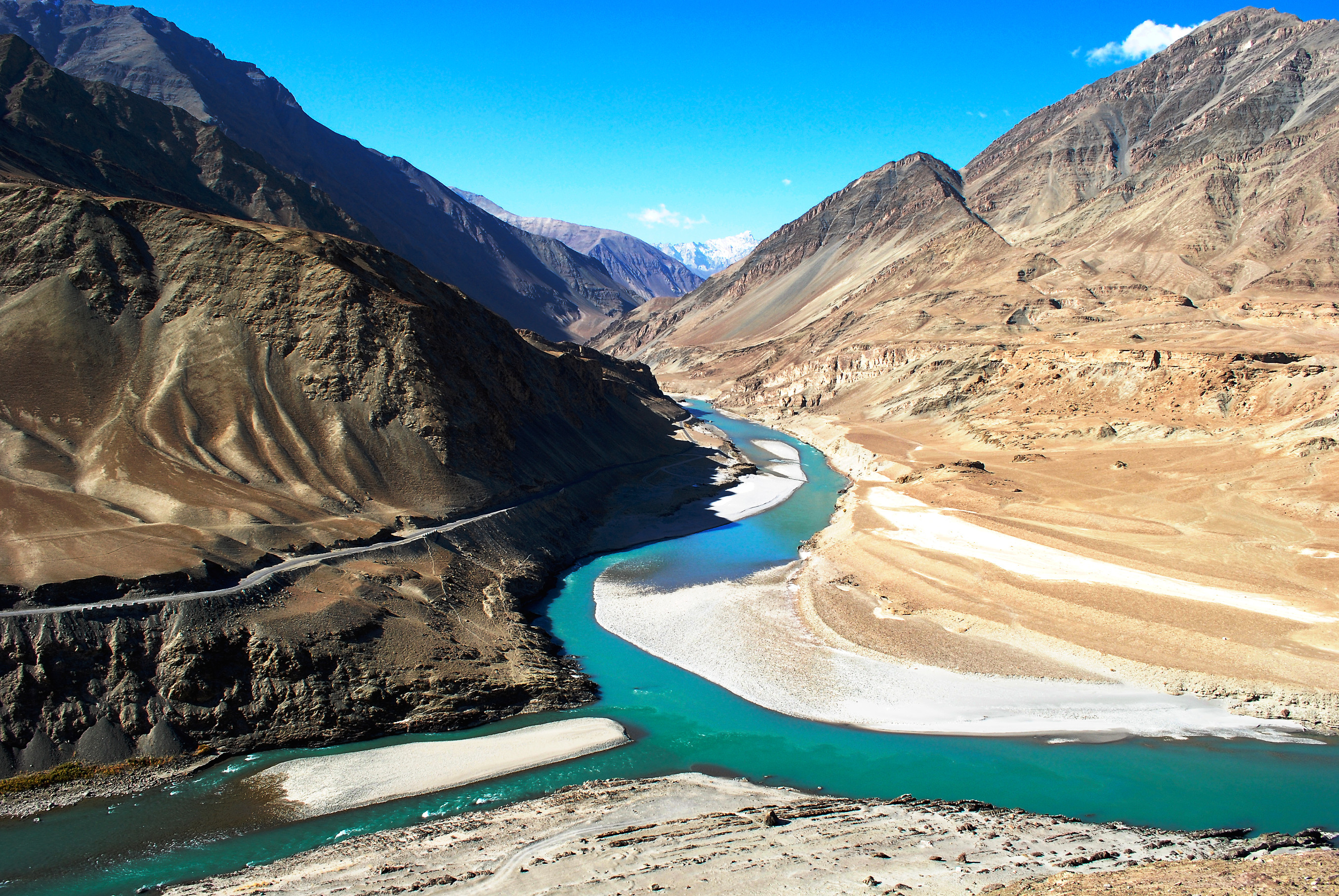
Snow Leopard Trek Hemis: The Ultimate 2026 Guide
The snow leopard trek in Hemis National Park, Ladakh, offers the world's best chance of spotting a wild snow leopard, with 70–80% guided sighting success rates
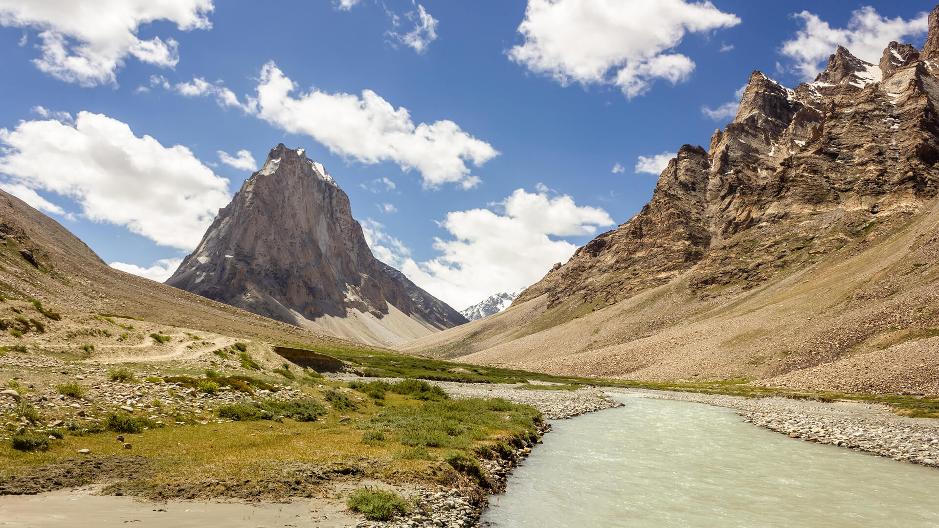
Padum to Darcha Trek: Complete High-Altitude Route Guide
The Padum to Darcha trek covers ~115–120 km in 8–9 days, crossing Shingo La (~5,060 m) between Zanskar and Lahaul.
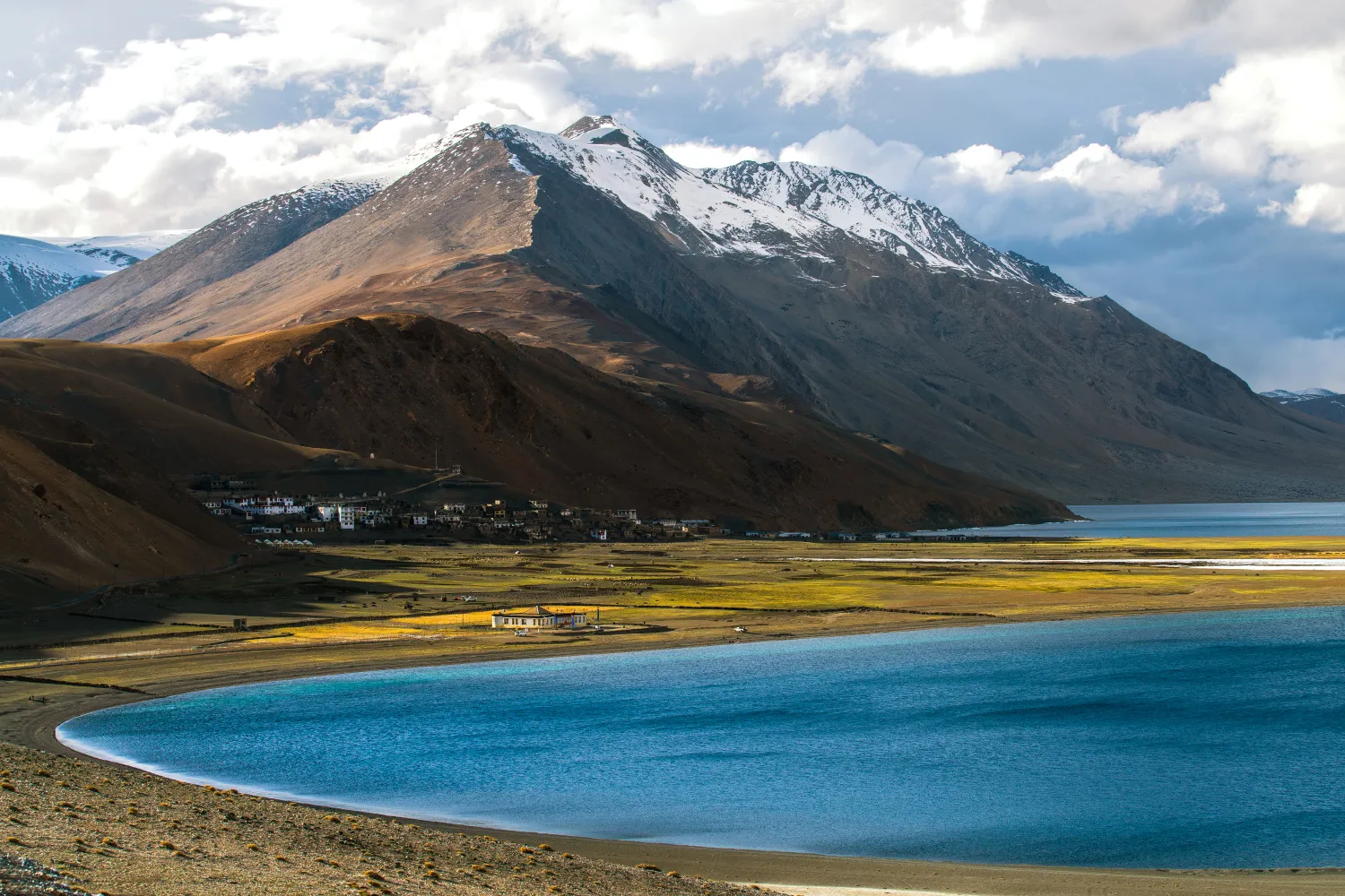
Rumtse to Tso Moriri Trek: Complete Ladakh Trail Guide
The Rumtse to Tso Moriri trek is an ~80 km, 7–8 day strenuous Ladakh trail crossing Kyamar La (~5,460 m) and Polokongka La (~5,190 m), ending at Tso Moriri Lake
Common questions answered
The Madmaheshwar Trek is classified as Moderate. Daily walking ranges from 5 to 8 km over 4–7 hours on uneven terrain, and the maximum altitude is 3,497 m (4,200 m if you add the Budha Madmaheshwar side trip). Anyone with reasonable baseline fitness and 3–4 weeks of walking preparation can complete it comfortably.
Live Conditions
Real-time weather & trail status
Trail Conditions
Crowdsourced reports from trekkers who've done this route
Sign in to add a trip report
Find a Trek Buddy
Connect with trekkers planning the same route
No buddies yet for this trek
Sign in and be the first to post a planning signal.