Why Indrahar Pass Trek is on every trekker's list
Indrahar Pass trek is a moderate-to-difficult 4-day high-altitude route in the Dhauladhar range, starting from McLeod Ganj and reaching 4,342 m (14,245 ft). Best done September–October.
The Indrahar Pass trek is one of the most exhilarating high-altitude adventures in the Indian Himalayas. Nestled in the Dhauladhar range of Himachal Pradesh, the pass sits at a commanding 4,342 metres (14,245 feet) above sea level. Starting from the vibrant town of McLeod Ganj near Dharamshala, this trek takes you through dense rhododendron forests, open alpine meadows, and finally onto a wind-swept pass straddling Kangra and Chamba districts. Whether you are a seasoned trekker chasing panoramic Himalayan vistas or an intermediate hiker ready for a serious step up, Indrahar Pass delivers.
With hundreds of treks scattered across Himachal Pradesh, what makes Indrahar Pass stand out?
Stunning panoramic views: From the pass, on a clear day you can see the snow-capped peaks of the Pir Panjal range to the north and the sweeping Kangra Valley sprawling to the south. Few Himalayan viewpoints offer such dramatic contrast in a single gaze.
A genuine high pass crossing: Unlike many popular day hikes in the region, Indrahar Pass is a true mountain pass — crossing the main Dhauladhar ridge at 4,342 m. That sense of crossing a natural boundary between two worlds is hard to replicate.
Less crowded than Triund: While Triund attracts thousands of visitors every season, Indrahar Pass remains significantly quieter above Laka Got. You will share the upper trail mostly with dedicated trekkers and the occasional Gaddi shepherd moving their flocks along centuries-old transhumance routes.
Spiritual and cultural richness: The trail passes near Gallu Devi Temple, a sacred site for locals, and follows traditional Gaddi routes that have connected Kangra and Chamba for generations. This is not just trekking — it is walking through living cultural history.
Proximity to Dharamshala: The trailhead is barely 10 km from Dharamshala, making it one of the most accessible high-altitude treks in India. You can step off a bus from Delhi and be on the trail the very next morning. See our McLeod Ganj travel guide for arrival tips.
At a glance
The route at a glance
The standard route begins at Dharamkot village or the Gallu Devi Temple checkpost, both easily reachable from McLeod Ganj by a short walk or taxi. The trail climbs steadily north-northeast through forests before breaking into the famous Triund meadows and then ascending into the raw alpine zone above.
The total one-way distance is approximately 26–28 km from Dharamkot to Indrahar Pass. Most trekkers return the same way (making it a 52–56 km round trip), though experienced trekkers can descend into Chamba district via Kuarsi village for a rewarding point-to-point traverse.
For an overview of more treks in the region, check our guide to the best treks in Himachal Pradesh.
Key Waypoints and Elevation Profile
| Waypoint | Altitude | Distance from Previous Point |
|---|---|---|
| Dharamkot / Gallu Devi Checkpost | ~1,457 m | — (trailhead) |
| Triund Meadow | ~2,842 m | ~9 km |
| Laka Got | ~3,200 m | ~4 km |
| Chata Parao | ~3,650 m | ~3 km |
| Indrahar Pass | 4,342 m | ~3–4 km |
Total one-way: ~26–28 km | Cumulative elevation gain: ~2,900 m
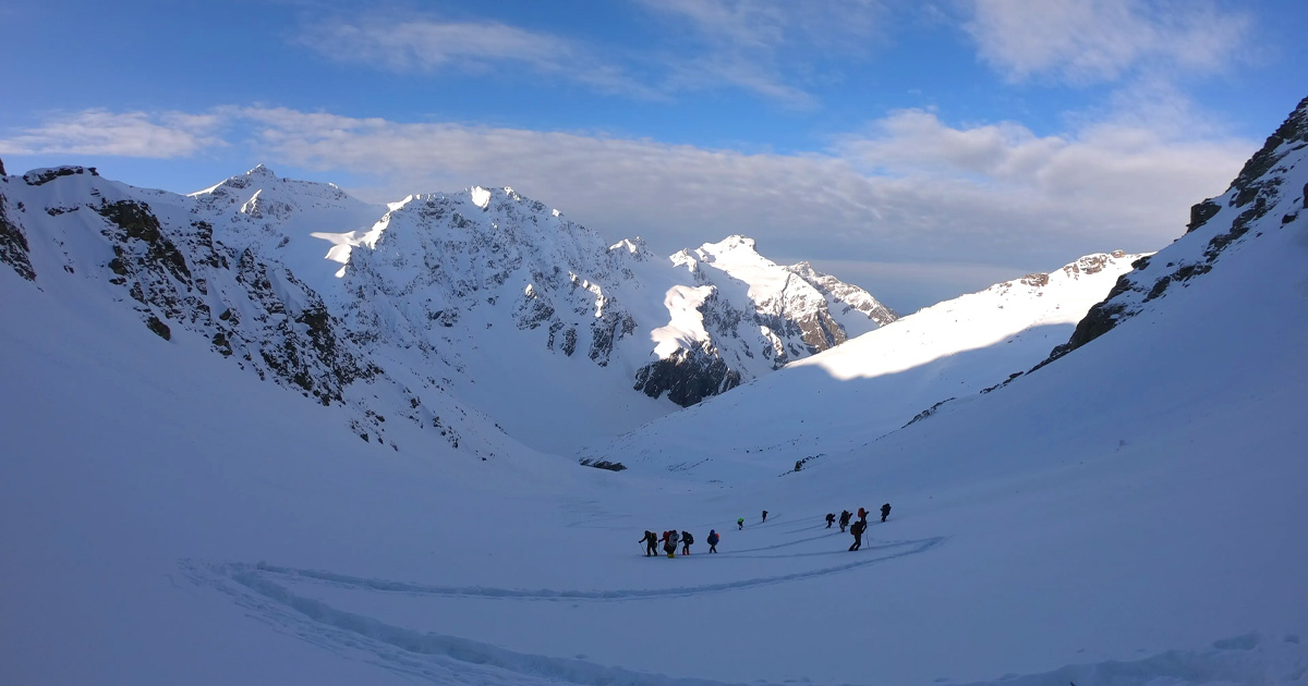
The ascent from Chata Parao to the pass is the steepest and most demanding section. Above Laka Got, the trail frequently crosses snow fields even in June and September, so trekking poles are essential.
Indrahar Pass Trek Distance and Altitude: Quick Reference
- One-way distance: ~26–28 km (Dharamkot to Indrahar Pass)
- Round-trip distance: ~52–56 km
- Maximum altitude: 4,342 m (Indrahar Pass)
- Starting altitude: ~1,457 m (Dharamkot)
- Total elevation gain: ~2,900 m
One-way vs. round-trip: The majority of trekkers do a round trip, returning to McLeod Ganj the same way. If you plan to exit via Chamba, arrange transport from Kuarsi village in advance — it is a remote area with limited connectivity.
What each day actually looks like
This 4-day standard itinerary is suitable for fit intermediate trekkers. A 5-day version with an extension into Chamba is noted at the end.
Day 1 — McLeod Ganj to Triund (9 km | 4–5 hours | Camp: Triund meadow)
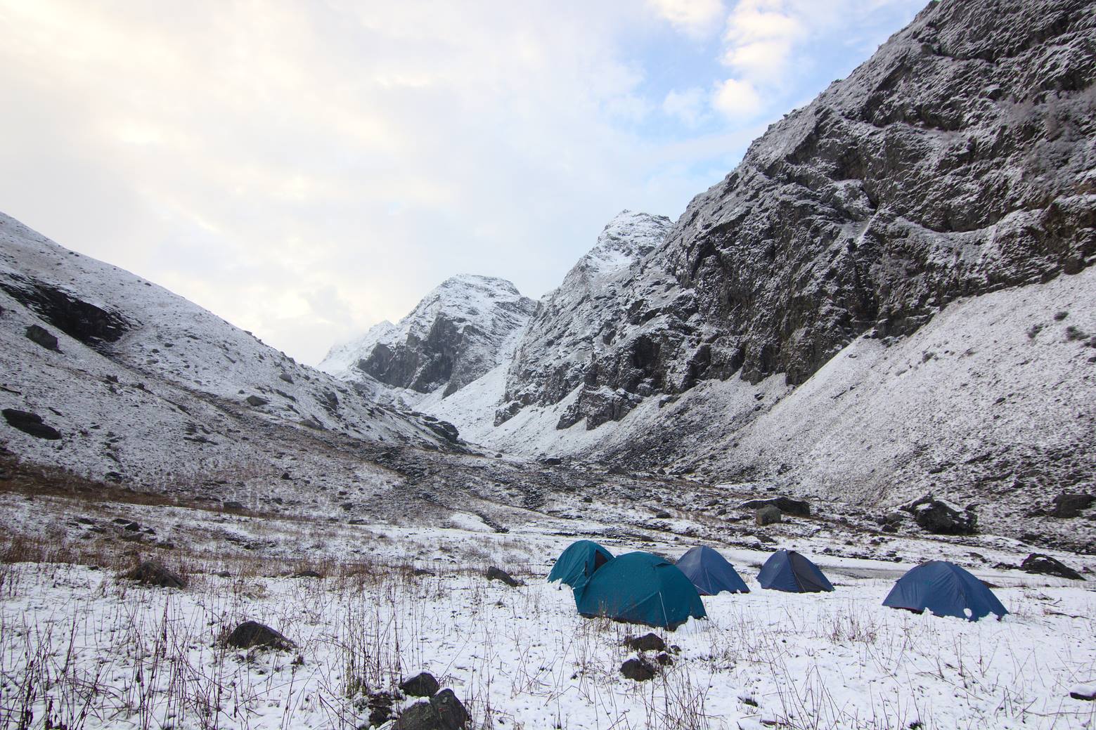
Start early from Dharamkot (reachable by 15-minute walk from McLeod Ganj or short taxi). Register at the Gallu Devi Temple checkpost and collect your camping permit. The trail winds through oak and rhododendron forest before opening dramatically onto the vast Triund meadow at 2,842 m. The meadow offers one of the finest campsites in the Dhauladhar — pitch your tent facing the Kangra Valley for a sunset you will not forget. HP Forest Department huts are available for basic accommodation.
Day 2 — Triund to Laka Got to Chata Parao (7 km | 4 hours | Camp: Chata Parao or Laka Got)
Leave Triund after an early breakfast. The trail climbs past Laka Got (3,200 m), a shepherd settlement with basic cave shelters. Continue upwards to Chata Parao (3,650 m), where the treeline ends and the high-alpine landscape begins in earnest. Camping here feels exposed but the stargazing is extraordinary. This is a shorter day by distance — use the afternoon to rest and acclimatise. See our high-altitude trekking tips for acclimatisation guidance.
Day 3 — Chata Parao to Indrahar Pass and back to Triund (12 km | 7–8 hours | Camp: Triund meadow)
This is your summit day. Start by 5:00 AM — the early start is critical for safe conditions at the pass (afternoon clouds and wind build rapidly). The climb from Chata Parao to the pass involves rocky scrambles and often significant snow. At the top, the 360-degree panorama of Pir Panjal peaks and the Kangra Valley far below is your reward. Descend carefully back to Chata Parao, collect your camp, and continue down to Triund for your final night.
Day 4 — Triund to McLeod Ganj (9 km | 3 hours | Trek ends)
A leisurely morning descent through familiar forest trail brings you back to Dharamkot and McLeod Ganj. Celebrate with a hot meal at one of McLeod Ganj's many cafes.
Optional Day 5 — Extension into Chamba via Kuarsi: Experienced trekkers can descend from Indrahar Pass into Chamba district. This requires pre-arranged transport from Kuarsi and adds a full day of walking on a less-maintained trail. Do thorough research before attempting this variation.
Where Do You Camp on the Indrahar Pass Trek?
Triund Meadow (2,842 m)
The most developed campsite on the route. HP Forest Department huts offer basic dormitory shelter as an alternative to tents. A small café operates here during trekking season (May–October) serving Maggi, chai, and simple meals (₹150–300 per dish). Clean water is available from nearby streams; basic toilet facilities exist near the huts. This is the best place to camp for first-timers.
Laka Got (3,200 m)
A traditional Gaddi shepherd stop with natural cave shelters. No formal facilities — carry all food and water. This is a backup campsite if weather pushes you to stop short of Chata Parao. Water sources are available from seasonal streams nearby (treat before drinking).
Chata Parao (3,650 m)
An exposed, high-altitude camp. No facilities whatsoever — you must be fully self-sufficient with tent, sleeping bag, food, and water. Fill water bottles at Laka Got as the source at Chata Parao may be unreliable later in the season. Toilet facilities: none — follow Leave No Trace principles and bury waste well away from water sources.
When to go
Choosing the right season is crucial for a safe and enjoyable experience. See also our guide on the best time to visit Himachal Pradesh.
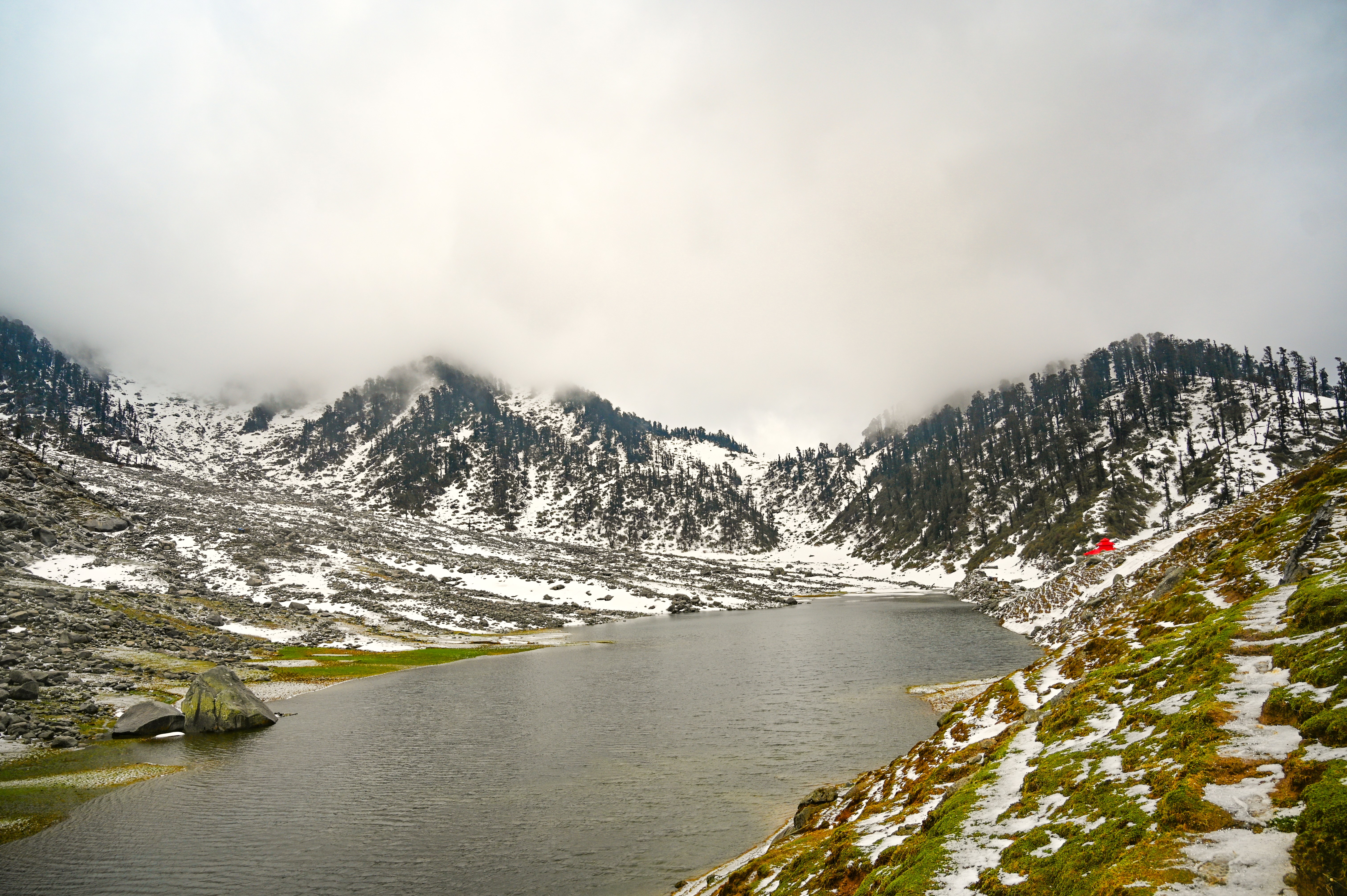
May–June (Pre-monsoon | Good): Snow patches remain on the upper trail, creating dramatic scenery. Skies are generally clear in the mornings. Temperatures are pleasant in lower sections but cold at altitude. A solid choice for those who want snow experience without full winter conditions. Trails can be slightly slippery.
July–August (Monsoon | Not recommended): The western Dhauladhar receives heavy monsoon precipitation. Trails become dangerously slippery, landslides are a real risk, and leeches are abundant below the treeline. The pass is frequently obscured in cloud. Avoid this window unless you have no alternative and have expert guidance.
September–October (Post-monsoon | Optimal ✓): This is the best time for the Indrahar Pass trek. Skies are crystal clear after the monsoon washout, views are at their finest, the trail is stable, and temperatures are comfortable. October brings the first dusting of snow to the pass — dramatic and manageable. Peak trekking season means slightly more company on trail, especially at Triund. This is also the best window for the Indrahar Pass trek in 2026.
November (Early winter | Experienced only): Fresh snowfall transforms the landscape but makes the route above Laka Got seriously challenging. Suitable for experienced trekkers with winter camping gear and navigation skills. Days are short and temperatures drop sharply at night.
December–April (Winter closure | Avoid): The pass is buried under several metres of snow and is impassable for recreational trekking. Avoid unless you are an experienced mountaineer with avalanche training and appropriate equipment.
Indrahar Pass Trek Season Summary
| Month | Condition | Recommended? |
|---|---|---|
| May–June | Pre-monsoon, snow patches | ✓ Good |
| July–August | Monsoon, dangerous trails | ✗ Avoid |
| September–October | Post-monsoon, optimal | ✓✓ Best |
| November | Early winter, snow | ⚠ Experienced only |
| December–April | Winter closure | ✗ Avoid |
Is this trek right for you?
Grade: Moderate to Difficult
The Indrahar Pass trek is not suitable for absolute beginners. Here is what makes it demanding:
- Steep ascent above Laka Got: The gradient increases sharply after 3,200 m. Loose scree and potential snow/ice require careful footwork.
- Snow and ice on the pass: Even in September, the final 200–300 m below the pass often involves walking on compacted snow. Microspikes are worth carrying from October onwards.
- Total elevation gain of ~2,900 m spread over 3 days is significant — your legs and lungs will know about it.
- Daily distances of 9–12 km with a loaded pack on mountain terrain.
Who should attempt this trek:
- Trekkers who have completed at least one moderate Himalayan trek (Triund, Kedarkantha, or equivalent)
- Those comfortable walking 10–12 km per day carrying 5–8 kg
- Anyone with a reasonable cardio base
Who should avoid this trek:
- Absolute beginners with no prior altitude or mountain experience
- Those with cardiac, respiratory, or severe knee conditions
- Anyone unwilling to camp in cold, exposed conditions
4-week training suggestion: Begin 4 weeks before your trek. Week 1–2: 30-minute daily brisk walks + stair climbing (10 floors minimum). Week 3–4: Increase to 45–60 minutes of cardio (running, cycling) plus weighted stair climbs with a 5 kg pack. Stretch hamstrings and calves daily.
What permits you need
Permits for the Indrahar Pass trek are straightforward but mandatory.
Forest Department Camping Permit:
- Required for all trekkers camping at Triund and beyond
- Obtained at the Gallu Devi Temple checkpost on the trail just above Dharamkot
- Cost: approximately ₹150–200 per person per night (2026 rates — Confirm current HP Forest Department rates for 2026 season)
- You must sign the entry register at Gallu checkpost regardless of whether you are camping — this is mandatory for safety tracking
- Permits can also be obtained via the HP Forest Department online portal (check the official HP government website for the current booking link, as portal URLs update seasonally)
Inner Line Permit:
- Not required for Indian nationals on this route
- The Indrahar Pass route does not cross into a restricted/protected area requiring an ILP for Indian citizens
Foreigners:
- Foreign nationals should verify requirements with the FRRO (Foreigners Regional Registration Office) before the trek
- McLeod Ganj has a tourist registration process for foreign visitors — check with your accommodation upon arrival
- No specific inner line permit is currently required for this route for foreigners, but regulations can change — verify closer to your trek date
What this trek will cost you
DIY Trekking Budget (4 Days)
| Expense | Estimated Cost (INR) |
|---|---|
| Bus Delhi to McLeod Ganj (one-way) | ₹500–800 |
| Local taxi McLeod Ganj to Dharamkot | ₹200–400 |
| Camping permit (₹150–200 x 3 nights) | ₹450–600 |
| Tent rental (₹300–500/night x 3) | ₹900–1,500 |
| Sleeping bag rental (₹200/night x 3) | ₹600 |
| Food at Triund café + carried supplies | ₹1,200–2,000 |
| Miscellaneous (sunscreen, ORS, snacks) | ₹300–500 |
| Total DIY estimate | ₹4,150–6,400 |
Note: Costs assume tent and sleeping bag rental from McLeod Ganj gear shops. Owning your own gear reduces costs significantly.
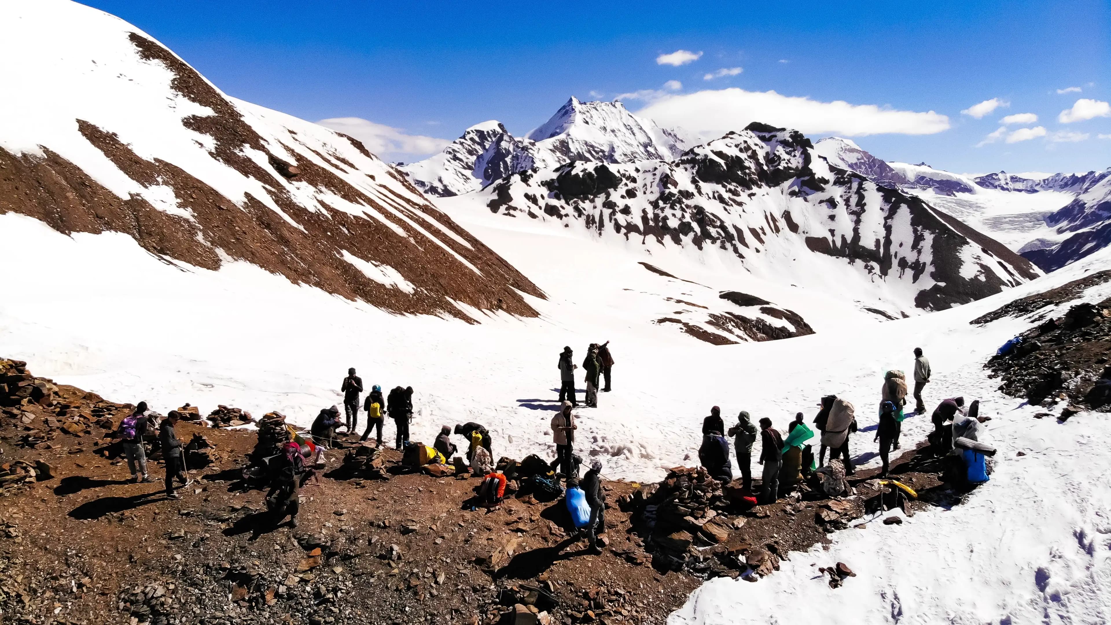
Optional guide: A local guide costs approximately ₹1,500–2,000 per day — highly recommended for solo trekkers above Laka Got or for first-timers on this route.
Guided Package Cost
Trekking agencies operating from McLeod Ganj offer all-inclusive packages:
- 2–3 day packages (Triund to pass and back): ₹6,000–9,000 per person
- 4-day full Indrahar Pass packages: ₹8,000–12,000 per person (includes guide, camping equipment, meals, permits)
Package costs are per-person estimates based on group departures. Solo or private departures cost more. Confirm 2026 agency rates with local operators in McLeod Ganj.
Solo vs. agency: DIY saves money but requires experience, gear, and navigation confidence. For first-timers on this route, the guided package is worth the extra cost — especially above Laka Got where route-finding can be unclear in poor visibility.
What to pack
Keep your pack under 12 kg — every extra kilo becomes painful above 3,500 m. See our complete trekking gear checklist for India for a full breakdown.
Clothing (layer system):
- Thermal base layer (top and bottom)
- Fleece mid-layer
- Windproof and waterproof outer jacket
- Trekking trousers (quick-dry)
- Warm hat, buff, and gloves
- 2–3 pairs of moisture-wicking socks
Footwear & equipment:
- Waterproof trekking boots (ankle support essential)
- Trekking poles (pair — mandatory above Laka Got)
- Headlamp with spare batteries
- UV400 sunglasses
- Sunscreen SPF50+, lip balm
Camping gear (if not renting):
- 3-season tent (4-season for October onwards)
- Sleeping bag rated to -10°C
- Sleeping mat (foam or inflatable)
Documents:
- Government-issued photo ID
- Camping permit (carry copy)
- Emergency contact card (separate from phone)
Food & water:
- 3-litre water carrying capacity (bottles or bladder)
- Water purification tablets
- Energy bars, trail mix, nuts, chocolate
- Ready-to-eat meals for Chata Parao nights
First aid:
- Blister kit (moleskin, needles, antiseptic)
- ORS sachets (minimum 6)
- Paracetamol, ibuprofen
- Diamox (acetazolamide) — consult your doctor before the trek; do not self-prescribe
- Personal medications
What NOT to carry: Jeans, cotton inner layers, glass bottles, excessive camera gear, full-size toiletries. Leave anything you are not certain you will use.
Recommended gear for this trek
Staying safe on the mountain
Acute Mountain Sickness (AMS): Symptoms include headache, nausea, dizziness, and fatigue. If symptoms appear, do not ascend further — descend immediately to a lower altitude. Diamox can help prevent AMS but must be prescribed by a doctor. Acclimatise properly by not rushing the Day 2 section.
Never trek alone above Laka Got: The terrain becomes remote and route-finding difficult. If you are solo, pair up with other trekkers at Triund or hire a guide.
Register at Gallu checkpost — always: This is your safety net. In case of emergency, the checkpost team knows you are on the trail.
Weather changes rapidly: Summit day (Day 3) must begin by 5:00 AM to reach the pass before afternoon cloud and wind build up. If weather looks threatening from Chata Parao, do not push for the summit.
Emergency essentials: Carry a whistle and emergency foil blanket. These weigh almost nothing and could save your life.
Mobile network: Signal is limited to BSNL above Triund. Other networks are largely absent. If you carry a phone, ensure you have a BSNL SIM or roaming coverage on BSNL. Do not rely on your phone as your sole navigation device.
Nearest medical facility: Zonal Hospital Dharamshala is approximately 20 km from the Dharamkot trailhead — the nearest facility equipped for serious emergencies.
Emergency contacts:
- Dharamshala Police: 01892-224141
- Himachal Pradesh Tourism Helpline: 1364
- Gallu Devi checkpost (ask for current number at your accommodation in McLeod Ganj before departure)
Solo trekking: It is possible but risky above Laka Got. If trekking solo, inform your accommodation of your planned itinerary and expected return date, always register at Gallu checkpost, and check in with any other trekkers you meet on trail.
Similar treks to explore
Kareri Lake Trek: Complete Guide for 2026
Plan your Kareri Lake trek with our 2026 guide covering route, difficulty, permits, cost, packing list, best time to visit, and day-wise itinerary.
Buran Ghati Trek: Complete Guide 2026
The Buran Ghati Trek is a difficult 40 km trail in Himachal Pradesh crossing a 4,700 m pass with India's only glacier rappel descent on a mainstream trek.
Pin Parvati Pass Trek: The Ultimate Guide 2026
Complete Pin Parvati Pass trek guide 2026: route, itinerary, permits, costs, best time, packing list & safety tips for this 110km Himachal crossing at 5,319m.
Common questions answered
Indrahar Pass stands at 4,342 metres (14,245 feet) above sea level in the Dhauladhar range of Himachal Pradesh. It is one of the highest accessible passes in the Kangra-Chamba border area.