Why Kedartal Trek is on every trekker's list
Kedartal trek is a 34–36 km round-trip high-altitude trail from Gangotri to a glacial lake at 4,750 m (15,584 ft) in the Garhwal Himalayas, completed in 4–5 days and rated Difficult (Grade 4/5).
Nestled at 4,750 m (15,584 ft) above sea level in the Garhwal Himalayas, Kedartal is one of the most visually arresting glacial lakes in Uttarakhand. Fed by the Thalay Sagar glacier and cradled by sheer granite walls, the lake reflects the soaring peaks of Thalay Sagar (6,904 m) and the Jogin massif — a scene that stops even seasoned mountaineers in their tracks.
The trek to Kedartal begins at Gangotri (3,048 m), the sacred Hindu temple town on the banks of the Bhagirathi River, and covers approximately 17–18 km one way through birch forests, rocky moraines, and high-altitude meadows. The round trip spans 34–36 km and is typically completed in 4–5 days. This is not a beginner trail — steep moraine ascents, unbridged river crossings, and genuine wilderness camping make it a serious undertaking. But for trekkers who come prepared, Kedartal rewards with solitude, grandeur, and memories that last a lifetime.
This guide covers everything you need to plan your 2026 Kedartal trek — from route details and day-wise itinerary to permits, costs, packing, and safety.
In a state overflowing with trekking options, Kedartal holds a distinct identity. Here is why it earns a place on serious trekkers' bucket lists:
Pristine glacial lake with jaw-dropping backdrops. The lake's turquoise waters mirror the near-vertical north face of Thalay Sagar — one of the most photographed big-wall objectives in the Indian Himalaya. Jogin I, II, and III loom equally large, making the lake shore a paradise for landscape photographers.
Off-the-beaten-path feel. Compared to the Valley of Flowers or the Kedarnath pilgrim route — which draw tens of thousands of visitors each season — Kedartal sees a fraction of that footfall. On most days at camp, your neighbours will be the wind and the peaks, not a queue of trekkers.
A genuine wilderness experience. There are no tea stalls beyond Gangotri, no lodge beds, and no fixed ropes. Everything you need, you carry or arrange with a registered operator. That self-reliance is precisely the point.
Photographer's dream. Golden-hour light on Thalay Sagar's granite face, the Kedar Ganga River threading through boulder fields, and the surreal silence of the Kedar Kharak meadow at dusk — every stage of this trek offers compositional magic.
Challenging but achievable. Kedartal is difficult, but it is not a technical mountaineering objective. Fit trekkers with prior experience at altitude can reach the lake without ropes or technical gear, making it one of the most accessible truly remote high-altitude destinations in the Garhwal Himalayas.
At a glance
The route at a glance
The trail follows the Kedar Ganga River valley northward from Gangotri, climbing steadily through three distinct zones: forest, high meadow, and moraine. The full one-way route is:
Gangotri (3,048 m) → Bhoj Kharak (3,500 m) → Kedar Kharak (4,270 m) → Kedartal (4,750 m)
The first section from Gangotri to Bhoj Kharak is relatively gentle, winding through dense stands of bhoj (birch) trees alongside the Kedar Ganga. Beyond Bhoj Kharak the terrain opens into alpine meadows before the trail steepens dramatically on the moraine approach to Kedar Kharak. The final push from Kedar Kharak to the lake is the most demanding — loose rock, significant elevation gain, and no shade.
Key terrain features to be aware of:
- River crossings: The Kedar Ganga must be crossed at least once before Bhoj Kharak. Crossing difficulty varies with season; early season snowmelt makes this crossing forceful.
- Moraine terrain: From Kedar Kharak onward, trekkers navigate boulder-strewn glacial moraine — demanding on ankles and concentration alike.
- Altitude gain: Total ascent from Gangotri to Kedartal is approximately 1,702 m over 17–18 km.
Kedartal Trek Distance and Elevation Profile
| Segment | Distance (approx) | Start Altitude | End Altitude | Gain |
|---|---|---|---|---|
| Gangotri → Bhoj Kharak | ~6 km | 3,048 m | 3,500 m | +452 m |
| Bhoj Kharak → Kedar Kharak | ~6 km | 3,500 m | 4,270 m | +770 m |
| Kedar Kharak → Kedartal | ~5–6 km | 4,270 m | 4,750 m | +480 m |
| One-way total | ~17–18 km | 3,048 m | 4,750 m | +1,702 m |
| Round trip | ~34–36 km | — | — | — |
The highest point on the trek is the Kedartal lake shore at 4,750 m. Some trekkers explore slightly above the lake toward the glacier snout, but this is not part of the standard trail.
Key Campsites on the Kedartal Trek
Bhoj Kharak (~3,500 m)
A forested clearing beside the Kedar Ganga, Bhoj Kharak is the first major campsite. It sits amid birch trees that provide modest windbreak. Water is sourced directly from the river. There are no permanent facilities — no toilets, no shelters, no shops. Tent capacity is moderate; in peak season expect other groups here but rarely overcrowding. Nights at this altitude can be cold (temperatures can drop to 0–5°C in September–October).
Kedar Kharak (~4,270 m)
This high-altitude meadow campsite is fully exposed — no tree cover, no windbreak. The views of Thalay Sagar and the surrounding peaks are extraordinary. Water is available from a stream (verify it is flowing; in dry spells or early winter it may be reduced). Nights here are genuinely cold, often dropping to -5°C or below in September–October. This camp demands a proper -10°C rated sleeping bag. There are absolutely no facilities.
Gangotri is the starting point for the Kedartal trek and is located approximately 490 km from Delhi.
By Road from Delhi:
- Delhi → Rishikesh → Chamba → Uttarkashi → Gangotri
- Total road distance: ~490 km; driving time: 14–16 hours (typically split over 2 days)
- Recommended: Delhi → Rishikesh or Haridwar overnight → Uttarkashi (Day 2) → Gangotri (Day 3 morning)
Nearest Railhead: Rishikesh or Dehradun (Dehradun is slightly closer to the mountain roads)
Nearest Airport: Jolly Grant Airport, Dehradun (~25 km from Dehradun city). Flights connect Jolly Grant to Delhi, Mumbai, and Bengaluru. From Jolly Grant, take a taxi or bus to Rishikesh and onward to Uttarkashi.
Local Transport:
- Shared taxis and private jeeps run between Uttarkashi and Gangotri (approx 100 km, 4–5 hours)
- Government buses also operate this route but are slower
- Book Uttarkashi–Gangotri transport the previous evening for an early morning start — the mountain road is best driven before afternoon
For accommodation and logistics in the region, see our Uttarkashi travel guide and Gangotri temple travel guide.
What each day actually looks like
The standard Kedartal trek itinerary runs over 5 days as described below. A 6-day version is recommended for trekkers who want safer acclimatization — details in the acclimatisation section below.
Day 1 — Reach Gangotri
- Drive from Uttarkashi (approx 100 km, 4–5 hours) or direct from Rishikesh/Dehradun (approx 12–16 hours total drive)
- Altitude: 3,048 m
- Rest, hydrate, collect permits at the Forest Check Post
- Explore Gangotri temple, acclimatise to altitude
- Overnight in Gangotri (guesthouses available)
Day 2 — Gangotri to Bhoj Kharak
- Distance: ~6 km | Walking time: 4–5 hours
- Altitude gain: ~452 m | End altitude: ~3,500 m
- Trail follows the Kedar Ganga upstream through birch forest
- River crossing — use trekking poles for balance
- Camp at Bhoj Kharak (wilderness camping, carry all supplies)
Day 3 — Bhoj Kharak to Kedar Kharak
- Distance: ~6 km | Walking time: 5–6 hours
- Altitude gain: ~770 m | End altitude: ~4,270 m
- Trail climbs steeply above the tree line into open meadows
- Moraine terrain begins in the upper section
- First close-up views of Thalay Sagar's granite pillars
- Camp at Kedar Kharak — exposed, cold, spectacular
Day 4 — Kedar Kharak to Kedartal and return to Kedar Kharak
- Distance: ~10–12 km round trip to lake | Walking time: 6–8 hours
- Altitude gain to lake: ~480 m | Lake altitude: 4,750 m
- Early start essential (pre-dawn if possible) to avoid afternoon weather
- Trail over boulder and moraine — demanding; poles essential
- Spend 30–60 minutes at the lake; photograph the reflections of Thalay Sagar
- Descend back to Kedar Kharak for the night
- Do not attempt to camp at the lake shore unless with a very experienced guide — weather deteriorates rapidly
Day 5 — Kedar Kharak to Gangotri and drive out
- Distance: ~12 km descent | Walking time: 6–7 hours
- Descend via Bhoj Kharak (brief stop) to Gangotri
- Drive to Uttarkashi for overnight (recommended) or continue toward Rishikesh
Acclimatization Tips for the Kedartal Trek
Kedartal's altitude of 4,750 m is high enough to cause Acute Mountain Sickness (AMS) in unprepared trekkers. The standard 5-day itinerary is workable for fit trekkers with prior altitude experience, but consider these adjustments:
- Spend Day 1 fully at Gangotri. Do not arrive and immediately trek. Give your body 12–18 hours at 3,048 m before ascending.
- On Day 3, ascend slowly. The jump from 3,500 m to 4,270 m is the critical acclimatisation step. Take rest breaks every 30–45 minutes.
- 6-day option: Insert a rest/acclimatization day at Kedar Kharak (making Day 4 a rest/explore day at ~4,270 m and Day 5 the summit-to-lake push). This approach significantly reduces AMS risk and is strongly recommended for anyone who has not recently trekked above 4,000 m.
- AMS warning signs: headache, nausea, loss of appetite, dizziness, confusion, difficulty breathing at rest. If two or more symptoms appear, do not ascend further — descend immediately. See our altitude sickness prevention guide for detailed protocols.
- Drink 3–4 litres of water daily. Avoid alcohol at altitude.
When to go
May–June (Pre-monsoon)
The trail opens roughly when the Gangotri temple opens for the season (typically late April to early May). Snow patches persist above Kedar Kharak, making the terrain more demanding. Weather is generally stable in the mornings, with cloud build-up in afternoons. The landscape is vivid green and the Kedar Ganga runs high with snowmelt — making river crossings more challenging. A viable window for experienced trekkers comfortable with snow.
July–August (Monsoon)
Generally not recommended. The Garhwal Himalayas receive heavy monsoon rainfall, making trails slippery, river crossings dangerous, and landslide risk elevated on the approach roads to Gangotri. Most registered operators suspend departures during this period. Unless you have specific experience with monsoon trekking in Uttarakhand, avoid July–August.
September–October (Post-monsoon) ✅ Optimal
This is the best time for the Kedartal trek. The monsoon withdraws by mid-September, leaving behind crystal-clear skies, stable daytime weather, and excellent visibility of Thalay Sagar and Jogin Peak. Temperatures are cold but manageable. The landscape turns golden and amber with autumn vegetation. Most organised treks operate in this window. This is the recommended season for 2026.
November onward (Winter)
The trek is effectively closed. The Gangotri temple closes for winter (typically early November), heavy snowfall blankets the trail above Bhoj Kharak, and temperatures at Kedar Kharak can drop to -20°C or below. Do not attempt the trek after early November.
Is this trek right for you?
Difficulty: Grade 4/5 — Difficult
Kedartal is one of the harder non-technical treks in Uttarakhand. Here is why:
- Steep moraine ascent: The section above Bhoj Kharak and especially the approach to Kedartal involves sustained climbing on loose, ankle-challenging boulder terrain with no fixed ropes or chains.
- High altitude: Sustained time above 4,000 m with the lake at 4,750 m demands genuine physiological adaptation.
- No facilities on trail: No tea stalls, no rescue posts, no mobile network — you are on your own beyond Gangotri.
- Rapidly changing weather: High-altitude storms can arrive with little warning.
Who should attempt this trek:
- Trekkers with prior experience at altitudes above 4,000 m (e.g., Kedarnath trek, Har Ki Dun, or similar)
- Adults aged approximately 16–55 with good cardiovascular fitness
- Those able to walk 6–8 hours daily on rough terrain with a 12–15 kg pack
Recommended pre-trek training:
- 8–12 weeks of cardio: running, cycling, stair climbing (aim for 45–60 min sessions, 4x per week)
- Leg strength: squats, lunges, step-ups with weight
- At least one prior trek above 3,500 m in the 12 months before attempting Kedartal
See our high-altitude trekking tips for a full preparation framework.
What permits you need
A mandatory entry permit from the Uttarakhand Forest Department is required to trek beyond the Gangotri National Park boundary. As of the 2026 trekking season:
- Where to obtain: Forest Check Post at Gangotri — the permit is issued on-site before you begin the trek
- Cost: Approximately INR 150–200 per person per day for Indian nationals (flag for review: 2026 rates not independently confirmed — verify at the check post)
- Documents required: Valid government-issued photo ID (Aadhaar, passport, or voter ID)
- Permits are checked on trail — rangers have been reported to conduct checks at Bhoj Kharak and Kedar Kharak
- Foreign nationals: May require additional documentation. The Gangotri area has historically not required a formal Inner Line Permit for most foreign nationals, but regulations change — verify current rules with the Uttarakhand Forest Department or GMVN before travel
- GMVN registration: Some operators facilitate registration with the Garhwal Mandal Vikas Nigam (GMVN); check whether this is additionally required in 2026
Always carry photocopies of ID and permit in a waterproof sleeve separate from your originals.
What this trek will cost you
DIY Trek Cost Breakdown (Per Person, 2026 Estimates)
| Item | Estimated Cost (INR) |
|---|---|
| Delhi → Rishikesh → Uttarkashi → Gangotri (bus/shared taxi) | 1,500 – 2,500 |
| Return transport | 1,500 – 2,500 |
| Forest permit (4 days × INR 150–200) | 600 – 800 |
| Accommodation in Gangotri (1–2 nights) | 500 – 1,200 |
| Food (Gangotri + self-carried trail food) | 1,500 – 2,500 |
| Camping gear rental (sleeping bag, tent share) | 1,000 – 2,000 |
| Guide/porter (optional but strongly recommended) | 1,500 – 3,000 |
| DIY Total (estimated) | INR 8,100 – 14,500 |
Note: DIY trekkers must carry or rent all camping equipment. Costs vary significantly based on gear owned, transport choices, and whether a guide is hired.
Guided Package Cost (Per Person, 2026)
| Package Type | Estimated Cost (INR) |
|---|---|
| Budget operator (4–5 days, shared tents) | 12,000 – 15,000 |
| Mid-range operator (5–6 days, quality gear) | 15,000 – 20,000 |
| Premium operator (small group, quality meals) | 20,000 – 28,000 |
Typical inclusions: tents, sleeping bags, all meals on trail, guide, porter support, forest permits, first aid kit. Typically excludes: transport to/from Gangotri, personal trekking gear, travel insurance.
All cost estimates above are projections for 2026. Verify with operators and transport providers before finalising your budget. See our best treks in Uttarakhand guide for operator recommendations.
What to pack
Clothing (Layering System)
- Base layer: Moisture-wicking thermal top and bottom (merino wool or synthetic)
- Mid layer: Fleece jacket or softshell
- Outer layer: Down jacket (600-fill or higher recommended for Kedar Kharak nights)
- Shell layer: Waterproof, windproof rain jacket and rain trousers
- Trekking trousers (2 pairs; avoid cotton)
- Warm hat, balaclava, sun hat
- Fleece gloves + waterproof outer gloves
- Wool/synthetic trekking socks (3–4 pairs)
- UV-protective sunglasses (Category 3 or 4)
Footwear
- Waterproof high-ankle trekking boots (broken in — never debut new boots on this trail)
- Gaiters (highly recommended for moraine and snow patches)
- Camp sandals or lightweight shoes for evenings
Gear
- Trekking poles (essential for moraine and river crossings)
- Headlamp with spare batteries (LED, minimum 150 lumens)
- Sleeping bag rated to -10°C (non-negotiable for Kedar Kharak)
- Sleeping mat (foam or inflatable)
- Backpack 50–60L with rain cover
- Dry bags or waterproof pack liners (2–3)
- Water bottles (2 × 1L) + purification tablets or filter
- Sunscreen SPF 50+, lip balm with SPF
- Trekking snacks: energy bars, nuts, dried fruit, electrolyte sachets
Documents
- Original government ID + 2 photocopies (waterproof sleeve)
- Forest permit copy
- Travel/trek insurance documents
- Emergency contact card (keep one in pack, give one to someone at home)
First Aid Basics
- Diamox (acetazolamide) — consult a doctor before trek for AMS prevention/treatment
- Ibuprofen and paracetamol
- Blister kit (moleskin, antiseptic)
- Bandages, antiseptic wipes, medical tape
- Oral rehydration salts
What NOT to Bring
- Glass bottles (prohibited in Gangotri National Park)
- Heavy SLR camera kit without appropriate weight management plan
- Cotton clothing (kills in cold when wet)
- Single-use plastics (banned in the National Park area)
See our comprehensive trekking gear checklist for a printable version.
Recommended gear for this trek
Staying safe on the mountain
Altitude and AMS
Acute Mountain Sickness is the most serious risk on the Kedartal trek. The rapid ascent from Gangotri (3,048 m) to Kedartal (4,750 m) over 3–4 days is aggressive. Know the symptoms (persistent headache, nausea, vomiting, disorientation, loss of coordination, difficulty breathing at rest) and act immediately. The golden rule: never ascend with AMS symptoms — descend. Review our altitude sickness prevention guide before departing.
Weather
Afternoon thunderstorms are common throughout the trekking season, particularly in September. Always aim to reach camp by 1:00–2:00 PM. If caught in a storm on the moraine, do not shelter under isolated boulders or ridgelines. Lightning risk above the tree line is real.
Do Not Trek Alone
Always trek with at least one partner and ideally with a registered local guide. The moraine sections above Kedar Kharak are confusing in low visibility or cloud. A guide also provides language access to local emergency networks.
Emergency Contacts
- SDRF (State Disaster Response Force) Uttarkashi: Contact via Uttarkashi District administration (specific 2026 number — verify before travel)
- Uttarkashi District Hospital: The nearest hospital with reasonable emergency facilities; approximately 100 km from Gangotri
- Mobile network: Absent beyond Gangotri on the trek. If you have access to a satellite communicator (e.g., Garmin inReach), bring it.
Wildlife
The Gangotri National Park is Himalayan bear country. Store food in sealed bags away from your tent, do not leave food scraps, and make noise on the trail to avoid surprise encounters, especially in forest sections near Bhoj Kharak.
River Crossings
Never attempt a crossing if the water level is unusually high (common in early June). Wait, or seek an alternative line. Unbuckle your pack hip belt before crossing so you can shed your pack quickly if you lose footing.
Similar treks to explore
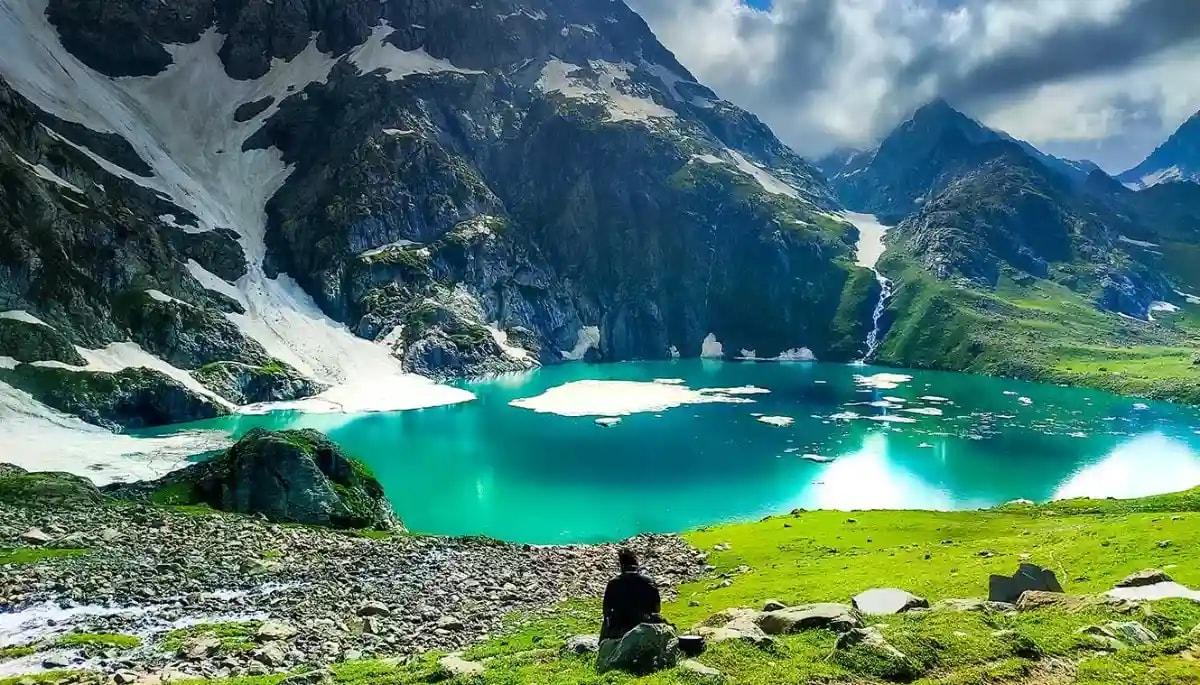
Kareri Lake Trek: Complete Guide for 2026
Plan your Kareri Lake trek with our 2026 guide covering route, difficulty, permits, cost, packing list, best time to visit, and day-wise itinerary.
Buran Ghati Trek: Complete Guide 2026
The Buran Ghati Trek is a difficult 40 km trail in Himachal Pradesh crossing a 4,700 m pass with India's only glacier rappel descent on a mainstream trek.
Indrahar Pass Trek: Routes, Difficulty & Best Time
Indrahar Pass trek is a moderate-to-difficult 4-day route in the Dhauladhar range, starting from McLeod Ganj and reaching 4,342 m (14,245 ft). Best done September–October.
Common questions answered
Kedartal sits at 4,750 m (15,584 ft) above sea level. At this elevation, oxygen availability is roughly 40% lower than at sea level, making acclimatization non-negotiable. Even fit trekkers should ascend gradually and watch for AMS symptoms throughout the approach.