Why Phulara Ridge Trek is on every trekker's list
Phulara Ridge Trek is a moderate 45–50 km ridge walk in Uttarkashi, Uttarakhand, reaching ~12,000 ft with 360° views of Bandarpoonch, Black Peak, Kedarkantha, and Swargarohini. Best done May–June or October.
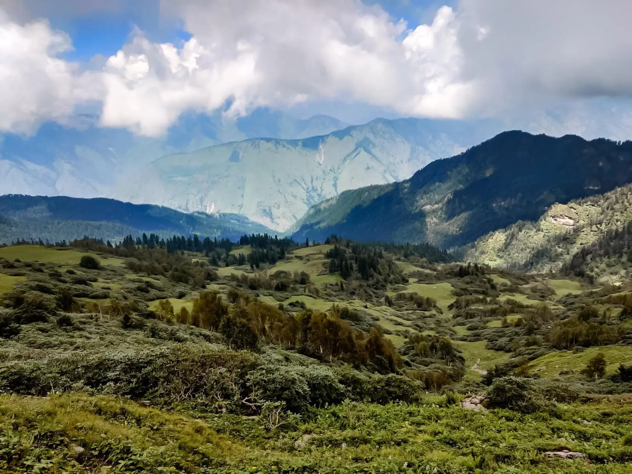
Imagine walking along an open spine of the Himalayas for hours, with nothing above you but sky and nothing around you but an unbroken panorama of snow-draped giants. That is the promise of the Phulara Ridge Trek — widely regarded as the longest continuous ridge walk in Uttarakhand. Located in the Uttarkashi district inside the buffer zone of Govind Pashu Vihar National Park, this trail skirts altitudes between roughly 11,000 ft and 12,000 ft, threading through alpine meadows, dense pine forests, and the timeless Osla village before depositing you on a high ridge with views that most trekkers only see in photographs. In 2026, the Phulara Ridge is quietly becoming one of the most talked-about moderate treks in the Garhwal Himalayas — and this guide covers everything you need to plan it right.
At a glance
The route at a glance
The Phulara Ridge trek route follows a well-established path through the Supin River valley before climbing to the ridge crest above Har Ki Dun. The phulara ridge trek distance for a standard round trip is approximately 45–50 km, spread across four to five trekking days.
Elevation Profile (South to North)
| Point | Altitude (approx.) |
|---|---|
| Sankri (base camp) | ~6,400 ft (1,950 m) |
| Taluka road-end | ~7,200 ft (2,195 m) |
| Osla Village | ~8,200 ft (2,500 m) |
| Phulara Ridge campsite | ~11,500–12,000 ft (3,505–3,660 m) |
| Phulara Ridge high point | ~12,000 ft (3,660 m) |
From Sankri, a jeep track runs approximately 12 km to Taluka (the motorable road-end), which most trekkers bypass on foot or by shared local vehicle. The main trekking trail climbs steadily through mixed oak and rhododendron forest, crossing the Supin River on wooden bridges before arriving at Osla — a traditional Harsil-valley village known for its intricately carved wooden temple dedicated to Duryodhana (a fascinating local legend worth asking your guide about).
Beyond Osla, the trail enters the national park buffer zone and ascends through increasingly open terrain. The tree line gives way to rolling meadows — locally called bugyals — and the ridge crest becomes visible long before you reach it. The final climb to the Phulara Ridge campsite is the steepest section, gaining roughly 3,000 ft over approximately 8 km.
Once on the ridge, the path continues along the crest for several kilometres, with side trails offering views down into the Har Ki Dun valley on one side and the Govind Pashu Vihar wilderness on the other. For more on Har Ki Dun or all Uttarakhand ridge treks, see our companion guides.
Key Campsites Along the Route
Sankri Base Camp (~6,400 ft)
Sankri is the logistical hub for several Uttarkashi-district treks, including Kedarkantha. Guesthouses, homestays, and small lodges are plentiful. A fresh-water stream runs through the village. Gear rental shops (sleeping bags, trekking poles, crampons) have expanded in recent years. See our Sankri base camp guide for accommodation options.
Osla Village (~8,200 ft)
Osla offers basic homestay accommodation and a small campground near the village edge with reliable stream water. Toilet facilities are rudimentary but functional. The campsite can comfortably hold 20–30 tents. Sleeping here gives you a genuine window into traditional Garhwali mountain life — locals weave and trade wool, and the 17th-century Duryodhana temple is worth an evening visit.
Phulara Ridge Campsite (~11,500–12,000 ft)
This is the star of the trek: a flat meadow on or just below the ridge crest, with commanding views in all directions. Water is sourced from snowmelt streams nearby (always purify). The campsite is exposed, so winds can be fierce — good tent pegs and a -10°C sleeping bag are non-negotiable. Capacity is effectively unlimited in the open meadow, though the forest department may impose group-size guidance. There are no permanent facilities here; all supplies must be carried in.
What each day actually looks like
The standard Phulara Ridge trek itinerary is structured over six days from Dehradun, making it ideal for a long weekend plus two days of travel.
Day 1 — Dehradun to Sankri (Drive)
Distance: ~200 km | Duration: 8–9 hours | Altitude: 6,400 ft
Depart Dehradun ISBT by shared jeep (depart 05:00–06:00 for best connection) via Mussoorie–Purola–Mori–Netwar–Sankri. The drive is scenic but long, climbing through pine-forested ridges and alongside the Tons River. Arrive Sankri by mid-afternoon. Use the rest of the day to collect your forest permit at the Sankri check-post, brief your guide, and do a short acclimatisation walk around the village. Overnight in guesthouse.
For transport details, see our how to reach Sankri from Dehradun guide.
Day 2 — Sankri to Osla
Distance: ~11 km | Duration: 5–6 hours | Altitude gain: ~1,800 ft | End altitude: ~8,200 ft
An early 07:00 start. The trail descends briefly to Taluka before entering the forest along the Supin River. The path is well-marked and shaded. Several river crossings on log bridges. Osla appears dramatically as you emerge from the treeline — the ancient village backed by snow-capped ridges. Afternoon rest, explore the Duryodhana temple. Overnight homestay or camp.
Day 3 — Osla to Phulara Ridge Campsite
Distance: ~8 km | Duration: 4–5 hours | Altitude gain: ~3,300–3,800 ft | End altitude: ~11,500–12,000 ft
The most physically demanding day. Climb steeply through bugyals, leaving the treeline behind around 10,000 ft. Take regular rest breaks — altitude can be felt here. The ridge appears in the final 45 minutes, and the view when you crest it is reportedly the single most memorable moment of the trek. Set up camp, allow time for acclimatisation. Explore the immediate ridge area in the afternoon. Overnight high camp.
Day 4 — Ridge Walk and Exploration
Distance: 5–8 km (varies by exploration) | Duration: 4–6 hours | Altitude: ~11,500–12,000 ft
The centrepiece day. Walk along the ridge crest in your chosen direction, with Bandarpoonch, Black Peak, Kedarkantha, and Swargarohini all in view simultaneously. This is a full day at altitude — pace yourself, stay hydrated, and watch the weather carefully. Return to camp. Option: descend to Osla in the afternoon for lower-altitude overnight (recommended for anyone feeling altitude effects).
Day 5 — Return to Sankri
Distance: ~11 km (ridge to Osla) + ~11 km (Osla to Sankri), or done in two stages | Duration: 6–8 hours total | Descent altitude: ~5,600 ft
Descend from the ridge to Osla (if not already there), then continue to Sankri. The return through the forest feels gentler with the altitude behind you. Arrive Sankri by late afternoon. Hot meal, hot water, and well-earned rest. Overnight guesthouse.
Day 6 — Sankri to Dehradun (Drive)
Distance: ~200 km | Duration: 8–9 hours
Shared jeep departs Sankri early (06:00–07:00). Arrive Dehradun by late afternoon or evening, depending on road conditions.
When to go
Understanding Phulara Ridge trek weather is essential — this is an exposed ridge, and conditions change fast.
May–June (Recommended ✓)
The best overall window for the Phulara Ridge trek best time. Snow has cleared from the trail, wildflowers — purple primulas, yellow potentilla, blue gentians — carpet the bugyals, and skies are reliably clear before the monsoon arrives. Temperatures are pleasant during the day (12–18°C on the ridge) and cool at night (0–5°C at camp). Book transport and guides in advance as this is peak season.
July–September (Avoid ✗)
The southwest monsoon brings heavy rainfall to Uttarkashi. Trails become slippery and prone to landslides, leeches are abundant in the lower forests, and the ridge is frequently shrouded in cloud. The forest department may restrict access. Avoid this window unless you are an experienced monsoon trekker with a knowledgeable local guide.
October–November (Recommended ✓)
Post-monsoon clarity brings arguably the sharpest mountain views of the year. The meadows turn gold and amber, nights are cold (-5 to -10°C at the high camp), and the trails are quiet. Snow arrives at ridge level by late November, making October the sweet spot. Pack warmer layers than you would for May.
December–April (Closed for most ✗)
Heavy snowfall closes the trail above Osla. Experienced winter mountaineers with full snow gear occasionally attempt the route, but it is not recommended for general trekkers.
Is this trek right for you?
The Phulara Ridge trek difficulty is rated moderate. Daily walking distances range from 8 to 11 km, the ascent is gradual except for the Osla-to-ridge climb on Day 3, and there are no technical sections, fixed ropes, or glacier crossings. This makes it genuinely suitable for first-time Himalayan trekkers.
Recommended fitness preparation (4 weeks before departure):
- 30-minute brisk walk or jog, five days per week
- Stair climbing with a loaded backpack (10–12 kg) twice per week
- Weekend hikes of 10–15 km to condition your feet and knees
Altitude considerations: The highest camp sits at approximately 12,000 ft. Above 10,000 ft, Acute Mountain Sickness (AMS) is a real risk, even for fit trekkers. Symptoms include headache, nausea, dizziness, and fatigue. The gradual ascent profile helps with acclimatisation, but do not ignore early symptoms. See our altitude sickness prevention tips for a full protocol.
What permits you need
Entering the Phulara Ridge area requires a Govind Pashu Vihar National Park / Forest Department permit, as the route passes through protected forest land administered by the Uttarakhand Forest Department.
2026 Permit Costs (approximate):
- Indian nationals: ₹150–₹200 per person per day
- Foreign nationals: ₹600–₹800 per person per day (Confirm 2026 rate with Uttarakhand Forest Department)
Where to obtain:
1. Sankri Forest Check-post — the most reliable option. The check-post is located at the entrance to the trekking zone in Sankri village. Carry a valid government-issued photo ID (Aadhaar, passport, or driving licence). Permits are typically issued same-day.
2. Uttarakhand Forest Department online portal — permits can sometimes be booked in advance online; check the official Uttarakhand government forest portal before departure as the system is periodically updated.
Group size: No fixed group cap has been publicly declared for this route as of 2025, but the forest department recommends groups of no more than 20 trekkers per day at the ridge campsite to minimise ecological impact. (Verify 2026 group-size regulations with Uttarkashi forest office.)
Always carry multiple copies of your permit on the trail. Rangers do conduct checks beyond Osla.
What this trek will cost you
DIY Budget Breakdown (Per Person, 2026 Estimates)
| Item | Estimated Cost (INR) |
|---|---|
| Shared jeep Dehradun–Sankri (one way) | ₹500–₹700 |
| Shared jeep Sankri–Dehradun (return) | ₹500–₹700 |
| Accommodation in Sankri (2 nights) | ₹600–₹1,000 |
| Accommodation/homestay Osla (1–2 nights) | ₹400–₹800 |
| Local guide (₹800–₹1,200/day × 4 days) | ₹3,200–₹4,800 |
| Porter if needed (₹700–₹1,000/day × 4 days) | ₹2,800–₹4,000 |
| Forest permit (~₹150–₹200/day × 4 days) | ₹600–₹800 |
| Food en route (~₹400/day × 4 days) | ₹1,600 |
| Gear rental in Sankri (if needed) | ₹500–₹1,000 |
| Total DIY estimate | ₹8,000–₹14,000 |
Note: The above DIY total includes guide and porter fees. A truly self-guided (no guide/porter) budget could be as low as ₹5,000–₹6,000 per person, but hiring a local guide is strongly recommended for first-timers.
Guided Package Cost
All-inclusive guided packages departing from Dehradun typically range from ₹8,000–₹14,000 per person for a 6-day programme, covering transport, accommodation, guide, permits, and all meals on trail. Prices vary by operator and group size.
For a broader comparison, see our best treks in Uttarakhand guide which includes operator reviews.
What to pack
A well-packed bag makes the difference between a gruelling slog and a comfortable ridge walk. For a full checklist template, see our trekking gear checklist for India.
Clothing (layering system)
- Thermal base layer (top and bottom)
- Mid-layer fleece or down jacket
- Waterproof and windproof outer jacket
- Trekking pants (convertible zip-off recommended)
- Warm woollen or fleece cap
- Sun hat or cap for daytime
- Lightweight gloves (liner) + warm outer gloves
- 3–4 pairs moisture-wicking trekking socks
Footwear
- Ankle-support waterproof trekking shoes (broken in before the trek)
- Gaiters (especially useful post-monsoon or in early May snow patches)
- Lightweight camp sandals
Gear
- 50-litre backpack with rain cover
- Sleeping bag rated to -10°C (essential for ridge camp)
- Trekking poles (2 recommended for ridge descent)
- Headlamp with spare batteries
- UV-protection sunglasses
- Trekking poles available for rent in Sankri
Documents
- Original government-issued photo ID
- Permit copies (2–3 photocopies)
- Emergency contact list (printed)
- Travel insurance documents
Essentials
- 2-litre water bottle or hydration bladder
- Water purification tablets or filter
- Personal first aid kit (blister plasters, pain relief, ORS sachets)
- Sunscreen SPF 50+ and lip balm
- Energy bars, nuts, and dry fruit (3–4 days' supply)
- Trekking trowel and waste bags (leave no trace)
Gear rental is available in Sankri for sleeping bags, trekking poles, and gaiters. Quality varies — inspect before hiring.
Recommended gear for this trek
Staying safe on the mountain
Altitude Sickness
Above 10,000 ft, Acute Mountain Sickness can affect anyone regardless of fitness. Symptoms: persistent headache, loss of appetite, nausea, dizziness, and difficulty sleeping. Prevention: ascend slowly, drink 3–4 litres of water daily, avoid alcohol, and never ascend with worsening symptoms. If AMS symptoms develop at the ridge camp, descend to Osla immediately — even at night if necessary. Carry Diamox only if prescribed by a doctor after consultation. Full protocol at altitude sickness prevention tips.
Weather Changes on the Ridge
The Phulara Ridge is fully exposed. Afternoon storms can develop rapidly, particularly in May and October. Start ridge walks early (07:00) and aim to be back at camp or descending by 13:00. If you see anvil-shaped clouds building to the west, begin descent immediately.
Stay on Marked Trail
Do not shortcut across unmarked meadows, especially in mist. The ridge has steep drops on both sides. Always trek with a local guide who knows the trail in low visibility.
Hydration
Dehydration accelerates AMS. Drink consistently even if you do not feel thirsty. Purify all water sourced from streams using iodine tablets or a filter.
Mobile Network
BSNL has partial coverage in Sankri and Osla. Expect no mobile signal on the ridge or above 10,000 ft. Inform someone in Sankri of your planned return date. Satellite communicators (SPOT, Garmin inReach) are strongly recommended for independent trekkers.
Emergency Contacts
- Uttarkashi District Emergency: 01374-222220
- Nearest hospital: Uttarkashi District Hospital (~100 km from Sankri, approximately 4–5 hours by road)
- Sankri village has a basic health post; do not rely on it for serious emergencies
Hiring a local guide is not just strongly recommended — on this route, it is a genuine safety measure. Local guides know the weather patterns, the trail diversions, and the quickest descent routes in an emergency.
Similar treks to explore
Kareri Lake Trek: Complete Guide for 2026
Plan your Kareri Lake trek with our 2026 guide covering route, difficulty, permits, cost, packing list, best time to visit, and day-wise itinerary.
Buran Ghati Trek: Complete Guide 2026
The Buran Ghati Trek is a difficult 40 km trail in Himachal Pradesh crossing a 4,700 m pass with India's only glacier rappel descent on a mainstream trek.
Indrahar Pass Trek: Routes, Difficulty & Best Time
Indrahar Pass trek is a moderate-to-difficult 4-day route in the Dhauladhar range, starting from McLeod Ganj and reaching 4,342 m (14,245 ft). Best done September–October.
Common questions answered
The trek is rated moderate difficulty and is suitable for beginners with a reasonable base fitness level. Daily distances range from 8 to 11 km, the highest point is approximately 12,000 ft, and there are no technical climbing sections or glacier crossings. The steepest section is the climb from Osla to the ridge on Day 3. Four weeks of dedicated fitness preparation — daily walks, jogging, and stair climbing with a loaded pack — is sufficient for most first-timers.