
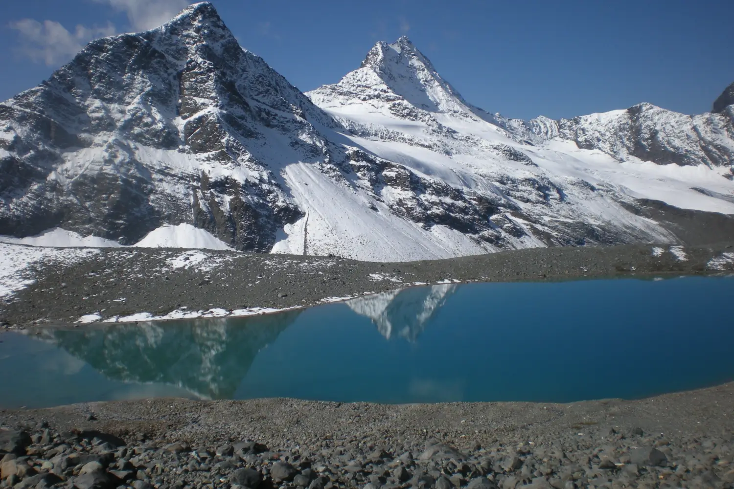
Why Bara Bhangal Trek is on every trekker's list
Few treks in India carry the weight of true wilderness the way the Bara Bhangal trek does. Tucked deep in the Dhauladhar range of Himachal Pradesh, the route leads to a village that has no motorable road, no mobile network, and is buried under snow for more than six months every year. Getting there means crossing high mountain passes — most notably Thamsar Pass at approximately 4,708 m — traversing alpine meadows, glacial moraines, and cold river channels fed by the upper tributaries of the Ravi River.
In terms of raw statistics, the trek covers approximately 65–70 km, reaches a maximum altitude of around 4,580–4,708 m at Thamsar Pass, and is completed in 7–8 days depending on your exit route. But numbers alone don't capture what makes Bara Bhangal special. This is a trek where you earn every kilometre, where the silence is absolute, and where an encounter with a Gaddi shepherd family feels like a genuine privilege rather than a packaged cultural experience.
If you're looking for something that sits alongside India's finest — and most demanding — Himalayan treks, read on. This 2026 guide covers everything you need to plan, prepare, and execute the Bara Bhangal trek safely.
In a state crowded with popular trekking destinations — Triund, Hampta Pass, Pin Parvati — the Bara Bhangal trek stands apart because of how utterly few people do it. There are no tea-shop queues at the pass, no organised camp cities at the meadows, and no social-media crowds at the summit. What you get instead is something increasingly rare in Himalayan trekking: genuine remoteness.
Here's why experienced trekkers rate this route so highly:
- Extreme isolation: Bara Bhangal village is one of the most isolated permanently inhabited settlements in Himachal Pradesh. Access is only possible by trekking trails or helicopter. This physical separation from the modern world gives the entire trek an otherworldly quality.
- Multi-pass drama: The route crosses multiple high passes, including Thamsar Pass (~4,708 m) on the Dhauladhar crest and, for those extending into Kullu, Kalicho Pass. Each crossing delivers sweeping panoramas across two distinct Himalayan ranges.
- Landscape diversity: Within a single trek you move through subtropical forest fringes, open meadows thick with wildflowers, stark boulder-strewn moraines, snowfields, and then a dramatic descent into a hidden river valley. Few treks in Himachal offer this range.
- Gaddi culture: The indigenous Gaddi community of Bara Bhangal maintains a subsistence lifestyle that has changed little over generations. Staying with a Gaddi family or watching a shepherd herd his flock across a snowfield is a living anthropology lesson.
- Minimal tourist footfall: Compared to treks like Kheerganga or Triund — or even the relatively busy Hampta Pass — the Bara Bhangal trail sees a fraction of the traffic. You'll often go full days without seeing another trekking group.
- Technical challenge with purpose: The difficulty here isn't artificial — it comes from the terrain, altitude, and remoteness. Trekkers who complete this route consistently describe it as one of their most memorable Himalayan experiences.
If you're looking for the best remote treks in India, the Bara Bhangal trail deserves a serious place on your shortlist. See also our guide to difficult treks in Himachal Pradesh for comparable challenges.
What Makes Bara Bhangal Village Special?
Sitting at approximately 2,195 m in a deep valley carved by the upper Ravi, Bara Bhangal village is the human heart of this trek. Its approximately 100–150 residents (population figures vary and should be verified locally) are almost entirely from the Gaddi community, a semi-nomadic pastoral group whose seasonal migrations across these very passes have defined the culture of the Dhauladhar for centuries.
The village is cut off by snow for roughly six months of the year — typically November through April or May — making it inaccessible except by helicopter in emergencies. There is no motorable road. The electricity situation is limited. The houses are built from local stone in a style that has evolved over generations to withstand the extreme winters. Residents who need medical care or schooling for children must trek out to Baijnath or Rajgundha, often over passes that are themselves challenging for experienced trekkers.
Yet the community is not defined by hardship. The Gaddi people of Bara Bhangal are known for their hospitality, and the opportunity to spend a night in a basic homestay here — sharing food, listening to stories through a guide's translation — is one of the most authentic cultural exchanges available anywhere on the Indian trekking circuit.
At a glance
Ask TrekSage about Bara Bhangal Trek
Get instant answers grounded in verified trek data — beginner-friendliness, best months, permits, packing, and more.
The route at a glance
The trek has two primary configurations in the 2026 season:
Route 1 — Billing to Bara Bhangal via Thamsar Pass (most popular)
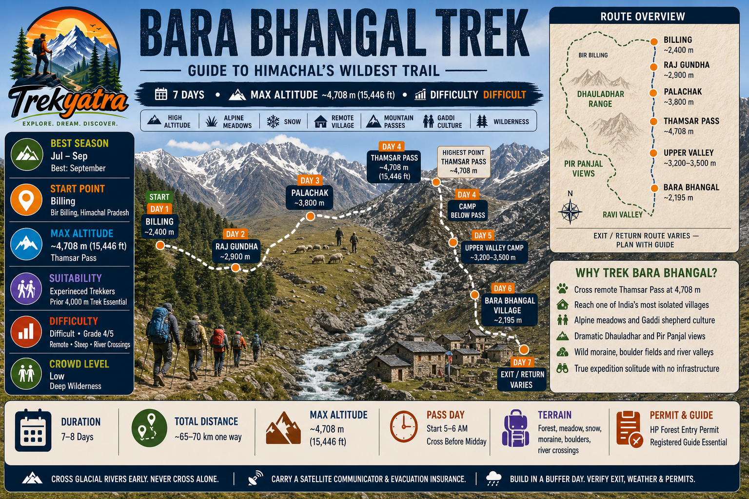
This is the standard direction. You begin at Billing (~2,400 m), the famous paragliding launch site above Bir Billing in Kangra district, and head northeast through forests and meadows toward Raj Gundha, continuing to Palachak, then summiting Thamsar Pass (~4,708 m) before a long descent to Bara Bhangal (~2,195 m). Total one-way distance: approximately 65–70 km over 6–7 trekking days.
Route 2 — Exit via Baijnath or Rajgundha
Many groups return via the same pass or take an extended exit toward Baijnath or Rajgundha in Kangra valley, which can be combined with a visit to the ancient Baijnath temple. Some operators also arrange helicopter evacuation/exit from Bara Bhangal's small helipad in cases of emergency or weather delay.
Key Waypoints and Terrain:
- Billing (~2,400 m): Trailhead; stock up on last supplies here
- Raj Gundha (~2,900 m): First major camp; alpine meadow with basic dhabas
- Palachak (~3,800 m): High camp before the pass; open grassland gives way to rock and snow
- Thamsar Pass (~4,708 m): Highest point; rocky, steep final approach; glacier remnants
- Bara Bhangal (~2,195 m): Destination village in the Ravi valley
The trail terrain transitions dramatically: forest paths above Billing, open meadows to Raj Gundha, rocky alpine terrain and possible snow patches from Palachak onward, a steep moraine/snow climb to Thamsar Pass, and then a sustained descent through boulder fields and river crossings before the valley opens up to Bara Bhangal. River crossings near Ravi tributaries on the descent can be challenging, especially in July–August when glacial melt peaks.
For a focused look at the Billing side of the route, see our Billing to Bara Bhangal trek guide.
Elevation Profile and Key Waypoints
| Day | Camp / Waypoint | Approx. Altitude | Approx. Distance |
|---|---|---|---|
| 1 | Billing (trailhead) | ~2,400 m | — (drive day) |
| 2 | Raj Gundha | ~2,900 m | ~12 km |
| 3 | Palachak | ~3,800 m | ~10 km |
| 4 | Thamsar Pass → Camp below | ~4,708 m (pass) | ~8 km |
| 5 | Upper valley camps | ~3,200–3,500 m | ~10 km |
| 6 | Bara Bhangal village | ~2,195 m | ~8 km |
| 7 | Exit (varied) | — | Variable |
Altitude figures are approximate and sourced from available trekking data. Thamsar Pass altitude is most commonly cited at ~4,708 m but some sources list ~4,680 m
The steepest altitude gain occurs on Day 3–4, climbing roughly 900 m from Palachak to the pass. The descent from the pass to Bara Bhangal is long (~1,500 m drop over two days) and involves rocky terrain and at least two significant river crossings. Carry trekking poles and cross rivers early in the morning when glacial melt water is at its lowest.
What each day actually looks like
Day 1: Drive to Billing — Acclimatise
Travel from Dharamsala or Kangra to Billing (approximately 2–3 hours by road via Bir). Billing sits above the town of Bir Billing at around 2,400 m — famous globally as a paragliding launch site. Use the afternoon to sort gear, confirm permits, meet your guide, and acclimatise. Overnight at Billing (basic guesthouses or camp).
Day 2: Billing to Raj Gundha — 12 km, ~2,900 m
The trail climbs steadily through oak and rhododendron forests before opening into the wide alpine meadow of Raj Gundha. This is a well-worn path used by Gaddi shepherds and is relatively straightforward. Raj Gundha has a few basic dhabas and is the last point with any kind of food or shelter infrastructure until Bara Bhangal. Overnight at Raj Gundha (dhaba tent or your own camp).
Day 3: Raj Gundha to Palachak — 10 km, ~3,800 m
A longer, more demanding day as the trail climbs above the treeline into high alpine territory. The meadows here are stunning in June–July when wildflowers are in bloom. Palachak is your high camp before the pass — set up early, hydrate well, and rest. Overnight camping at Palachak.
Day 4: Palachak to Thamsar Pass and Descent to Camp — 8 km, max ~4,708 m
The crux day of the trek. An early start (ideally by 5–6 AM) is essential to reach the pass before afternoon clouds and potential thunderstorms build. The final approach to Thamsar Pass is steep and rocky, with possible snow depending on the time of season. The views from the pass — across the Dhauladhar crest toward the Pir Panjal and beyond — are extraordinary. Descend to a suitable camp below the pass on the Bara Bhangal side. Overnight camping.
Day 5: Descent Toward Bara Bhangal Upper Valley — 10 km
A long descent through boulder fields and high pastures. You may encounter Gaddi shepherds with their flocks here. River crossings become increasingly relevant as you drop into the valley — cross carefully and early in the day. Camp at a riverside meadow in the upper valley (~3,200–3,500 m).
Day 6: Reach Bara Bhangal Village — 8 km, ~2,195 m
The final descent into the Ravi tributary valley and arrival at Bara Bhangal village. The moment the stone houses come into view is one of the great arrival moments in Indian trekking. Spend the afternoon exploring the village, interacting with residents through your guide, and resting. Overnight homestay with a Gaddi family or camping.
Day 7: Exit Options
Options include: (a) retrace via Thamsar Pass — requires a full additional day to Palachak; (b) continue to Baijnath/Rajgundha via an alternate trail (adds distance and days — consult your guide); (c) emergency helicopter from Bara Bhangal helipad (weather-dependent, expensive, for genuine emergencies only). Build at least one buffer day into your schedule for weather.
Note: Some operators run 8-day itineraries with a rest/acclimatisation day built in at Palachak. This is recommended, especially for trekkers who haven't recently been above 4,000 m.
Alternate Route: Bara Bhangal to Kullu via Kalicho Pass
For highly experienced trekkers, the adventure doesn't have to end at Bara Bhangal. The extended route continues west from the village, crossing Kalicho Pass and descending into the Kullu valley. This extension adds approximately 3–4 days to the itinerary and significantly increases the technical and physical demands. You'll need additional permits, a guide with specific knowledge of this crossing, and ample food supplies. The Kalicho crossing is not commonly guided and should not be attempted without an experienced local who has done it previously. Check with Dharamsala-based operators for current trail conditions before committing.
When to go
The Bara Bhangal trek is only feasible during a window of roughly four months each year. Here's the seasonal breakdown for the 2026 trekking season:
- Mid-June to July: Snow on the pass has usually melted enough for crossing, though patches remain and the trail can be slippery. Wildflowers are at their peak in the meadows. River levels begin rising from glacial melt. Manageable, but slightly more challenging underfoot.
- August to mid-September: Generally the best trail conditions. Skies are clearest, the pass is fully snow-free, river levels begin stabilising toward September. Monsoon affects the southern Dhauladhar slopes (Bir Billing side) but the upper elevations and the Bara Bhangal valley benefit from a partial rain-shadow effect. Watch river levels carefully in August.
- September (ideal): September is the single best month for this trek. Stable weather, clear high-altitude views, cool but not cold nights, and minimal other trekkers. Highly recommended.
- October: Possible but carry full winter gear. Early snowfall can close Thamsar Pass. Nights drop well below freezing. Not recommended for first-timers to this route.
- November to May: The trek is not feasible. Thamsar Pass is buried under deep snow and the route to/from Bara Bhangal is entirely blocked. The village is cut off.
For monsoon-season trekkers: if you plan to trek in July or August, start each day by 5–6 AM to beat afternoon thunderstorms and check river crossing conditions daily.
Is this trek right for you?
Difficulty Rating: 4/5 — Difficult
The Bara Bhangal trek is firmly in the 'difficult' category and is not suitable for beginners. Here's why:
- Sustained high altitude: Multiple days above 3,500 m, with the Thamsar Pass crossing above 4,700 m requiring genuine altitude resilience
- Remote terrain with zero infrastructure: No rescue posts, no medical facilities, no mobile network beyond Billing
- Long daily distances: Days of 10–12 km with significant elevation gain/loss on rough trails
- Steep pass ascent: The approach to Thamsar Pass involves steep, loose-rock and possible snow climbing
- Unpredictable weather: Afternoon thunderstorms in summer, sudden temperature drops, possible snow even in September
- River crossings: Cold, fast-moving Ravi tributaries require careful navigation
Fitness Requirements:
- Complete 6–8 weeks of pre-trek cardio training (running, cycling, stair climbing with a loaded pack)
- Prior experience on at least 2–3 Himalayan treks, with at least one above 4,000 m
- No active cardiac or respiratory conditions
- Strong knees — the descents are long and steep
For guidance on comparable preparatory treks in the region, see our best treks in Himachal Pradesh guide. If you've completed the Thamsar Pass trek as a standalone, you already have a solid foundation.
What permits you need
Permit requirements for the 2026 season (verify with authorities before departure — regulations can change):
-
Inner Line Permit: Not currently required for Indian nationals on the Billing–Bara Bhangal–Baijnath route. Foreign nationals should check requirements with the District Magistrate office in Dharamsala or Kangra before the trek.
-
Himachal Pradesh Forest Department Entry Permit: Required. Obtainable at the Billing Forest Checkpost or at the Dharamsala Forest Division office. As of available information, fees are approximately ₹50–100 per person per day. For a 7-day trek this works out to approximately ₹350–700 per person in forest permit fees.
-
HPTDC Registration: The Himachal Pradesh Tourism Development Corporation recommends (and may require) trekker registration for remote routes. Check with HPTDC or the Dharamsala tourist office.
-
Guide/Porter Registration: Your guide and porters should be registered with the local panchayat in Billing. Confirm this before hiring — it provides accountability and helps with emergency coordination.
Practical advice: Arrive in Dharamsala or Billing at least a day before your trek start to sort all permits. Carry multiple photocopies of your ID and permit documents. For a complete overview of trekking permit requirements in Himachal, see our Himachal trek permits guide.
What this trek will cost you
DIY Trekking Cost (Per Person, 7 Days, 2026 Estimates)
| Item | Estimated Cost (INR) |
|---|---|
| Transport: Dharamsala to Billing (shared taxi/bus) | ₹500–800 |
| Forest Department permits (7 days) | ₹350–700 |
| Registered guide (₹1,200–1,500/day × 7 days) | ₹8,400–10,500 |
| Porter if required (₹900–1,200/day × 7 days) | ₹6,300–8,400 |
| Camping gear rental (tent, sleeping bag, mat) | ₹2,000–3,000 |
| Food and rations (carried from Billing) | ₹3,000–4,000 |
| Miscellaneous (first aid, fuel, contingency) | ₹1,000–2,000 |
| Total DIY (with guide, no porter) | ~₹15,000–21,000 |
| Total DIY (with guide AND porter) | ~₹21,000–30,000 |
Note: DIY trekkers still strongly need a local guide on this route — budget accordingly.
Organised Package Cost (Per Person, 2026)
- Standard group package (group of 6–10): ₹18,000–28,000 all-inclusive
- Premium operator package (small group, better gear): ₹30,000–45,000
Organised packages typically include transport from Dharamsala, guide, porters, camping gear, permits, and all meals. They do not typically include personal trekking gear, travel insurance, or helicopter evacuation insurance.
Dharamsala-based operators to consider (independently verify current operations and reviews before booking):
- Local operators based in Bir Billing and McLeod Ganj advertise this route; ask specifically for guides with Bara Bhangal experience
- Check with the Himachal Pradesh Tourism office in Dharamsala for a registered operator list
All cost figures are estimates based on available 2026 data and should be confirmed with operators and local authorities. Prices may vary based on group size, season, and inclusions.
What to pack
There are no resupply points between Billing and Bara Bhangal village. Everything you need must come with you.
Clothing (Layering System)
- Moisture-wicking thermal base layer (top and bottom)
- Mid-layer fleece or softshell jacket
- 700-fill or equivalent down jacket (essential for pass crossing and cold nights)
- Waterproof, breathable hardshell jacket and trousers
- 2–3 pairs trekking trousers/convertible pants
- Thermal/wool trekking socks (5–6 pairs minimum)
- Lightweight gloves + warm gloves/mittens
- Balaclava or warm hat
- Sun hat/cap
- Gaiters (essential for snow on the pass)
Footwear
- Waterproof, high-ankle trekking boots — broken in before the trek. See our best trekking boots for India guide
- Camp sandals/lightweight shoes
- Two pairs of trekking poles (or at minimum one pair — invaluable for river crossings and descents)
Shelter
- Four-season tent rated to at least -10°C
- Sleeping bag rated to -15°C (nights can be extremely cold above 3,500 m)
- Insulating sleeping mat
Navigation
- Topographic map of the Dhauladhar region (1:50,000 or better)
- Compass
- GPS device or loaded offline GPS app (Maps.me, Gaia GPS)
Essentials
- Headlamp with spare batteries
- Sunscreen SPF 50+ (UV intensity at altitude is severe)
- UV-protective sunglasses
- Comprehensive first aid kit including blister treatment, bandages, antiseptic, altitude sickness medication (Diamox — consult your doctor before carrying)
- Water purification tablets or filter (all water from streams must be purified)
- Electrolyte sachets
- High-calorie snacks (nuts, energy bars, dried fruit — for 7+ days)
- Satellite communicator or Garmin inReach device (no mobile signal beyond Billing)
- Lightweight camp stove, fuel, and cookware (if not using a cook guide)
Documents
- Government-issued photo ID (Aadhaar, passport)
- All permit copies (carry minimum 3 sets)
- Emergency contacts list (laminated)
- Travel and trek insurance documents (ensure helicopter evacuation is covered)
Staying safe on the mountain
Altitude Sickness
Acute Mountain Sickness (AMS) can affect anyone above 2,500 m, regardless of fitness level. Ascend slowly, hydrate consistently, and never ignore symptoms. Classic AMS symptoms: headache, nausea, dizziness, loss of appetite, fatigue. If symptoms persist or worsen after rest — descend immediately, do not wait for morning. Carry Diamox (acetazolamide) only after consulting a doctor; it is not a substitute for proper acclimatisation. Read our altitude sickness prevention guide before departure.
Weather
Afternoon thunderstorms are common in July and August at high elevations. Always aim to cross Thamsar Pass by midday at the latest. If clouds build rapidly, retreat to a safe lower elevation — summiting in a thunderstorm on an exposed rocky pass is life-threatening. Check weather forecasts in Dharamsala or Billing before each day's trek.
River Crossings
- Cross glacial tributaries early in the morning when overnight temperatures have kept melt water low
- Unbuckle your pack hip belt and chest strap before entering — if you fall, you need to shed the pack quickly
- Use trekking poles for stability
- Never cross alone
Communication and Rescue
There is no mobile network beyond Billing on this route. Carry a satellite communicator (Garmin inReach or equivalent) as a non-negotiable safety item. The nearest helipad for emergency evacuation is at Bara Bhangal village itself. Emergency evacuation by helicopter is expensive (costs vary — budget ₹1,50,000+) and weather-dependent.
Emergency contacts:
- Dharamsala Police: +91-1892-224000 (verify this number before departure)
- HRTC helpline: check current number with HPTDC
- Himachal Pradesh Emergency Response: 112
Insurance
Trek insurance with helicopter evacuation coverage is mandatory for this route. Do not trek without it. Standard travel insurance without adventure/evacuation cover is not sufficient.
Always Trek With a Guide
Registered local guides are not optional on the Bara Bhangal route — they are a safety essential. They know the river crossing points, weather patterns, and emergency protocols. Solo trekking on this route is strongly discouraged. Minimum recommended group size: 3–4 people plus guide.
Similar treks to explore
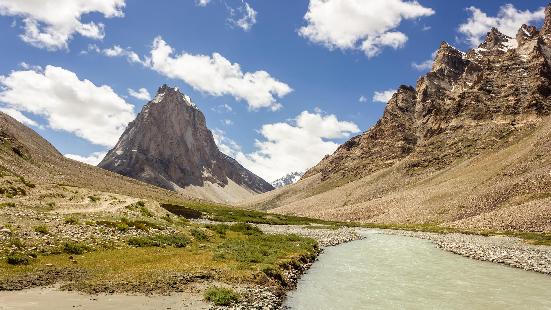
Padum to Darcha Trek: Complete High-Altitude Route Guide
The Padum to Darcha trek covers ~115–120 km in 8–9 days, crossing Shingo La (~5,060 m) between Zanskar and Lahaul.
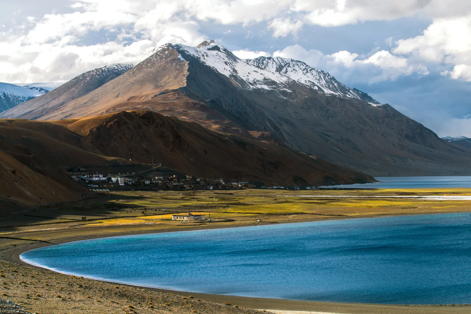
Rumtse to Tso Moriri Trek: Complete Ladakh Trail Guide
The Rumtse to Tso Moriri trek is an ~80 km, 7–8 day strenuous Ladakh trail crossing Kyamar La (~5,460 m) and Polokongka La (~5,190 m), ending at Tso Moriri Lake
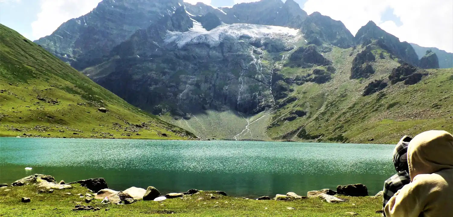
Naranag Gangabal Trek: Complete Guide (2026)
The Naranag Gangabal Trek is a 4–5 day moderate-difficult alpine trek in Kashmir, covering ~26–30 km from Naranag (2,150 m) to Gangabal Lake (3,570 m).
Common questions answered
The Bara Bhangal trek is rated difficult (4 out of 5). It is suitable only for trekkers with prior high-altitude experience — ideally on at least 2–3 previous Himalayan treks above 4,000 m. The key challenges are the steep ascent to Thamsar Pass (~4,708 m), long daily distances over rough terrain, river crossings, and the complete lack of rescue infrastructure. It is not suitable for beginners or casual trekkers.
Bara Bhangal trek — Latest News
Courage takes flight in Kangra district: 13-member team treks 24 hours to save critically ill shepherd in Bara Bhangal
Courage takes flight in Kangra district: 13-member team treks 24 hours to save critically ill shepherd in Bara Bhangal The Tribune
Critically ill Shepherd rescued by 13-member team from Bara Bhangal in Himachal Pradesh
Critically ill Shepherd rescued by 13-member team from Bara Bhangal in Himachal Pradesh The New Indian Express
Critically ill Shepherd rescued by 13-member team from Bara Bhangal in Himachal Pradesh
Critically ill Shepherd rescued by 13-member team from Bara Bhangal in Himachal Pradesh The New Indian Express
Live Conditions
Real-time weather & trail status
Trail Conditions
Crowdsourced reports from trekkers who've done this route
Sign in to add a trip report
Find a Trek Buddy
Connect with trekkers planning the same route
No buddies yet for this trek
Sign in and be the first to post a planning signal.