Why Churdhar Trek is on every trekker's list
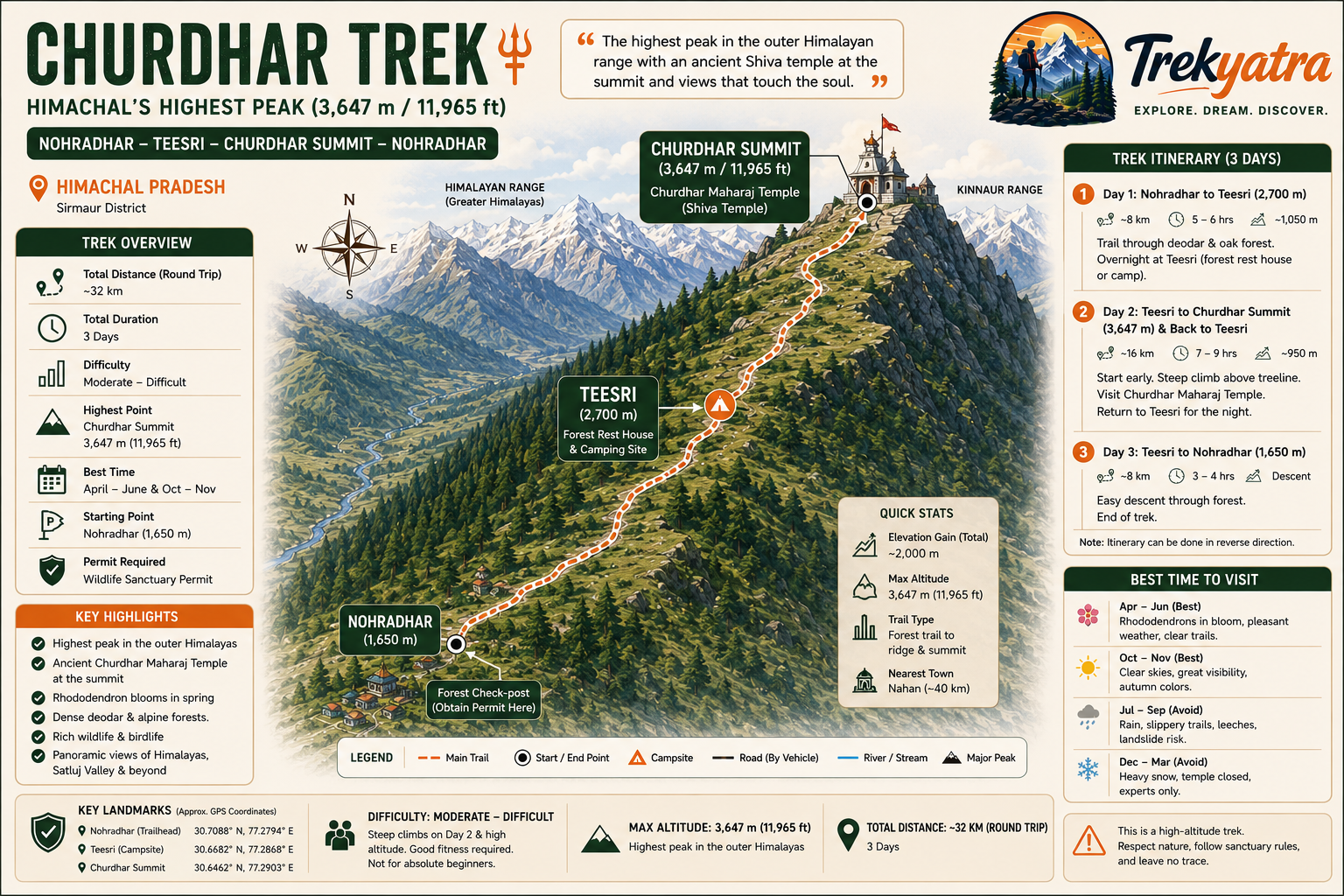
Churdhar Trek leads to the highest peak in the outer Himalayan range at 3,647 m (11,965 ft), starting from Nohradhar in Sirmaur district. The round trip covers ~32 km over 3 days.
Standing at 3,647 m (11,965 ft) above sea level, Churdhar Peak — also known as Chur Chandni — holds the distinction of being the highest peak in the outer Himalayan range. Tucked inside Sirmaur district in Himachal Pradesh, it is a summit that rewards effort with something genuinely rare: a working Shiva temple right at the top, jaw-dropping panoramic views stretching toward the Satluj Valley, and trails that still feel like a secret.
The primary trailhead for the Churdhar trek is Nohradhar, a quiet market town about 100 km from Shimla. From here, the path winds through the Churdhar Wildlife Sanctuary, climbing through rhododendron blooms and ancient deodar groves before breaking out above the treeline toward the summit ridge.
This guide covers everything you need for the 2026 trekking season: the best route, a day-wise itinerary, permit details, costs, packing essentials, safety advice, and the incredible biodiversity you'll encounter along the way.
In an era when Triund is gridlocked with Instagram crowds and Kheerganga queues start at 5 AM, Churdhar is a quiet revelation. Here's what makes it stand apart:
- Highest outer Himalayan peak: No other summit in the Shivalik Range touches Churdhar's elevation. The views from the top — on a clear autumn morning — can include Kinnaur's snow ranges, the Satluj Valley, and the plains of Haryana simultaneously.
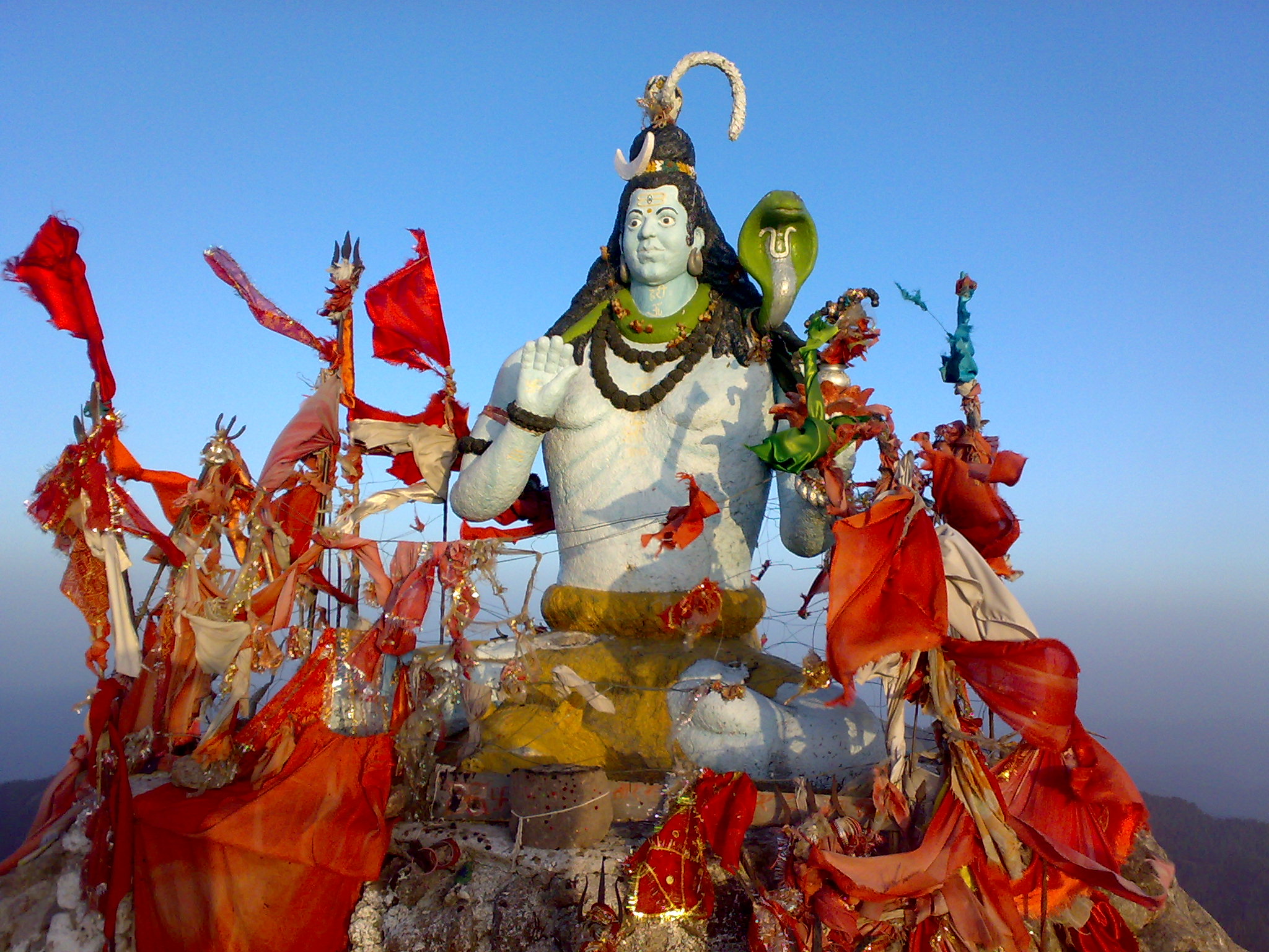
- The Churdhar Maharaj Temple: An ancient temple dedicated to Shirgul Maharaj (a local form of Lord Shiva) sits at the very summit. Pilgrims and trekkers share the trail, giving it a rare spiritual energy uncommon on Himalayan routes.
- Dense, cathedral-like forests: The ascent passes through protected deodar cedar, horse chestnut, and rhododendron forests — especially stunning in April–May when rhododendrons are in full bloom.
- Rich wildlife: As a designated wildlife sanctuary, Churdhar hosts musk deer, Himalayan black bear, barking deer, and Himalayan griffon vultures in numbers rarely seen on more commercialised routes.
- Less crowded than comparable treks: Even during peak season, daily footfall remains far lower than Triund or Kheerganga, making it suitable for trekkers who value solitude.
- Accessible from Delhi: Nohradhar is roughly 7–8 hours from Delhi by road via Chandigarh and Nahan — making this a viable long-weekend trek for trekkers based in northern India.
For other great Himachal options, see our Himachal Pradesh treks guide.
At a glance
Ask TrekSage about Churdhar Trek
Get instant answers grounded in verified trek data — beginner-friendliness, best months, permits, packing, and more.
The route at a glance
Primary Route: Nohradhar → Teesri → Churdhar Summit
| Segment | Distance | Elevation | Notes |
|---|---|---|---|
| Nohradhar trailhead | — | ~1,650 m | Start point |
| Teesri (midpoint camp) | ~8 km | ~2,700 m | Forest rest house & camping |
| Churdhar Summit | ~8 km | 3,647 m | Temple & summit views |
Total one-way distance: approximately 16 km
Round trip: approximately 32 km
Total elevation gain: approximately 2,000 m
The trail begins at Nohradhar (also the location of the forest check-post where you obtain your sanctuary permit) and follows a well-worn path northward into the Churdhar Wildlife Sanctuary. The first section to Teesri gains altitude steadily through mixed temperate forest. The trail is generally well-marked but can become less obvious above the treeline in misty or snowy conditions.
From Teesri, the trail steepens considerably, exiting the treeline and crossing open ridges before the final push to the summit. The Churdhar Maharaj Temple marks the true summit.
Alternate route via Sarain: A less-travelled approach from the Sarain side is also used by some trekkers and pilgrims, but involves more complex logistics and is best arranged with a local guide.
What each day actually looks like
Standard 3-Day Itinerary (Recommended)
Day 1: Nohradhar to Teesri
- Distance: ~8 km
- Elevation gain: ~1,050 m (1,650 m → ~2,700 m)
- Duration: 5–6 hours
- Overnight: Forest rest house or tent at Teesri
Begin at the Nohradhar trailhead after completing permit formalities at the forest check-post (allow 30 minutes). The trail enters dense deodar and oak forest almost immediately. Gradient is moderate for the first 4 km, steepening as you approach Teesri. Water sources are available along the route. Arrive at Teesri by early afternoon to acclimatise before the bigger push tomorrow. The forest rest house at Teesri is available on a first-come, first-served basis — carry a tent as backup.
Day 2: Teesri to Churdhar Summit and Back to Teesri
- Distance: ~8 km up, ~8 km down (16 km)
- Elevation gain: ~950 m (2,700 m → 3,647 m)
- Duration: 7–9 hours round trip
- Overnight: Teesri (tent/rest house)
Start no later than 6 AM. The first 2–3 km above Teesri remains forested; the final stretch crosses open alpine meadows and rocky ridgelines. Weather above 3,000 m can deteriorate rapidly in the afternoon — aim to reach the summit by 11 AM and begin descent by noon at the latest. Visit the Churdhar Maharaj Temple, take in the panoramic views, and descend to Teesri before dark.
Day 3: Teesri to Nohradhar (Descent)
- Distance: ~8 km
- Duration: 3–4 hours
- Overnight: Return to Nohradhar, onward transport
A steady descent through the same forests — often faster than the ascent. You'll be back in Nohradhar by mid-morning, with time to catch afternoon transport toward Shimla, Chandigarh, or Nahan.
Fast 2-Day Itinerary (For Fit, Experienced Trekkers)
Day 1: Nohradhar → Teesri → Churdhar Summit → Back to Teesri (~24 km, 10–12 hours)
Day 2: Teesri → Nohradhar (~8 km, 3–4 hours)
This is a demanding schedule. Only attempt if you have prior high-altitude trekking experience and excellent fitness.
When to go
Summer: April – June ⭐ Best Window
The primary trekking season. Rhododendrons bloom in April–May, trails are clear of snow from May onward, temperatures at the summit range from 5°C–15°C during the day, and visibility is excellent. June sees warmer lower slopes but remains comfortable at altitude. Recommended for most trekkers.
Monsoon: July – September ⚠️ Avoid
Heavy rainfall makes trails slippery and increases landslide risk along approach roads. Leeches are prevalent in the forest zone. Cloud cover often obscures summit views. The sanctuary forest can become hazardous. Not recommended.
Autumn: October – November ⭐ Second Best Window
Post-monsoon skies are the clearest of the year. Golden oak and chestnut forests make for stunning photography. Temperatures are cooler (0°C–10°C at the summit by day). Snowfall can begin in November at higher elevations — check conditions before departure. Excellent choice for experienced trekkers.
Winter: December – March ❄️ Experts Only
Heavy snowfall buries the trail above Teesri and the summit area. The Churdhar Maharaj Temple typically closes for winter. The route remains technically possible for experienced winter trekkers with proper gear, but is not suitable for general trekking. Avoid unless you have winter alpine experience.
Is this trek right for you?
Overall rating: Moderate to Strenuous
The ~2,000 m elevation gain across 16 km demands a level of fitness beyond casual walking. That said, the Churdhar trek does not require technical climbing skills or high-altitude experience above 4,000 m — making it achievable for motivated beginners who prepare properly.
Fitness preparation (recommended 4–6 weeks before the trek):
- 30–45 minutes of cardio (running, cycling, stair climbing) 4–5 days per week
- Leg and core strength work: squats, lunges, step-ups
- Weekend practice hikes with a loaded pack
Compared to Kedarkantha: The Churdhar trek involves a similar total distance to the Kedarkantha trek but with a more sustained single-day elevation push on summit day. Kedarkantha involves more gradual altitude gain over multiple days; Churdhar's summit push is more compressed.
Who should NOT attempt this trek without medical advice:
- Children under 12
- People with cardiac or respiratory conditions
- Anyone with a history of acute mountain sickness (AMS) above 3,000 m
Altitude sickness note: Churdhar's summit at 3,647 m puts it above the threshold where mild AMS symptoms (headache, nausea, fatigue) can occur in susceptible individuals. The 3-day itinerary's acclimatisation night at Teesri (~2,700 m) significantly reduces this risk. See our altitude sickness prevention guide for detailed advice.
What permits you need
A Churdhar Wildlife Sanctuary entry permit is mandatory for all trekkers.
- Where to obtain: At the Nohradhar forest check-post, at the trailhead before entering the sanctuary
- Fee: Approximately ₹50–100 per person
- Documents required: Government-issued photo ID (Aadhaar card, passport, or driving licence)
- Camping permit: No separate camping permit is currently required for designated camping areas, but confirm this with the local forest office before your trek as regulations can change seasonally
- Sanctuary regulations you must follow:
- No single-use plastic inside the sanctuary
- No loud music or speakers
- No disturbance to wildlife
- No open fires (use stoves only)
- Carry all waste out
- Seasonal closures: Parts of the sanctuary may be subject to seasonal restrictions. Check with the Nohradhar forest office or the Sirmaur District Forest Office before travelling.
What this trek will cost you
All prices are approximate for 2026 and subject to change.
DIY Trekking Budget
| Item | Cost (INR) |
|---|---|
| Bus Chandigarh → Nohradhar (HRTC or private) | ₹400–600 per person |
| Shared taxi Chandigarh → Nohradhar | ₹2,500–3,500 (shared, per vehicle) |
| Wildlife sanctuary entry permit | ~₹100 per person |
| Camping gear rental at Nohradhar | ₹500–800 per day |
| Food (trail meals, local dhabas) | ₹300–500 per day |
| Porter (if required) | ₹800–1,200 per day |
| Estimated 3-day DIY total | ₹3,000–6,000 per person |
Guided Package Cost
Organised guided packages from Shimla or Chandigarh typically range from ₹5,000–9,000 per person and include:
- Return transport from Shimla or Chandigarh
- Certified trek guide
- Camping tents and sleeping equipment
- All meals on the trail
- Permit assistance
For tips on what to pack and where to save money, see our trekking backpack guide.
What to pack
✅ Must-Haves
Clothing (layering system)
- Moisture-wicking base layer (top and bottom)
- Warm mid-layer fleece or down jacket
- Waterproof and windproof outer shell / rain jacket
- Trekking pants (quick-dry)
- Warm hat and gloves (essential even in summer above 3,000 m)
- Sun hat / cap for lower sections
Footwear
- Ankle-support waterproof trekking boots — see our best trekking boots guide
- Gaiters (especially useful in wet conditions or early/late season snow)
- Wool or synthetic trekking socks (bring 2–3 pairs)
Gear
- 40–50L trekking backpack
- Sleeping bag rated to at least -5°C
- Trekking poles (highly recommended for steep descents)
- Headlamp with spare batteries
- Rain cover for backpack
Documents
- Government-issued photo ID (original)
- Printed or digital copy of sanctuary permit
- Emergency contacts list (forest office, next of kin, nearest hospital)
Nutrition
- Trail mix, energy bars, dark chocolate
- ORS (oral rehydration salts) sachets
- Water bottles or hydration bladder (3L capacity minimum)
- Water purification tablets or filter
First Aid
- Blister treatment kit (moleskin, antiseptic)
- Diamox (acetazolamide) — consult your doctor before carrying
- Ibuprofen / paracetamol
- Elastic bandage and basic dressings
👍 Nice-to-Have
- Power bank (2+ charges; mobile signal is sparse)
- Offline maps downloaded (Maps.me or Google Maps offline)
- Lightweight camp shoes / sandals
- Camera or mirrorless kit (summit views are worth it)
- Insect repellent (useful in forested lower sections)
Staying safe on the mountain
Start the summit push early: Leave Teesri no later than 6 AM on summit day. Weather above the treeline changes fast — afternoon thunderstorms are common in summer. Reaching the summit before midday gives you a safety buffer.
Acclimatise at Teesri: Do not rush from Nohradhar to the summit in a single day. The overnight stop at ~2,700 m is an important acclimatisation step before ascending to 3,647 m.
Recognise AMS symptoms: Persistent headache, nausea, vomiting, loss of coordination, or confusion above 3,000 m are warning signs. The only safe treatment is to descend immediately. Do not push upward if symptoms appear.
Mobile network: Coverage is sparse throughout the sanctuary. BSNL has partial coverage in some sections but cannot be relied upon. Download offline maps before leaving Nohradhar.
Nearest medical facilities:
- Nahan district hospital: approximately 80 km from Nohradhar
- Shimla: approximately 100 km
Wildlife caution: Himalayan black bear sightings have been reported within the sanctuary. Make noise on the trail (talk, use a bear bell), do not leave food unattended, and never approach wildlife. In the unlikely event of a bear encounter, do not run — back away slowly.
Share your itinerary: Always inform the Nohradhar forest office of your planned route and expected return date. Share your itinerary with a contact outside the trek.
No solo night trekking: Do not attempt to walk between camps after dark, even with a headlamp. Trail markings are harder to follow at night and wildlife is more active.
Emergency contacts:
- Nohradhar Forest Office
- Sirmaur District Emergency / District Collector office
- Himachal Pradesh Police helpline: 100
Turn back if needed: No summit view is worth your safety. If weather deteriorates rapidly or any team member shows AMS symptoms, turn back without hesitation.
Similar treks to explore
Snow Leopard Trek Hemis: The Ultimate 2026 Guide
The snow leopard trek in Hemis National Park, Ladakh, offers the world's best chance of spotting a wild snow leopard, with 70–80% guided sighting success rates
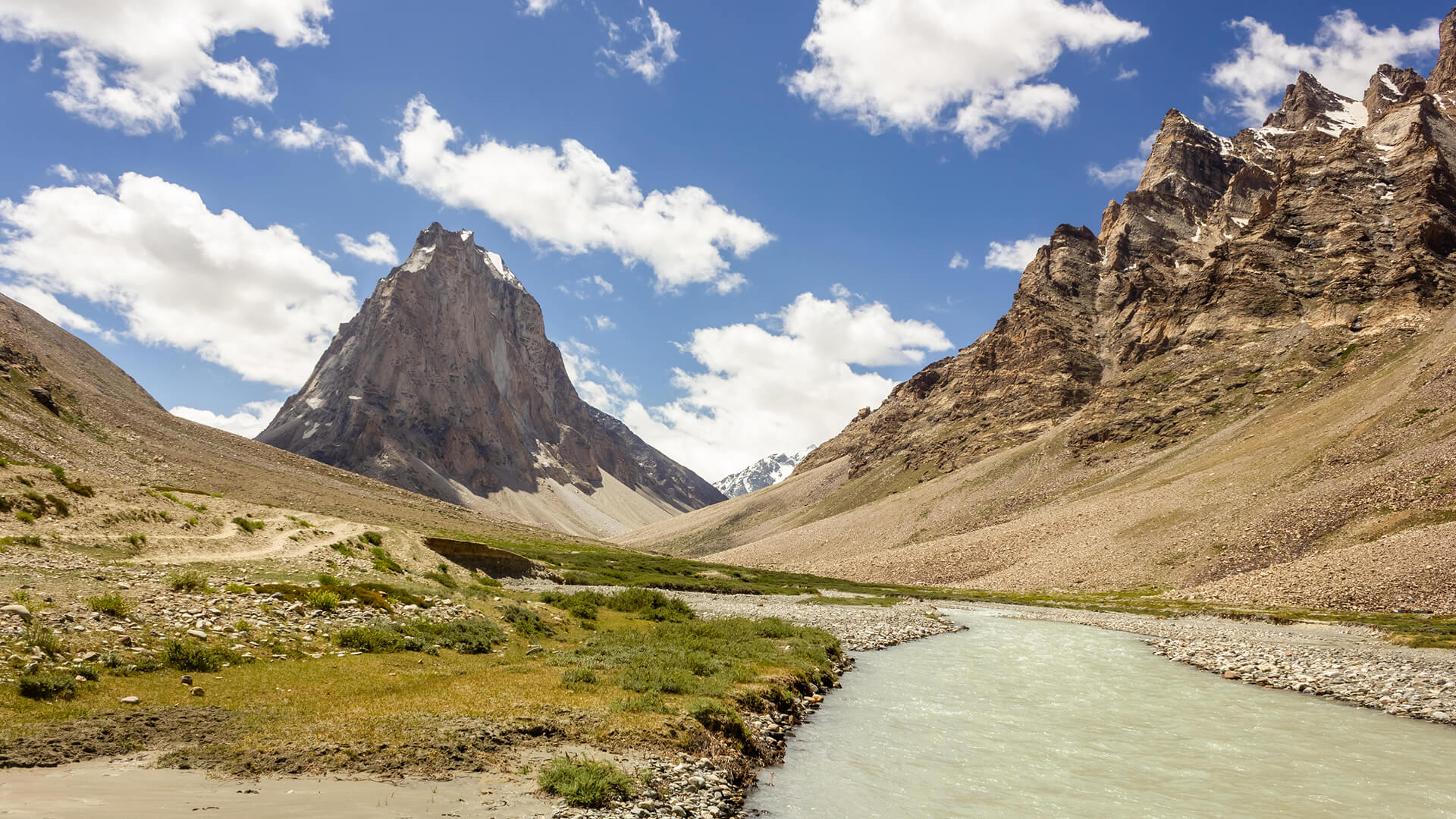
Padum to Darcha Trek: Complete High-Altitude Route Guide
The Padum to Darcha trek covers ~115–120 km in 8–9 days, crossing Shingo La (~5,060 m) between Zanskar and Lahaul.
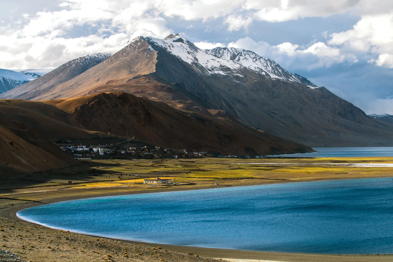
Rumtse to Tso Moriri Trek: Complete Ladakh Trail Guide
The Rumtse to Tso Moriri trek is an ~80 km, 7–8 day strenuous Ladakh trail crossing Kyamar La (~5,460 m) and Polokongka La (~5,190 m), ending at Tso Moriri Lake
Common questions answered
Churdhar Peak — also called Chur Chandni — stands at 3,647 m (11,965 ft) above sea level, making it the highest peak in the outer Himalayan (Shivalik) range. No other summit in the outer Himalayas exceeds this elevation.
Churdhar Trek — Latest News
27-year-old woman dies after 300-metre fall on Himachal’s Churdhar trek
27-year-old trekker fatally falls 300 metres on Churdhar Trek. Critical safety reminder for Himalayan trekkers planning this popular high-altitude route.
Travel alert: 13 things every traveller must know before trekking to Himachals Churdhar peak in 2026
Travel alert: 13 things every traveller must know before trekking to Himachals Churdhar peak in 2026 The Tribune
Worst Mistake or Best Trip? Churdhar Trek gone wrong! 🫶🏻🕉️🔱
Recent Churdhar Trek expedition highlights altitude and preparation challenges. Learn key lessons for trekking Himachal's popular 3,680m summit safely.
Live Conditions
Real-time weather & trail status
Trail Conditions
Crowdsourced reports from trekkers who've done this route
Sign in to add a trip report
Find a Trek Buddy
Connect with trekkers planning the same route
No buddies yet for this trek
Sign in and be the first to post a planning signal.